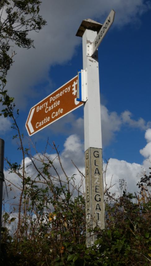
Although Higher Blagdon can be accessed on foot from both the main Totnes Road (the A385) via Glazegate Lane and the smaller Totnes Road to the north, one might be forgiven for having never heard of the former and certainly not having done the latter on foot.
By winter and following any substantial period of rain, Glazegate Lane can be considered inaccessible due to deep pools of water and thick mud. It certainly cannot be driven through (it barely resembles a road at times), so it may be fair to assume that this little lane might be barely known to those who do not walk regularly through the lanes.
In contrast, the junction with the northern Totnes Road at the top of Blagdon Road is far wider, far busier, and much more frequently trodden on by tyres than by trainers. It is, however, without a doubt, a point from which any walker can find some wonderful walking – in both directions north and south.
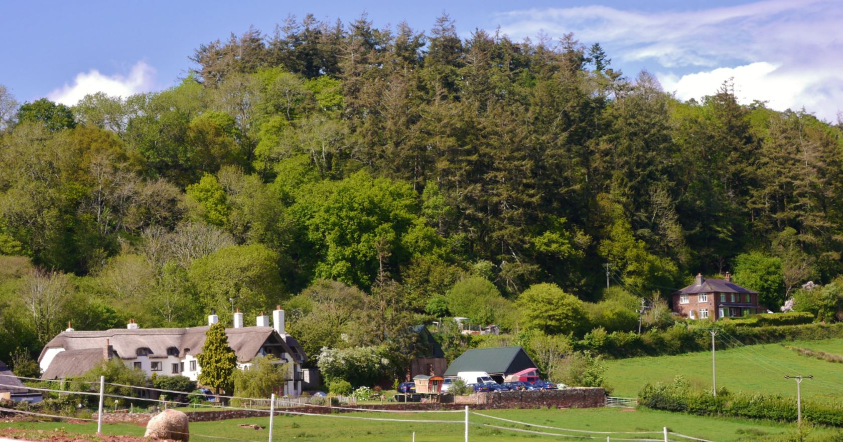
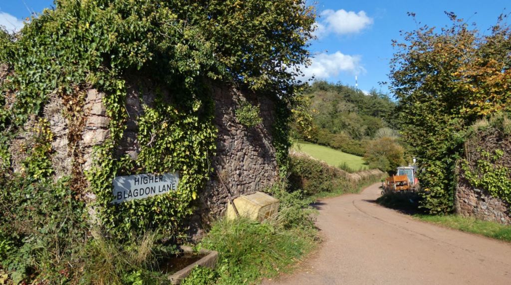
Should a walker be heading in the direction of Blagdon from the lanes that lie north of the smaller Totnes Road, nearer to Berry Pomeroy Castle (a gorgeous area that I shall most certainly cover at a later date), said walker will enter the lanes via Blagdon Lane, the entrance of interest to this part of my guide. The recently renamed (again, as of 2021) ‘Beyond Escapes’ / ‘Barton Pines’ complex is by far the most built up feature at this end of Blagdon Road, but to me the treasures still remain outside of the complex in the smaller lanes that are considerably less influenced by modern recreational needs. My aim is to cover all of the lanes that surround Higher Blagdon in this part of my guide, and to show what treasures can be uncovered if one were to walk away from the beaten path.
A Reminder – This Guide’s Five Entrances and Regions (On Foot)

Map imagery in this post courtesy of Google Maps and OpenStreetMap (© OpenStreetMap contributors).
Prior to this third part, you can find my comprehensive guides to the lanes that stem from the entrances at King’s Ash Road (Part One) and Marldon and Westerland Cross (Part Two). These parts of the guide contain innumerable photographs that I have taken over the years and, I hope, a complete perspective of what might be found in these zones.
Here, I shall cover everything south-east of the region near Berry Pomeroy as far as Higher Blagdon. I shall cover up to Buttshill Cross once more (the terminus for both walks in Part One and Part Two) and head down as far as Middle Blagdon, which shall be covered in the part that follows this (Part Four). The remained of the region surrounding Luscombe Lane and Great Parks will come in Part Five.
PART THREE – Entering from Totnes Road from the Direction of Berry Pomeroy Castle
Getting There
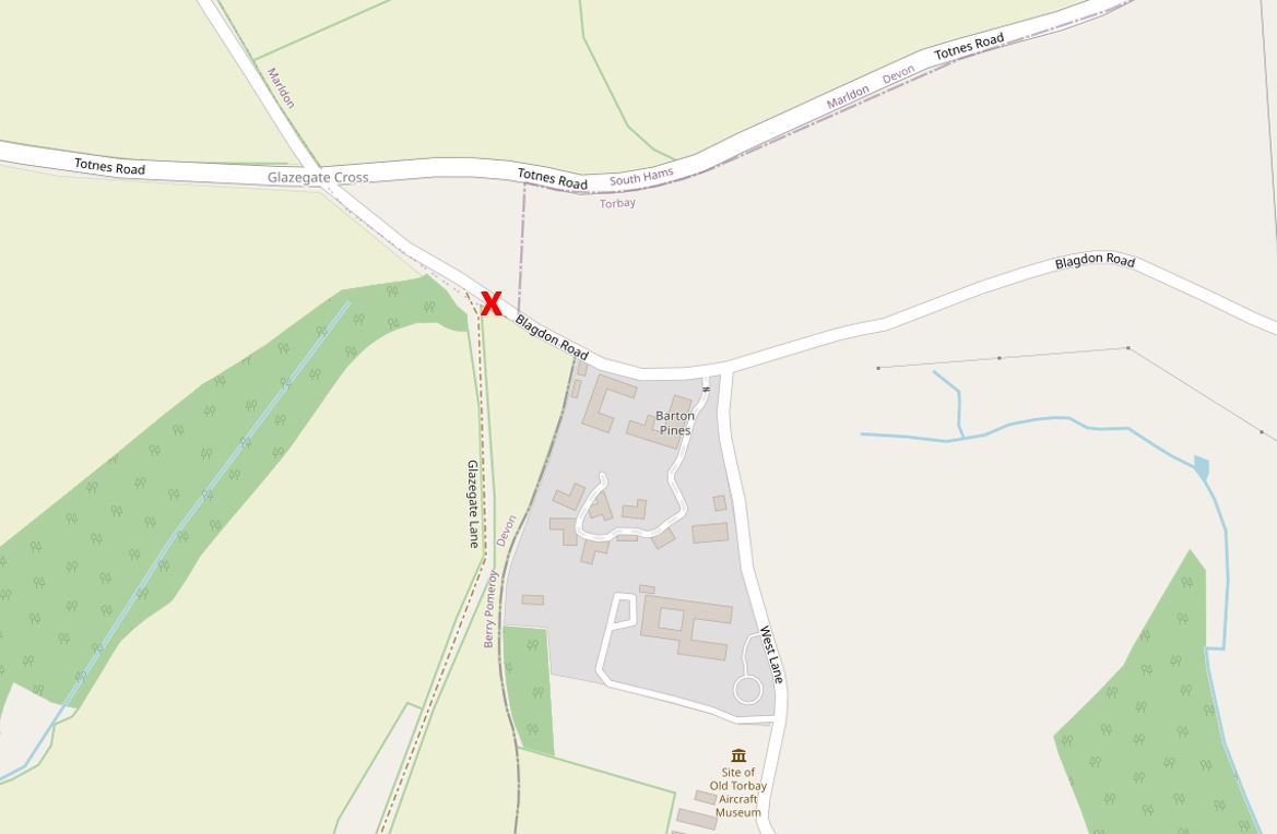
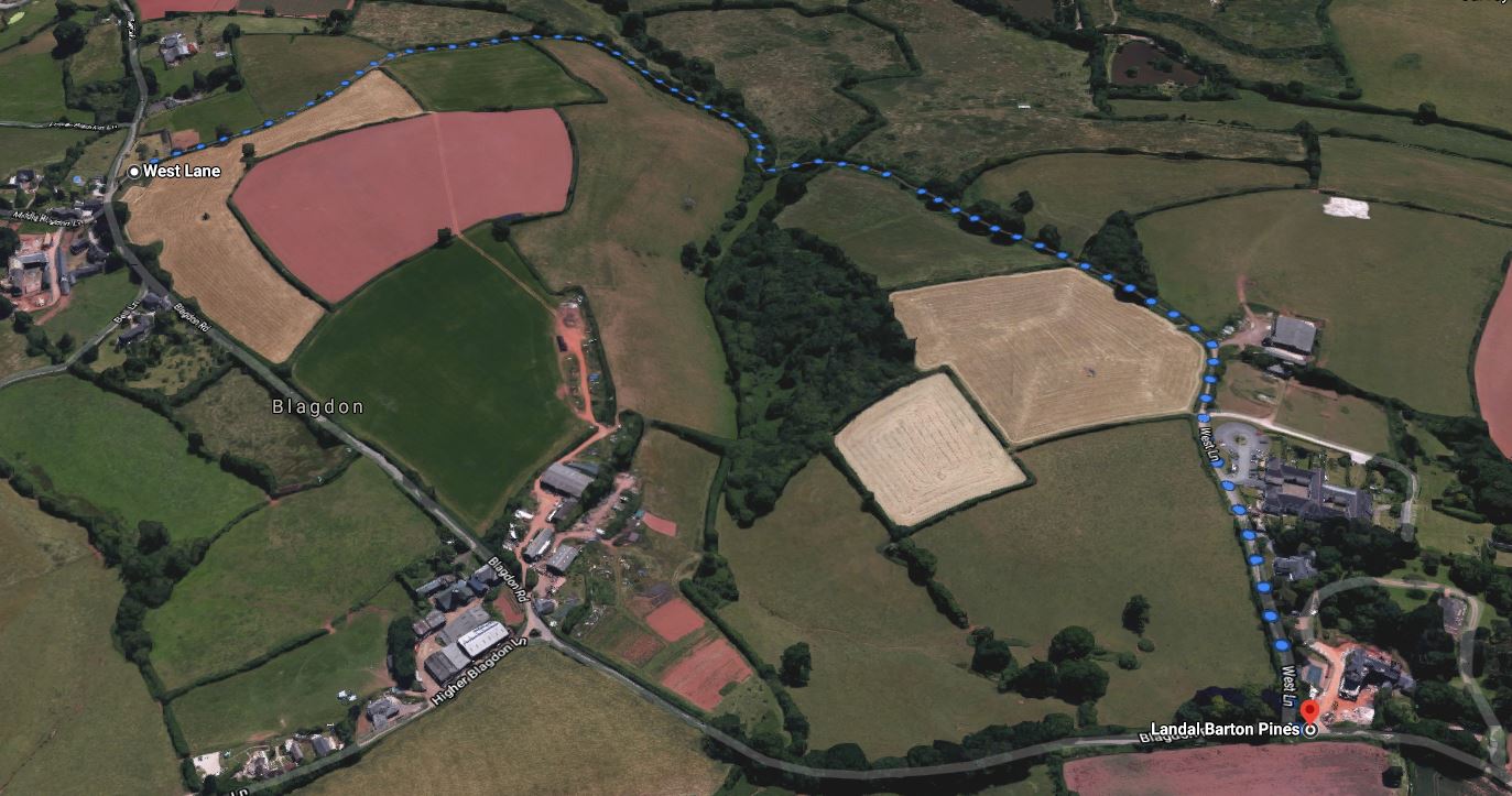
We shall begin covering this region by entering from here:

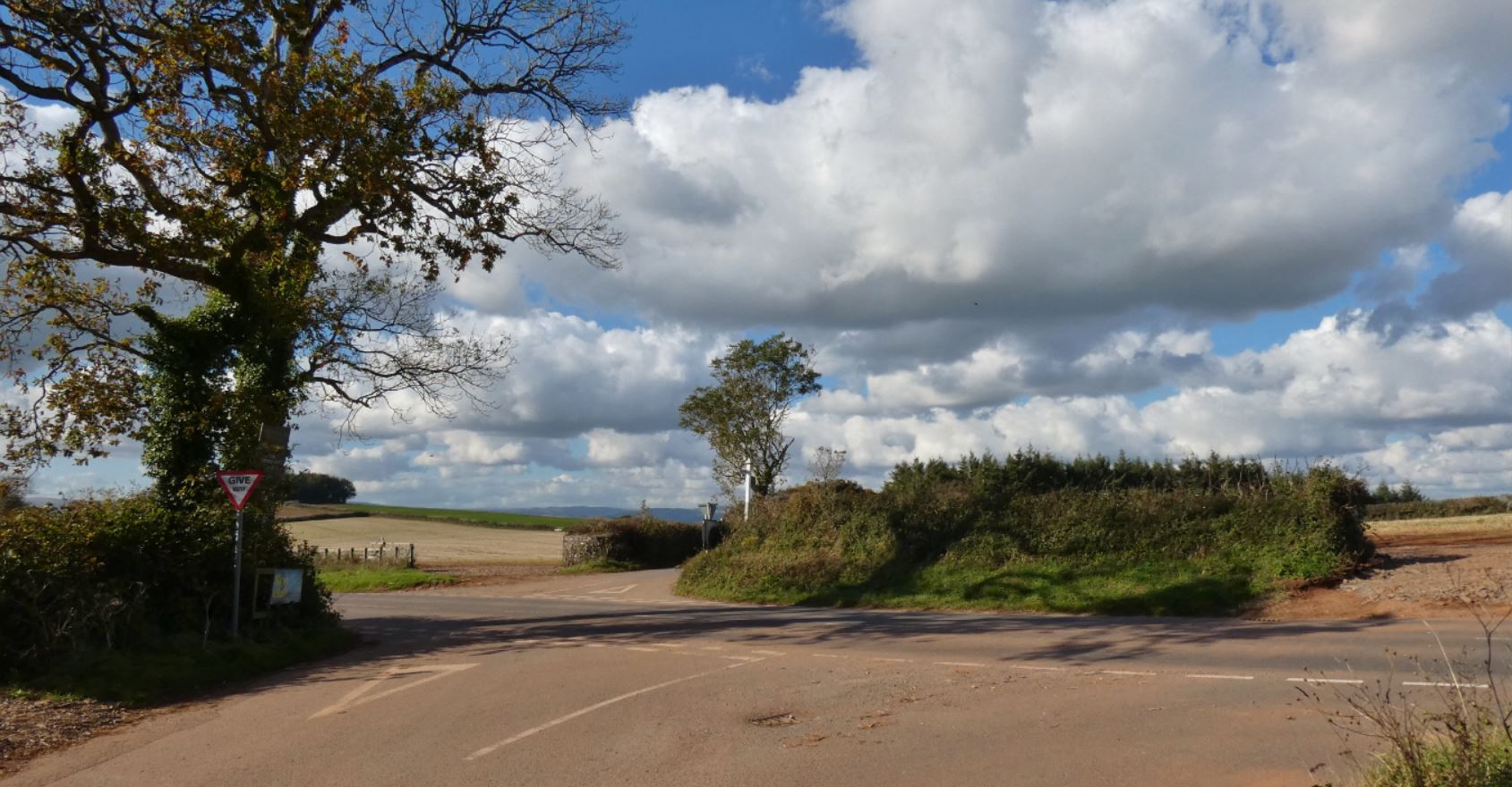
More precisely, we enter from Glazegate Cross as if we have just walked from the region around Berry Pomeroy Castle – the road leading to the northern Totnes Road from ‘Hangmans Cross‘.


As you can see from the above map, there are other ways of reaching this area; namely, via Glazegate Lane and from Buttshill Cross (which we have already found our way to in Part One from the south-east and Part Two from the north-east.
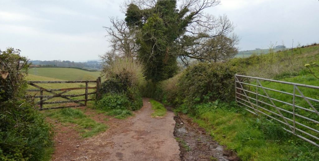
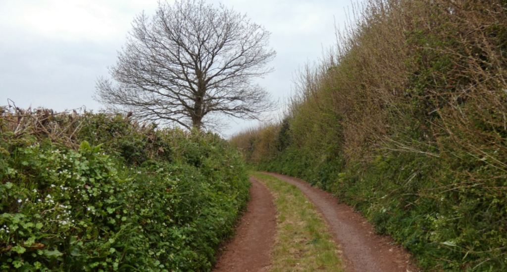
Glazegate Lane, as mentioned in my introduction, is truly a lane and not a road, and can thus be considered walker friendly! The only issue you might encounter that involves a vehicle is when the tractors are spraying ‘fertiliser’ (let’s call it fertiliser) in the fields that surround the lane, which might lead to one holding their breath for prolonged periods and becoming paranoid that what is being sprayed from the rear end of a tractor’s attached machinery might be sprayed in your particular direction (I imagine this would be extremely rare, however).

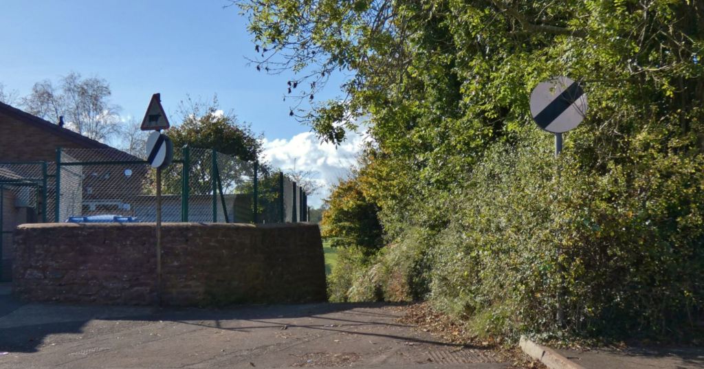
The opposite end to Glazegate Lane forms a junction with the A385 Totnes Road. This is a junction I have accessed on foot a few times, having climbed up the hill from Longcombe after a longer walk around Stoke Gabriel, Aish, and the treasures in that area. The main issue here is crossing the road – care must be taken as it is often busy, and vehicles are faster on this Totnes Road than the one to the north. Once crossed, however, you can leave those traffic worries behind until you reach the opposite end of the lane at Blagdon Road.
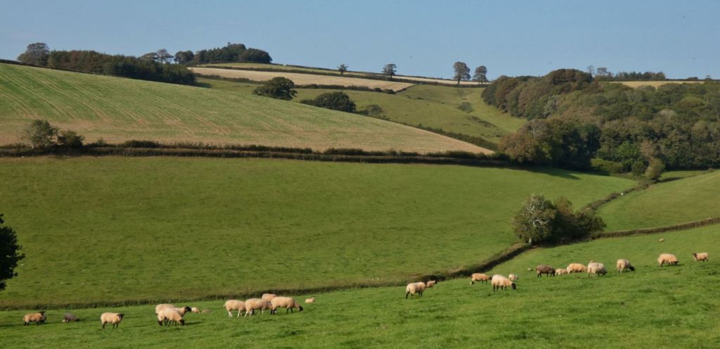
If you are unfamiliar with Glazegate Lane, I would recommend paying it a visit at least once. Starting at the A385, we quickly find vast, open fields visible ahead of us, often full of cows or sheep.


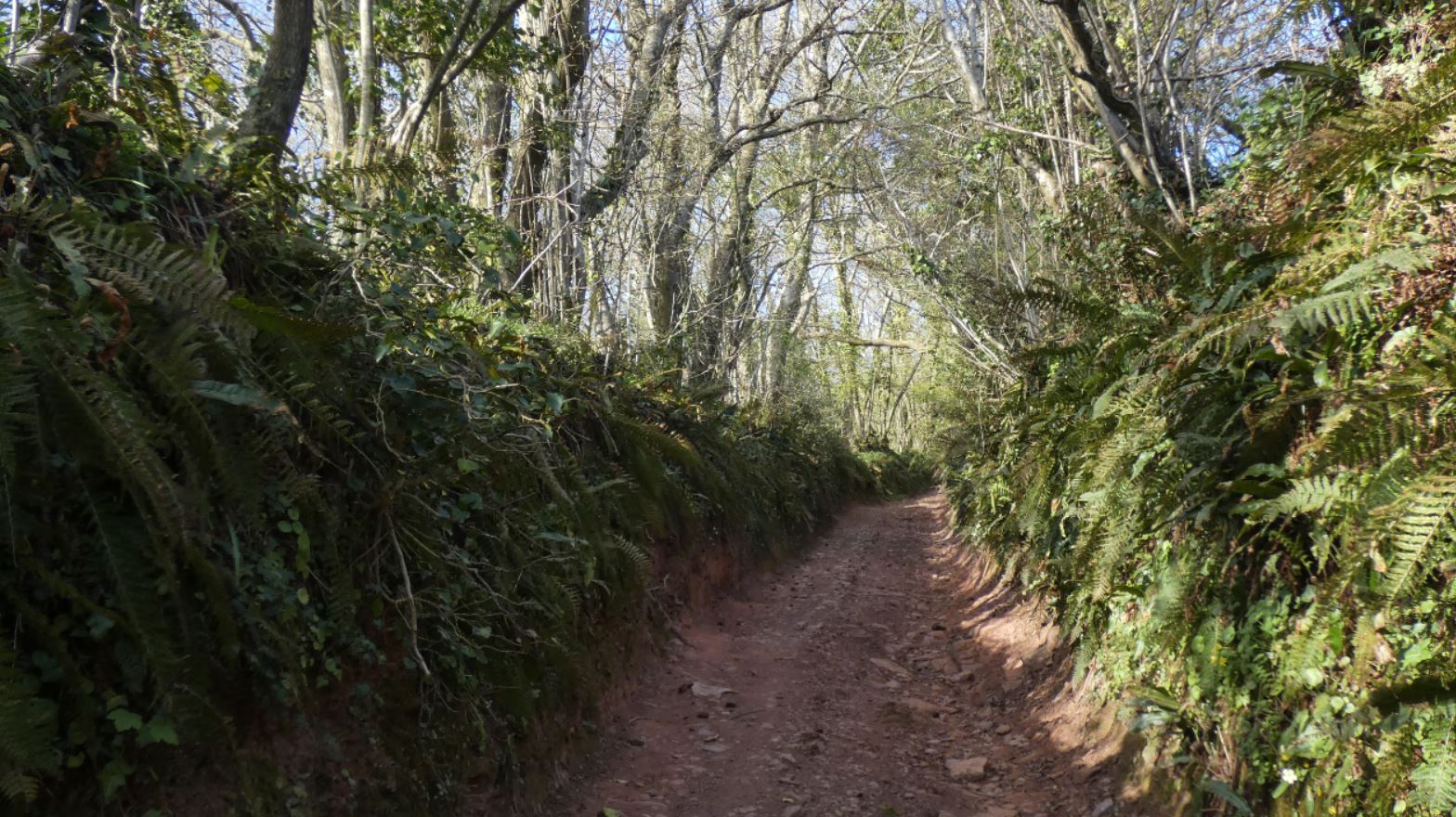
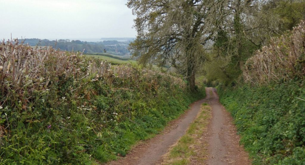
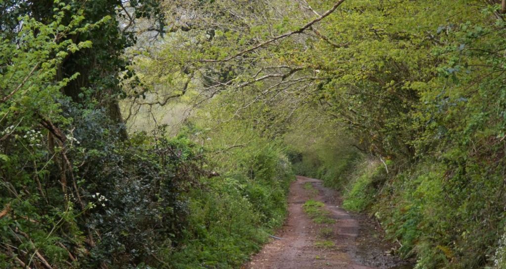
Further on, the lane narrows, grows steeper, and becomes far more wooded as it winds through Netherground Copse.
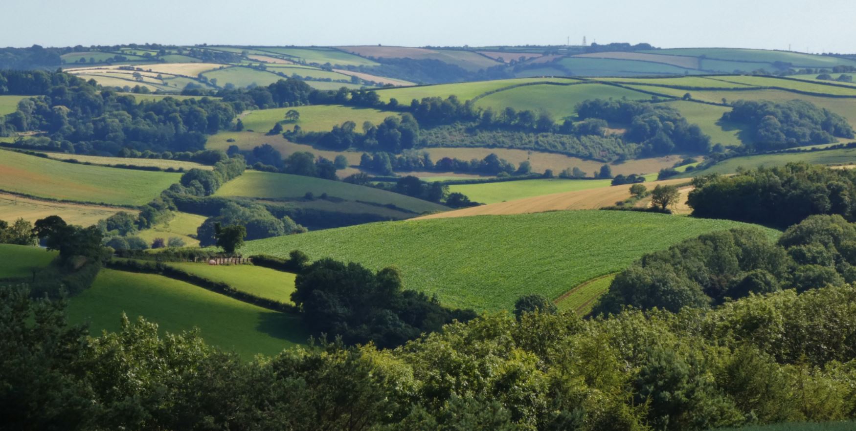
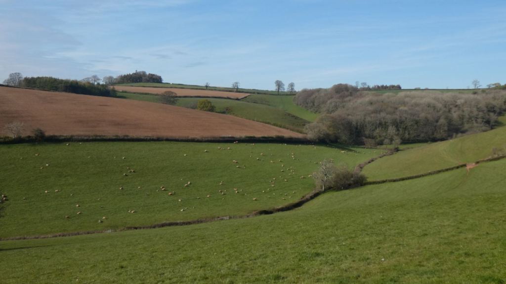
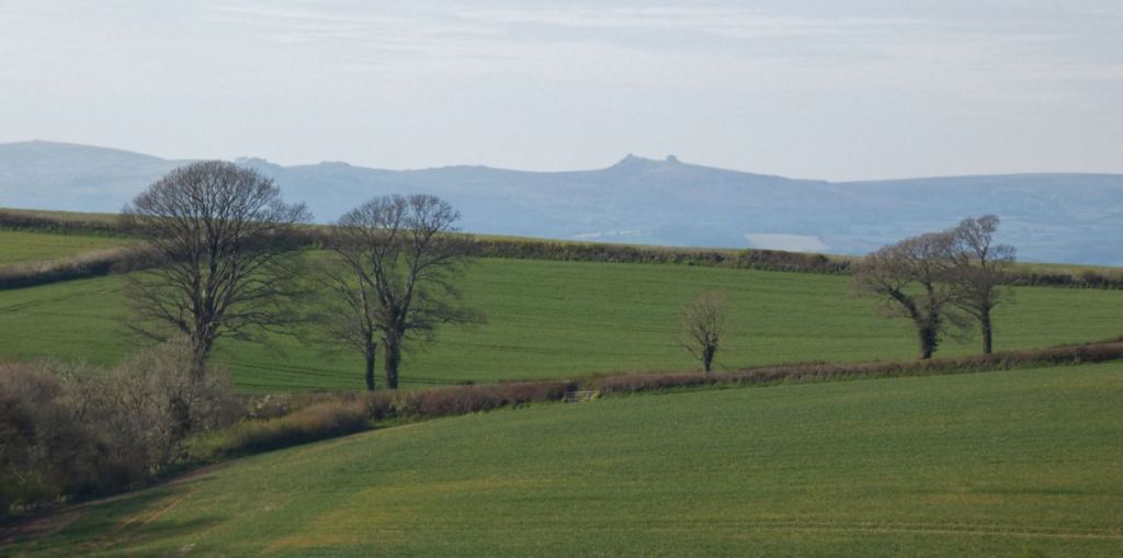
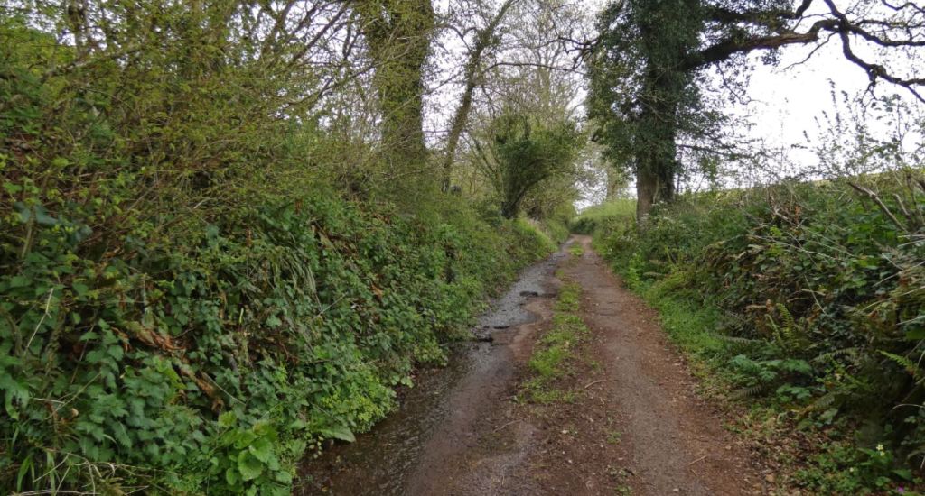
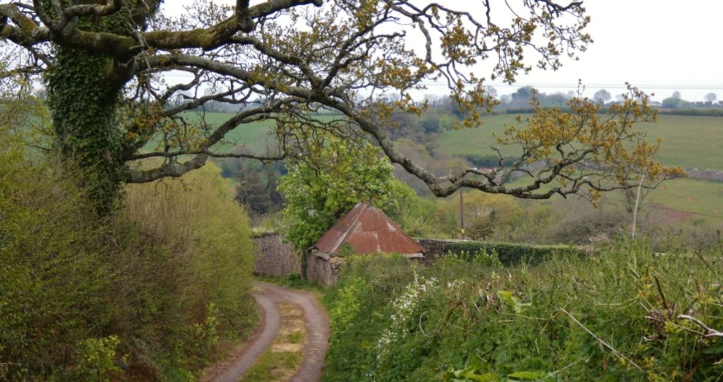
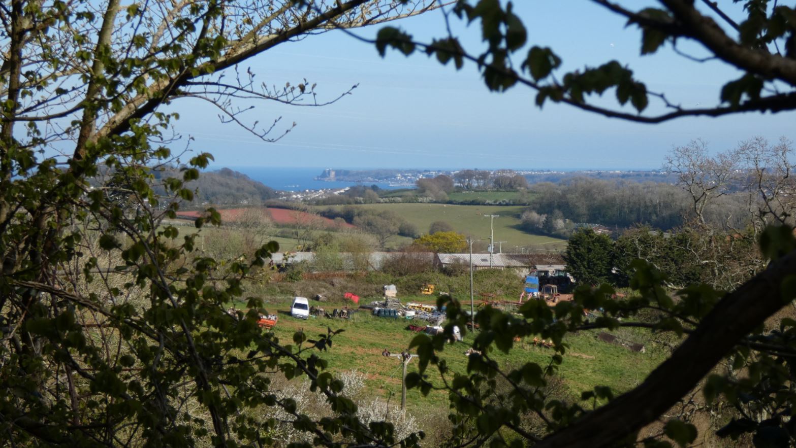
Beyond the woods, approximately halfway through the lane, our surroundings open up again, and to our left we can observe a wonderful view down and across the fields in the direction of Totnes.


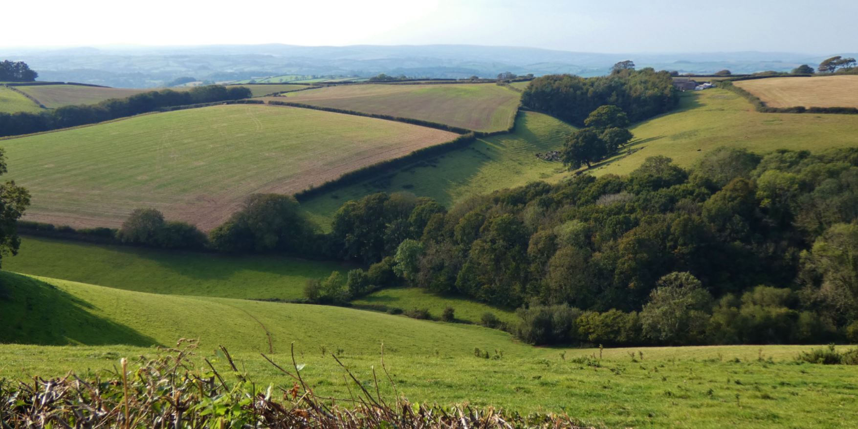

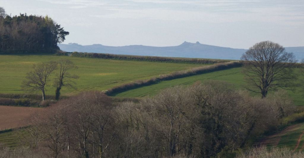
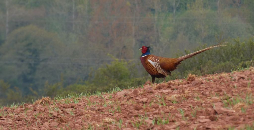
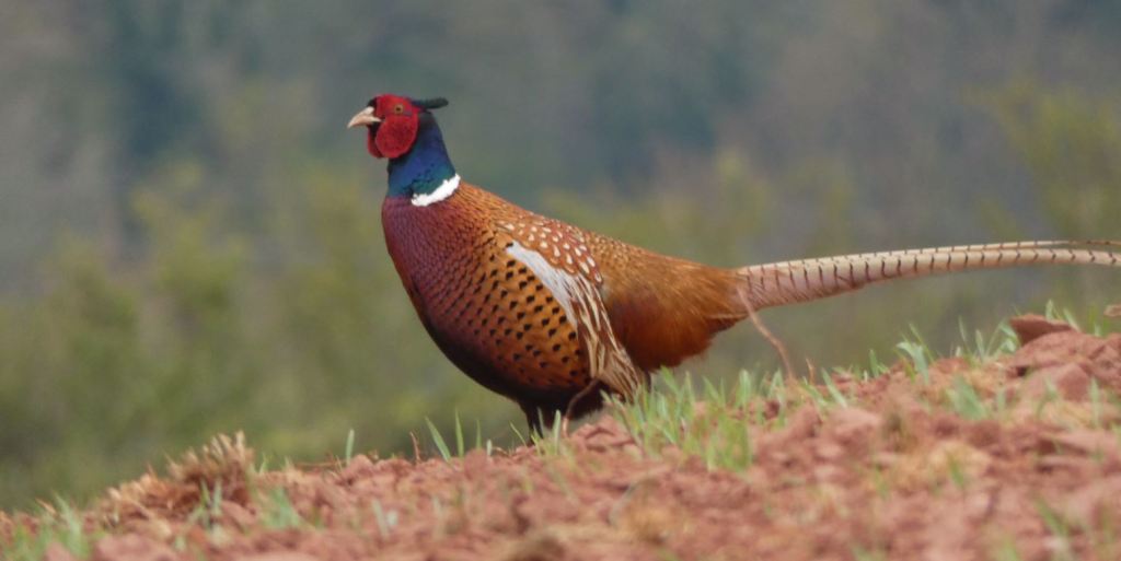
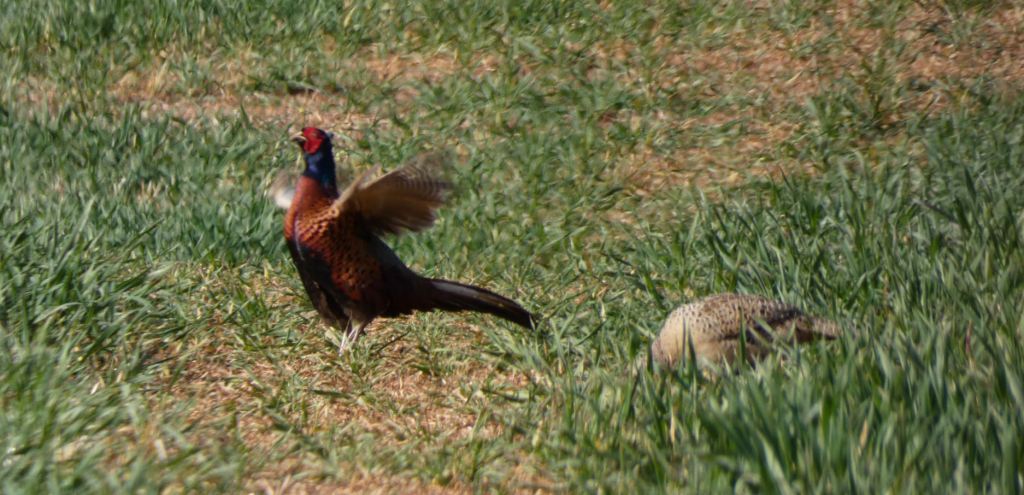
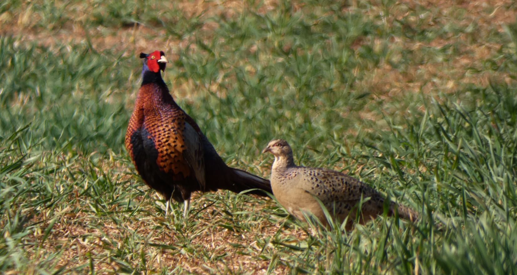
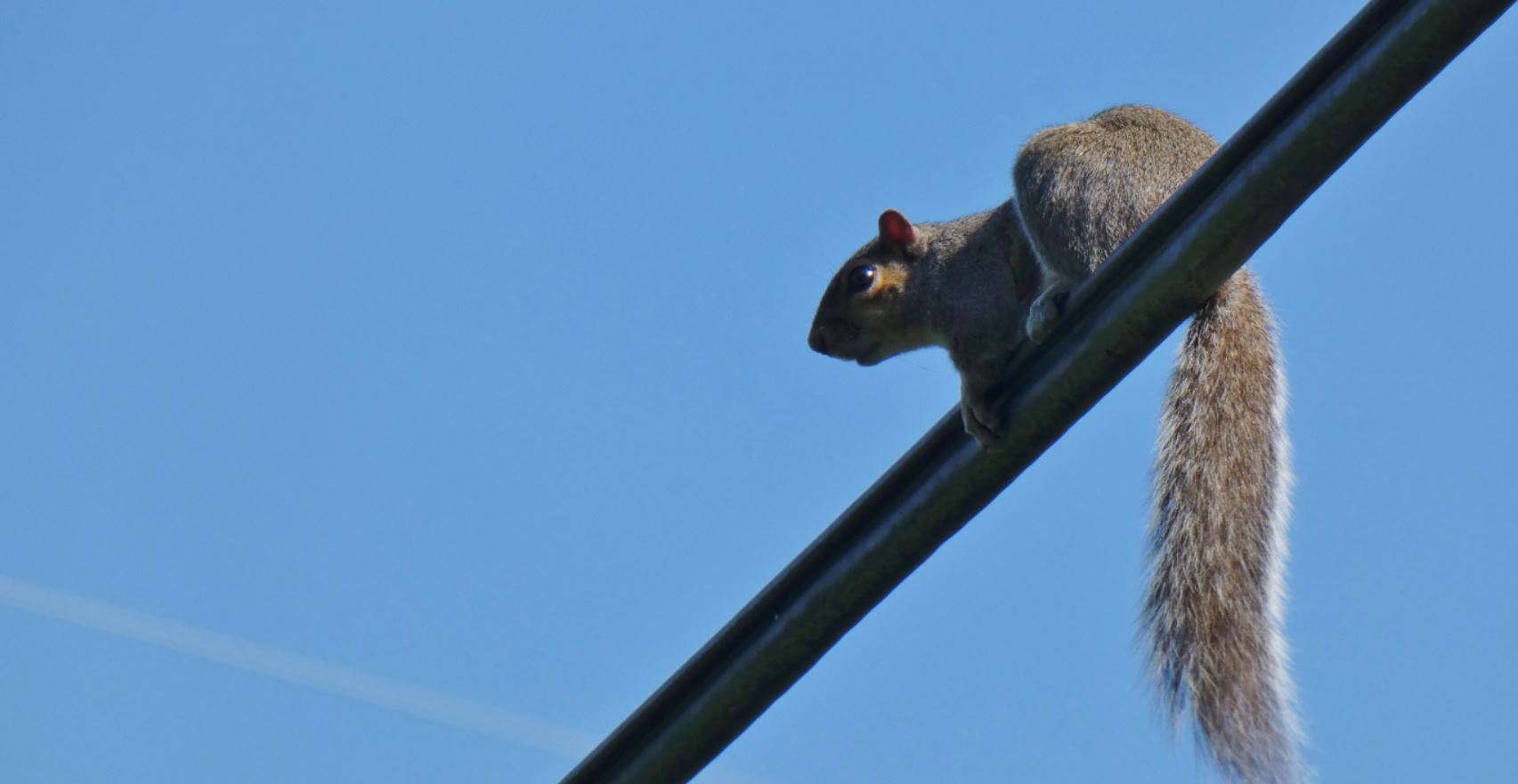
Pheasants often populate these fields (as they do with most fields down the lanes) and the view varies across the seasons. A little further on, you may even be able to see Dartmoor and Haytor beyond when looking north.


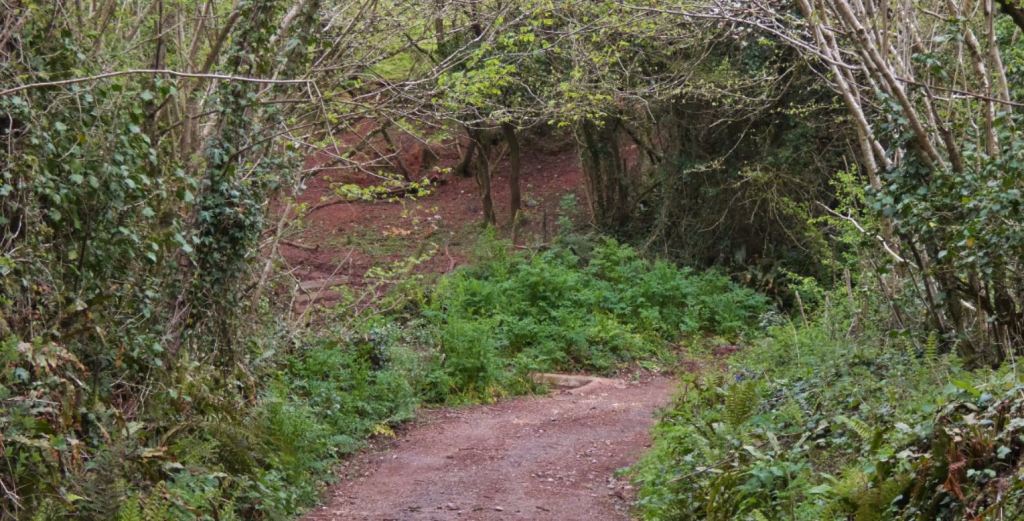
As we reach the end of Glazegate Lane, we approach a small fork in the lane. The left fork takes us in the direction of the Totnes Road and Glazegate Cross (mentioned earlier), while taking the right prong allows us to continue our walk into Blagdon.
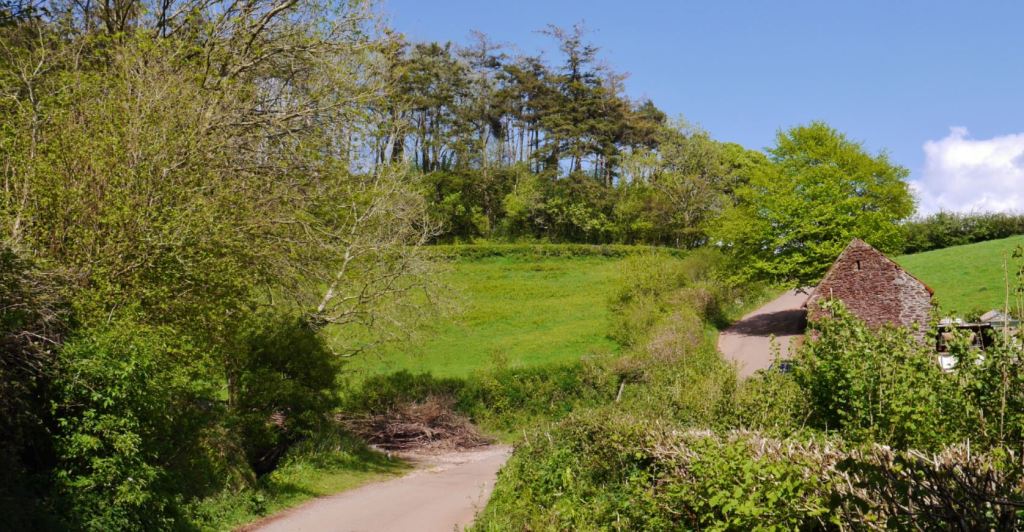
Down Blagdon Road and Barton Pines
With the entrances now covered, let us venture down Blagdon Road in the direction of Higher Blagdon: there is much to see.

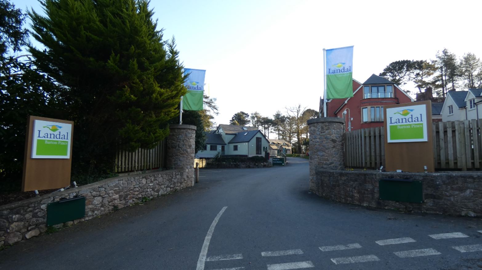
Within a couple of minutes, the entrance to a rather built up complex of structures appears to our right.
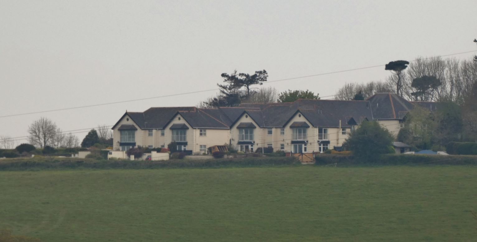
Barton Pines (also known as ‘Beyond Escapes’ or ‘The Arboretum’ over the years) is a complex of holiday accommodation, a spa, a restaurant, and I’m sure many other facilities (including, I believe, a tennis court). It has undergone a great change in the last decade, and at the time of writing (2021), it has just undergone another name change, becoming ‘Landal Barton Pines’ from ‘Beyond Escapes’.
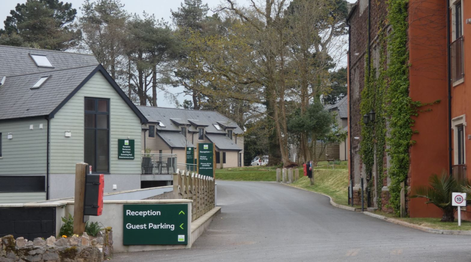
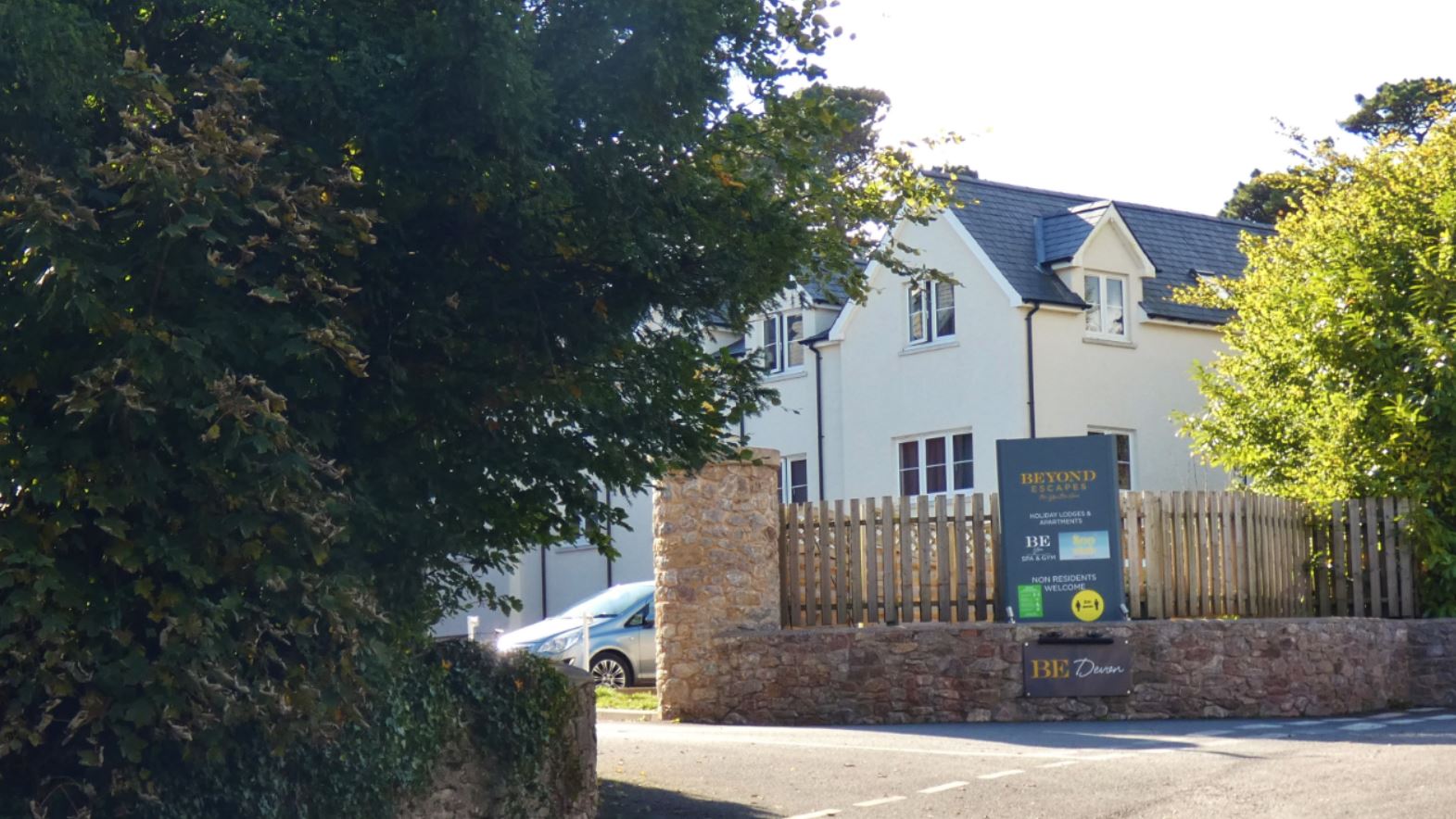

I have never stayed there myself, but I am sure it must be lovely. The views from some of the holiday accommodation (which I shall come to soon) are views that I love, and it does look like a comfortable piece of luxury now it has all been renovated.
Moving on slightly, the next entrance to our right is to a road called ‘West Lane‘. Vehicular access is only really possible at the extremities of the road since the central passage of the lane is both narrow and rough, but I believe West Lane is well worth passing through on foot – just be prepared for some steep hills!
West Lane
In this section I shall take us through West Lane from north to south; specifically, from just outside Barton Pines to the entrance that meets with Middle Blagdon.


Initially, the lane is wider, smoother, flatter, and generally much easier to access with a car (since private accommodation exists on this part of the lane). The opposite end actually has a sign at its entrance indicating that it is unsuitable for vehicles – the reason for this I shall come to soon.
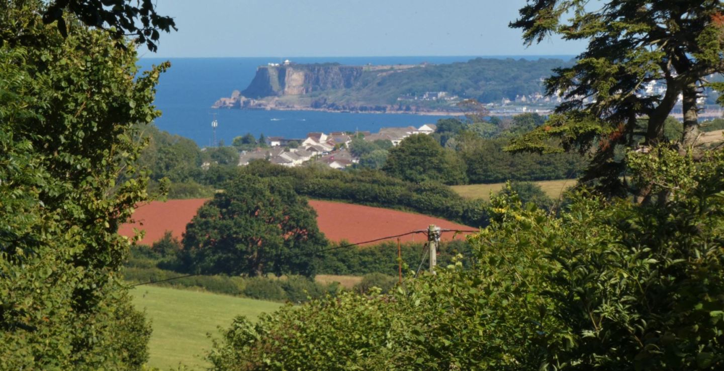
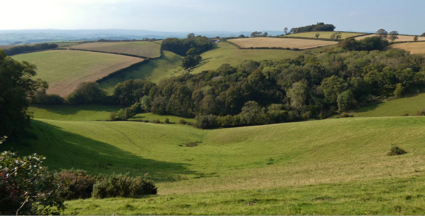
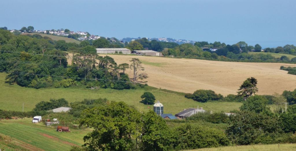
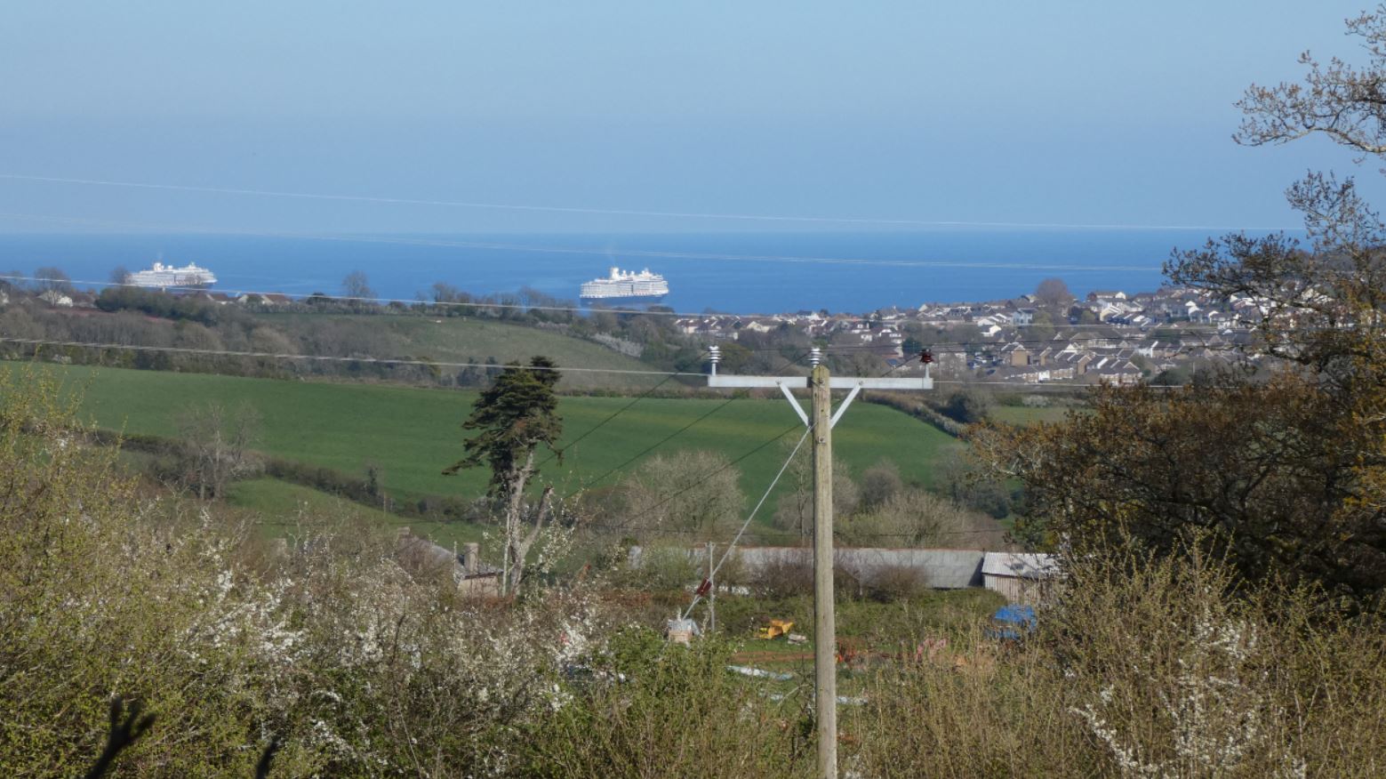
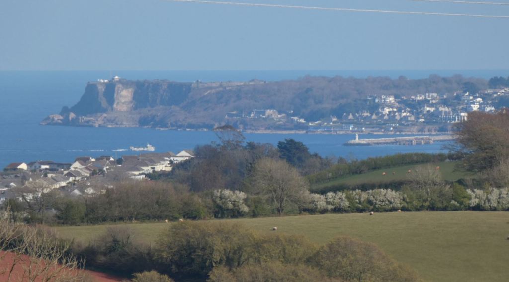
At this higher point of the lane, it is well worth pausing at the various gates and gaps in the hedgerow to take in the views. From here we can look back across to the beacons, see a fragment of Torquay, look over to the sea beyond Great Parks, see Berry Head, and look down at the church in Collaton St Mary nestled down among the trees with more of Paignton and Brixham visible beyond.


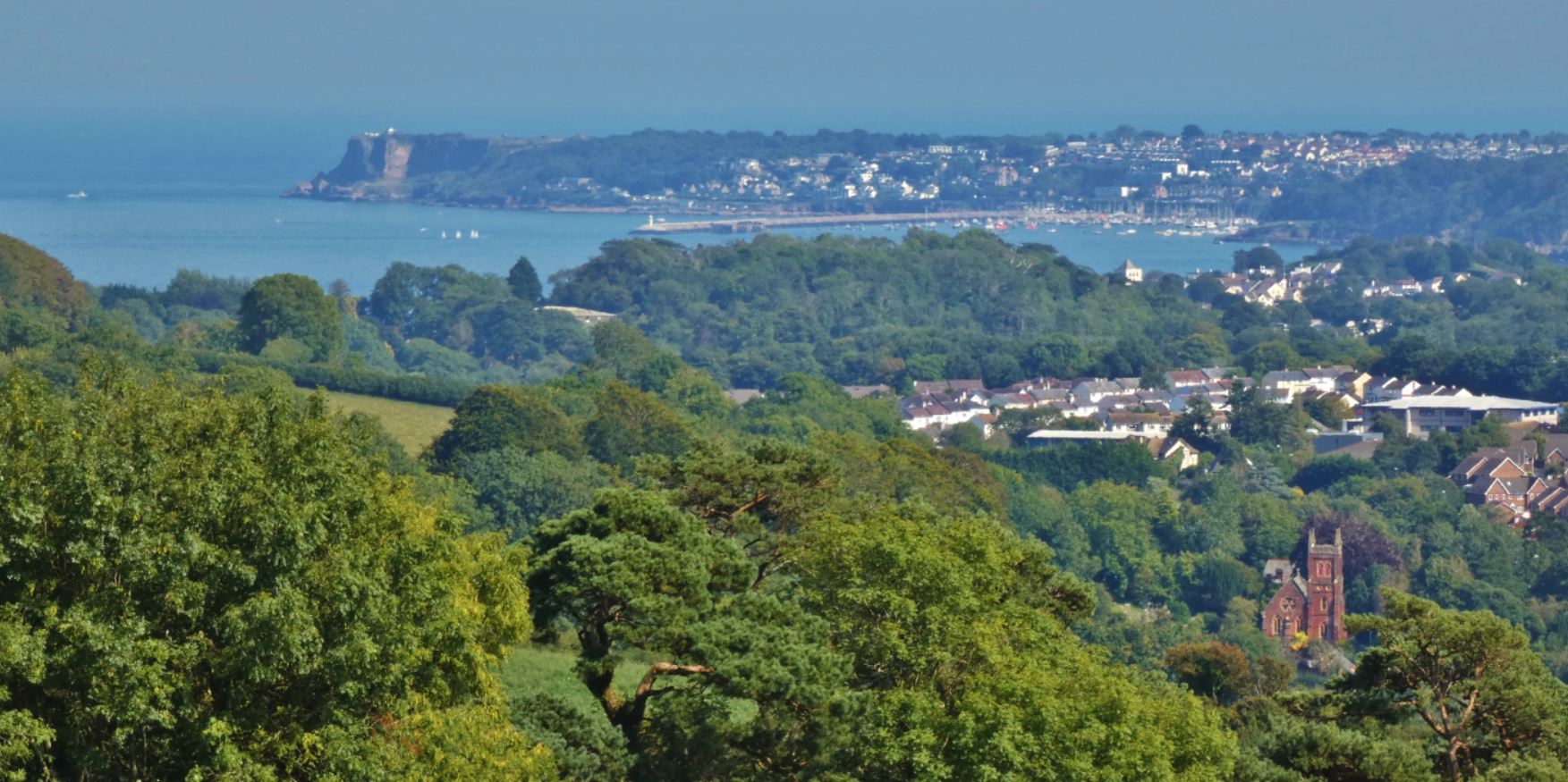
As I mention elsewhere, 2021 also provides unique views due to the cruise liners.

Also quite uniquely, famous DJ and presenter Keith Fordyce founded the Torbay Aircraft Museum in the 1971 in Paignton, and this museum was in fact located on West Lane. Unfortunately, I was not able to visit the museum as it closed seventeen years later when I was just one year old, but some information exists online, such as Air Britain’s photo library of the museum, the Mapping Museums Blog’s picture of a jigsaw featuring the museum, and Chris England’s Flickr album displaying the museum’s aircraft. Finally, and quite interestingly, the museum can be seen in action from 5:44 in this video in the Huntley Archives.
The location of the museum was, I believe, here:

As you can see, this is behind both Barton Pines and the private accommodation (Hunters Court).
Hunters Court itself is a pleasant-looking private accommodation complex – it appears to contain a number of flats to which one of the biggest draws must be the fantastic views across the countryside and to the sea.


Moving on, West Lane bends to the left and quickly goes downhill. Believe me, it is much easier to walk the lane in this direction – walking the lane from south to north is quite the climb!


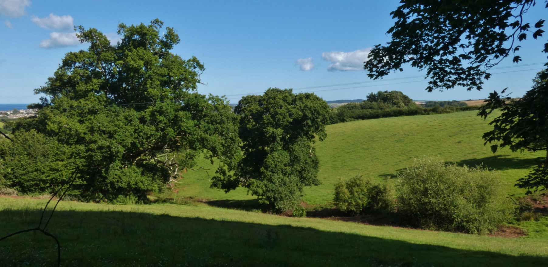
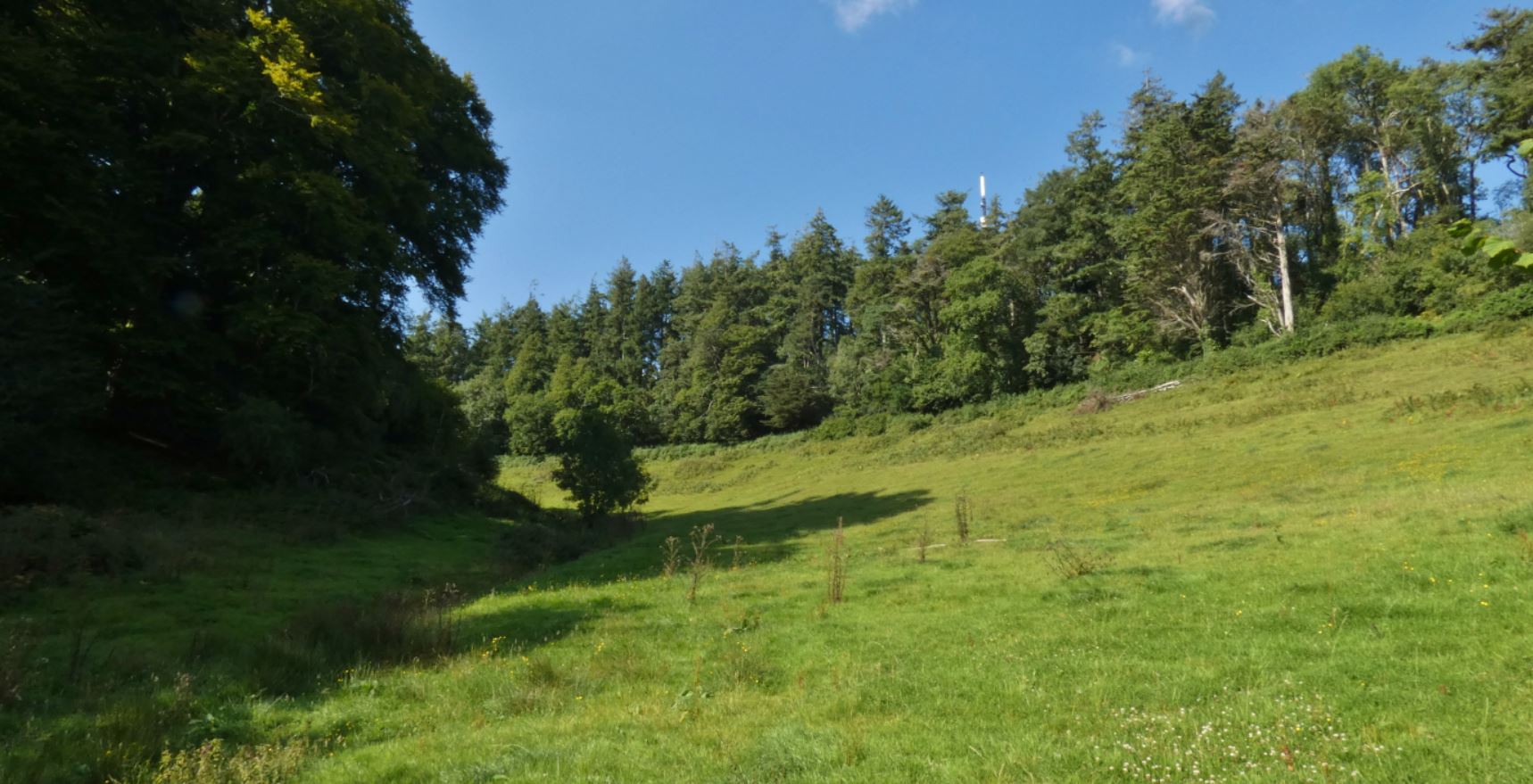
As we descend, the lane becomes slightly more wooded. The fields to the right become difficult to see, and slope uphill anyway, meaning that what lies beyond cannot be seen until later on at the other end of the lane. You may be able to spot some young Christmas trees up high, but our next checkpoint comes at the bottom of the slope.

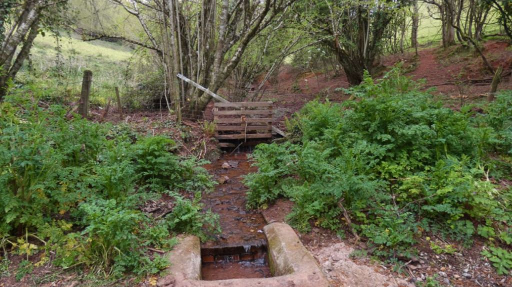
Eventually, when we get to the bottom of the steep slope and bend left, we meet a series of gates to fields and wild lanes and, just after, a small stream. To me, this is a little-visited treasure and I was not aware of it for many years before finally making the decision to cover every lane in the area with my walks.


The stream emerges from the fields above, flows under the lane and under what I presume is an old gate post, continues to flow alongside the lane as you walk on, before forking off to join up with the stream that flows down to Collaton St Mary.


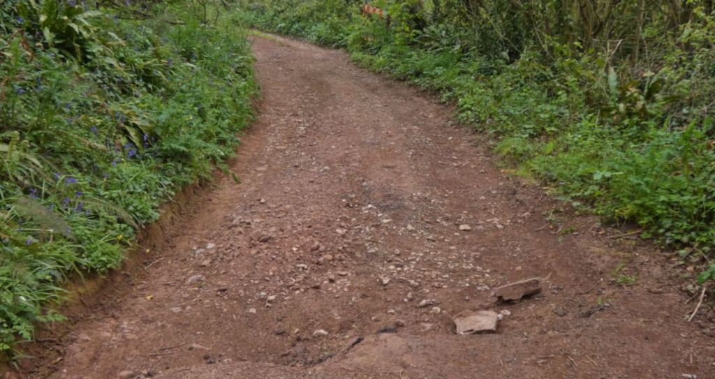
Continuing from here, it is easy to see why this section of West Lane is not suitable for vehicles. On a particularly dry day, one might be lucky, but following any period of rain, the lane can be treacherous.

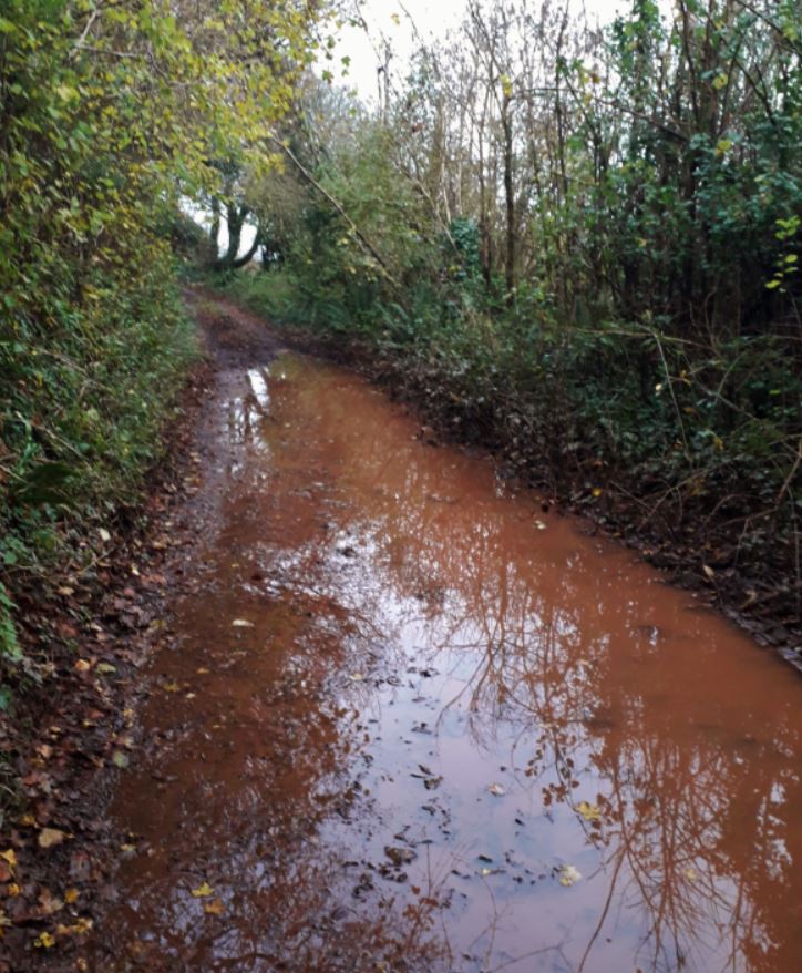
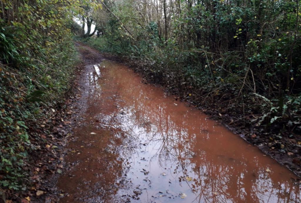
As you can see above, following a wet period, it can barely be passed through on foot.
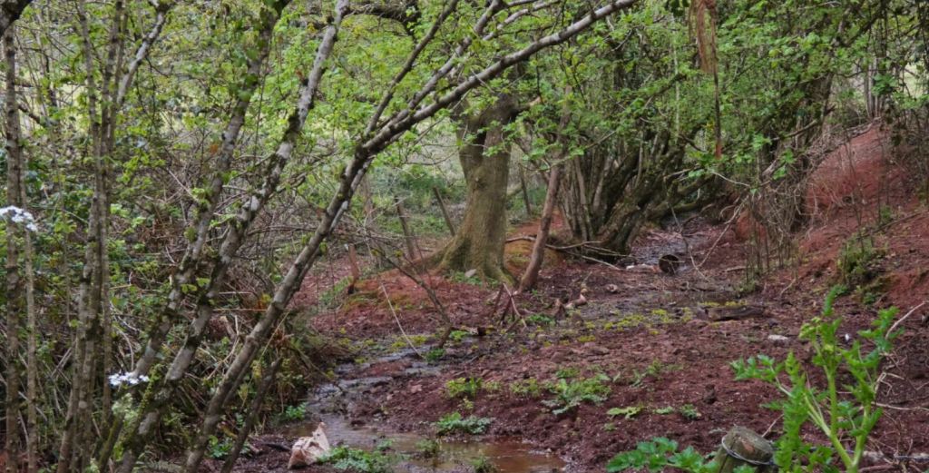
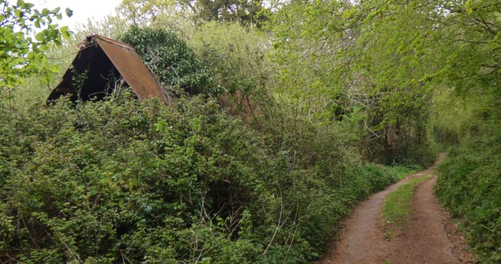
The lane down here is relatively secluded and lush with foliage – to your right, you may see how the surroundings open up to fields of Christmas trees or perhaps the borders with the fishing lakes, but there is little else barring an abandoned old farm building.


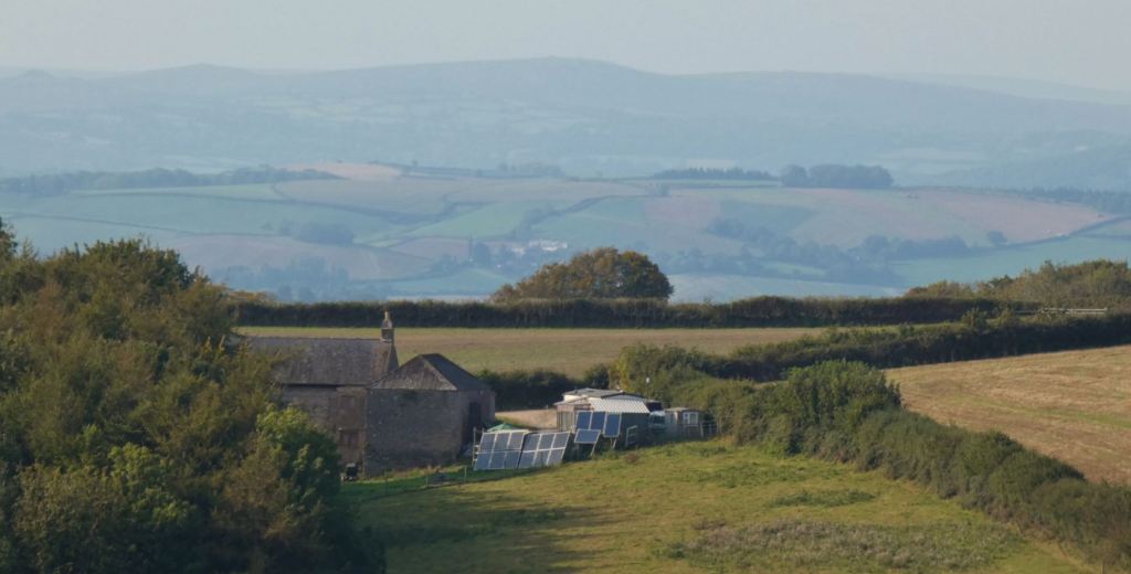
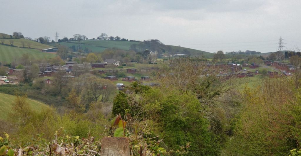
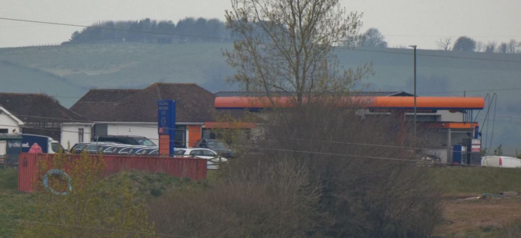
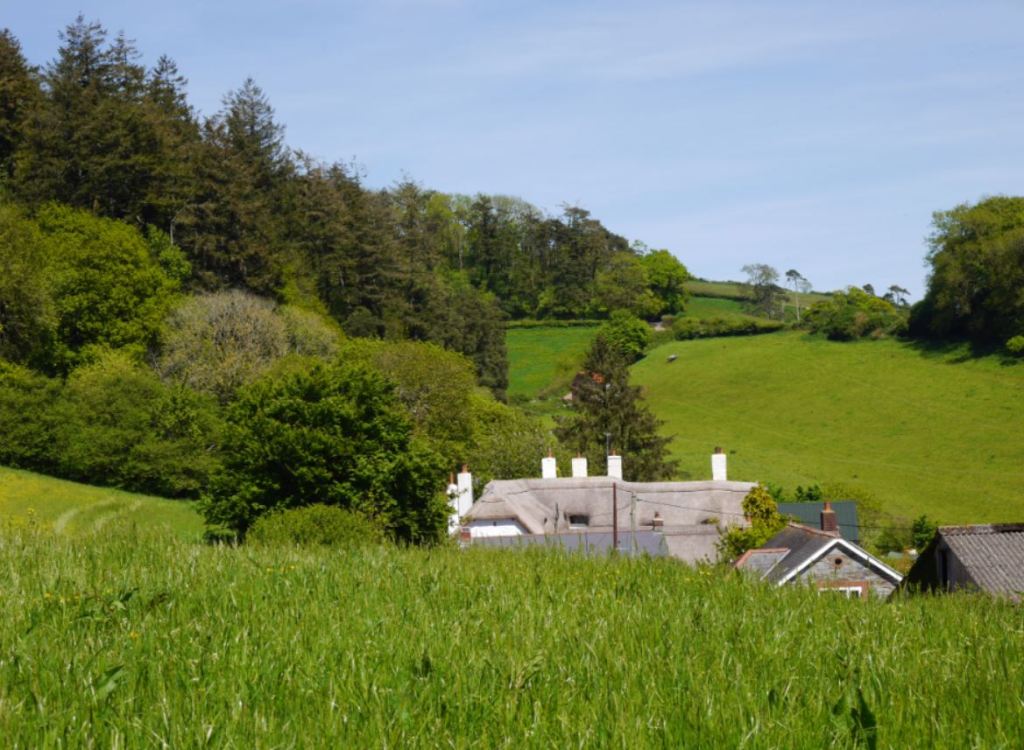
As we reach the end of the flat section and begin to climb up and left again (albeit less steeply than earlier!), you will be able to see a lot of the buildings that surround the main A385 Totnes Road (we are in fact pretty close to the road itself considering where we started). The further you progress up the slope, the more you will be able to see – from the garage to your far right, across to the Bay Tree restaurant, and up to the holiday park to your left.


As always, be on the lookout for animals! Pheasants are a constant presence.
As we near the other end of West Lane, when the lane levels out once more, we begin to approach Blagdon Road once more. Before reaching the road, however, there is one final potential treasure.
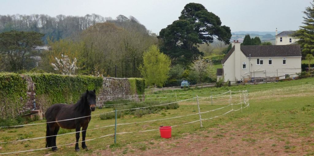
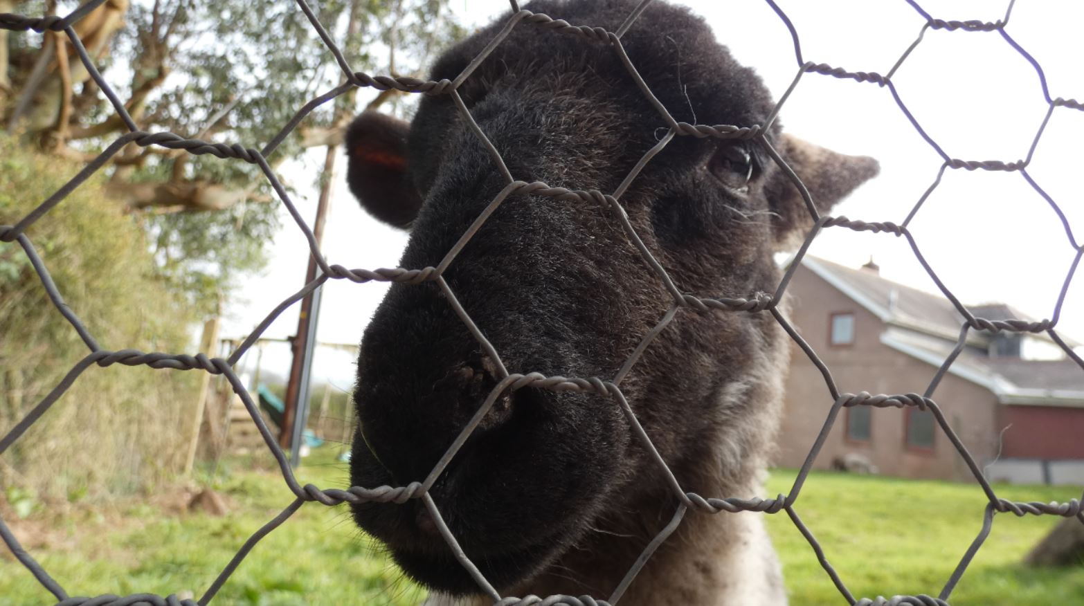
The grounds to a farmhouse, marked by a small barn to the right, often contain horses. On one particular day in May 2020, we were lucky enough to meet this fine creature in the field close to the end of West Lane:
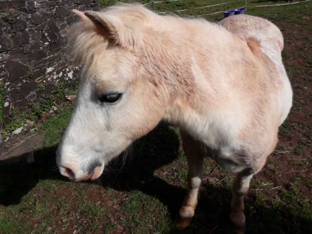


He was very friendly indeed!
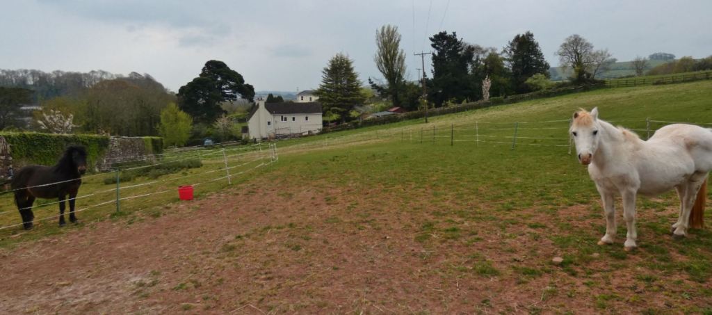
And when I went back recently (April 2021), he had a friend!


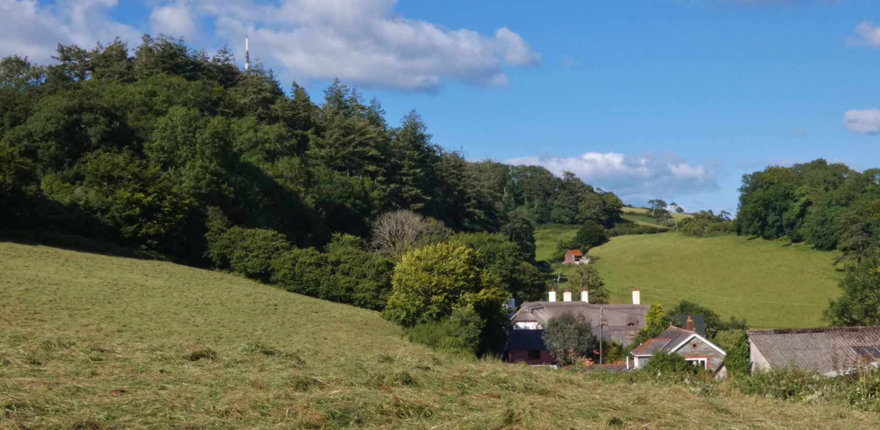
Just beyond here, we reach the end of West Lane and meet back at Blagdon Road in Middle Blagdon. I shall cover this area a little more in a later part of the guide; for now, we can either go back uphill to Higher Blagdon, go right down to Lower Blagdon and Collaton St Mary, or go straight ahead to see more of Middle Blagdon, head towards Great Parks, or loop around via Bell Lane. More to come in this later!

Further Down Blagdon Road from Barton Pines
I shall leave the area around this end of West Lane for Part Four of the guide, which takes us from here (Middle Blagdon) up to Buttshill Cross and down to Collaton St Mary.
For now, we shall continue down Blagdon Road from the upper entrance to West Lane at Barton Pines.
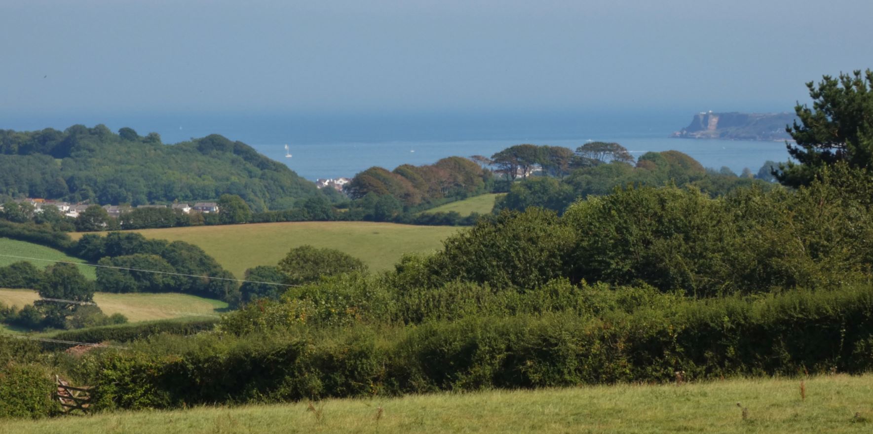
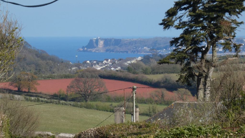
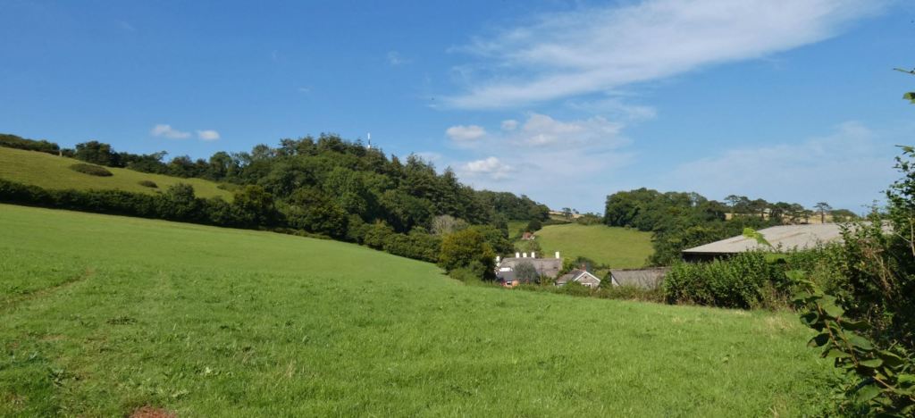
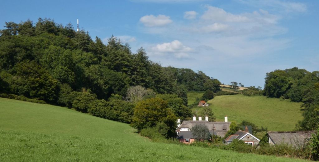
Our next stop is the junction at Higher Blagdon where Butts Hill meets Blagdon Road. Before that, we descend down a hill that not only provides wonderful views of the countryside but also of the sea and Brixham due to the unique position of the road that offers an uninterrupted view over to Berry Head.
Departing from West Lane, take a moment enjoy the views down across the fields to the right.
The sea, already visible at this point, provides the backdrop for residential areas of Paignton such as the Great Parks estate, which shall be covered in the fifth and final part of this guide.
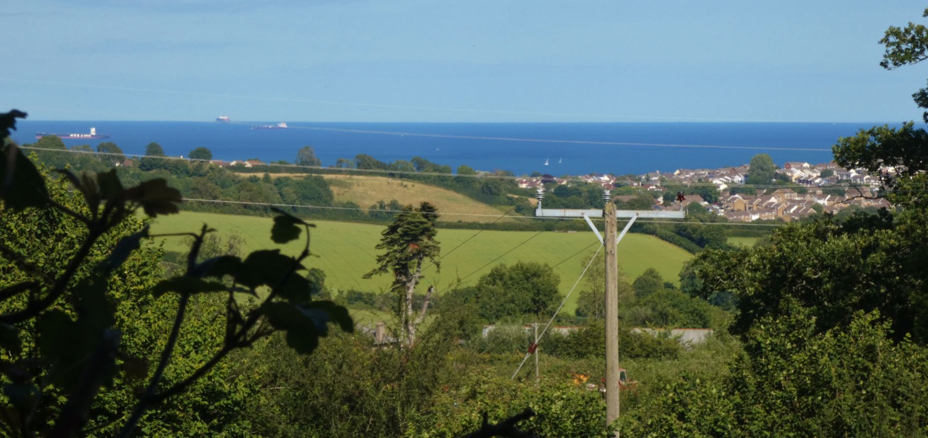
Unfortunately, the power lines are a little obtrusive here; however, clearer views over to the sea come as we descend down the hill, so we need not worry.


The fields on the other side (to our left as we head downhill) do not necessarily offer many views, but are frequently teeming with wildlife and may be worth checking out if you like your pheasants.

It should also be noted that although the road becomes much wider further down, this is also due to the slightly higher volume of traffic that passes through here. It is usually by no means busy (it is all relative, after all), but care should still be taken and one should be aware of their surroundings if stepping into the middle of the road to take a photograph.
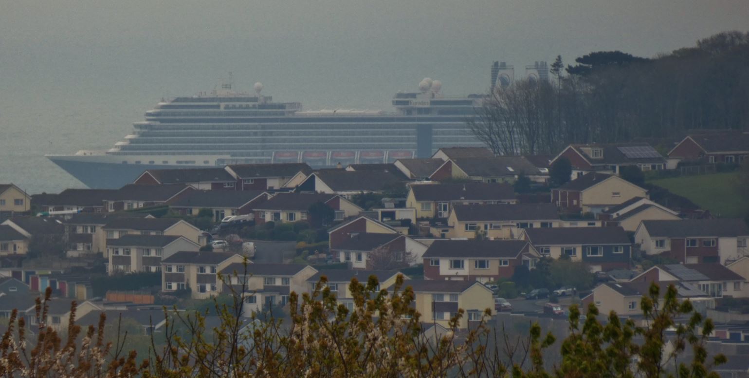
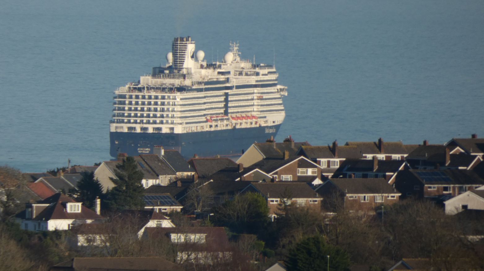
In 2020 and 2021, the Covid pandemic led to cruise ships making Torbay their home. Therefore, as with many other parts of these lanes, there are some unique views that may not be seen again when this crisis hopefully abates.
Those clearer views across to Brixham appear as we get closer to the junction with Butts Hill.


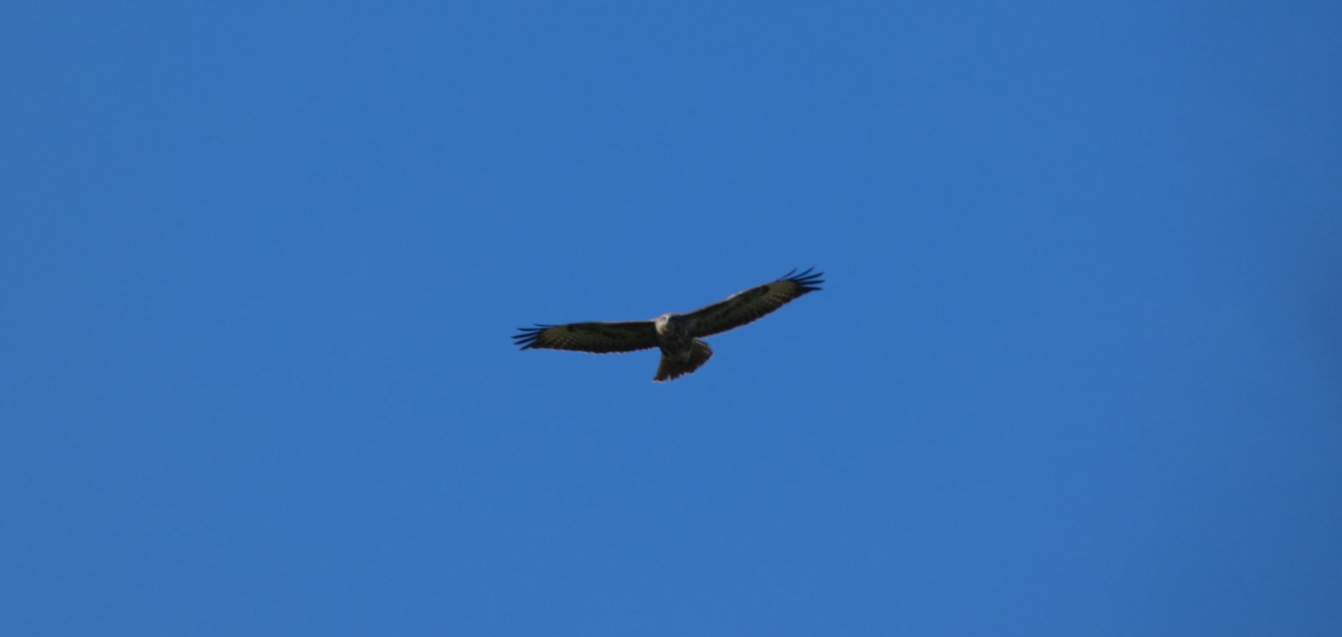
Just occasionally you might not be alone in taking in the views…


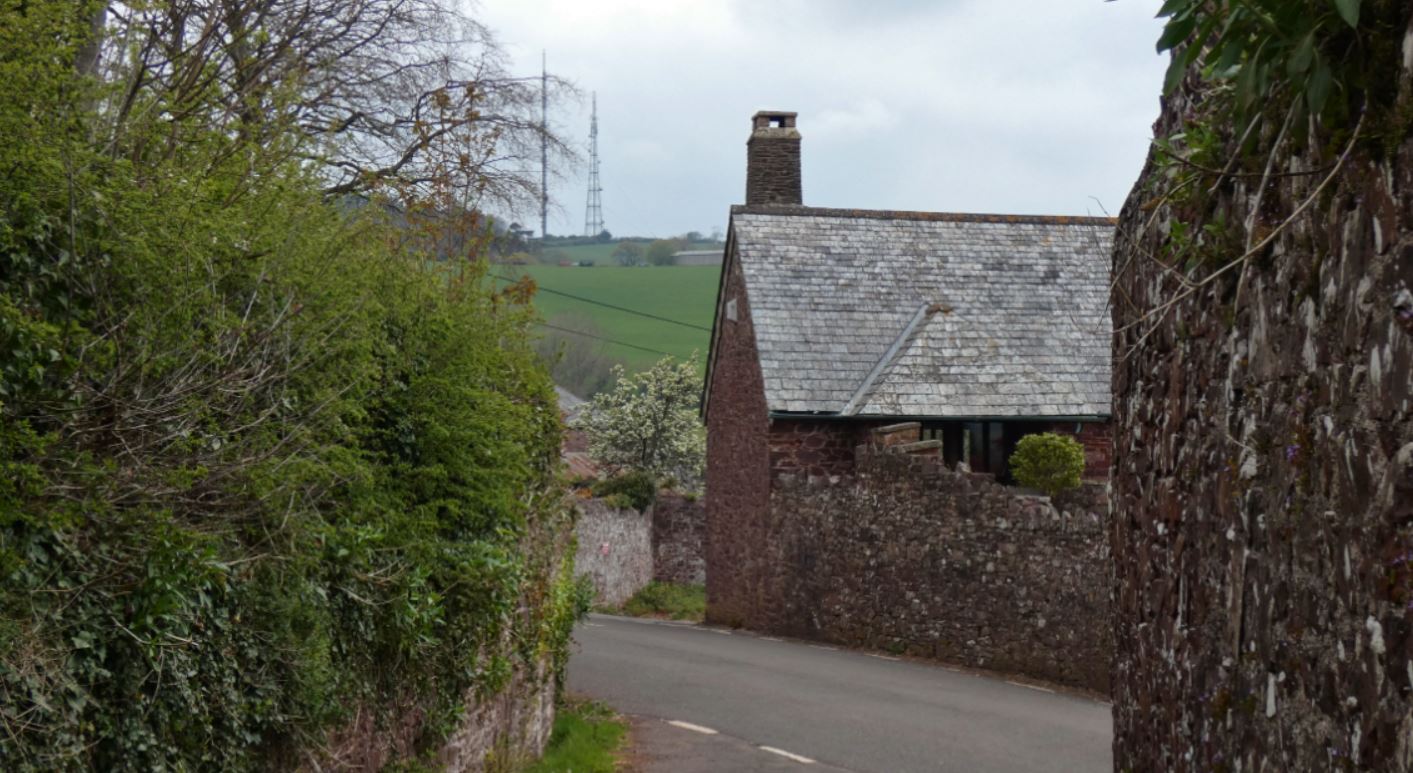
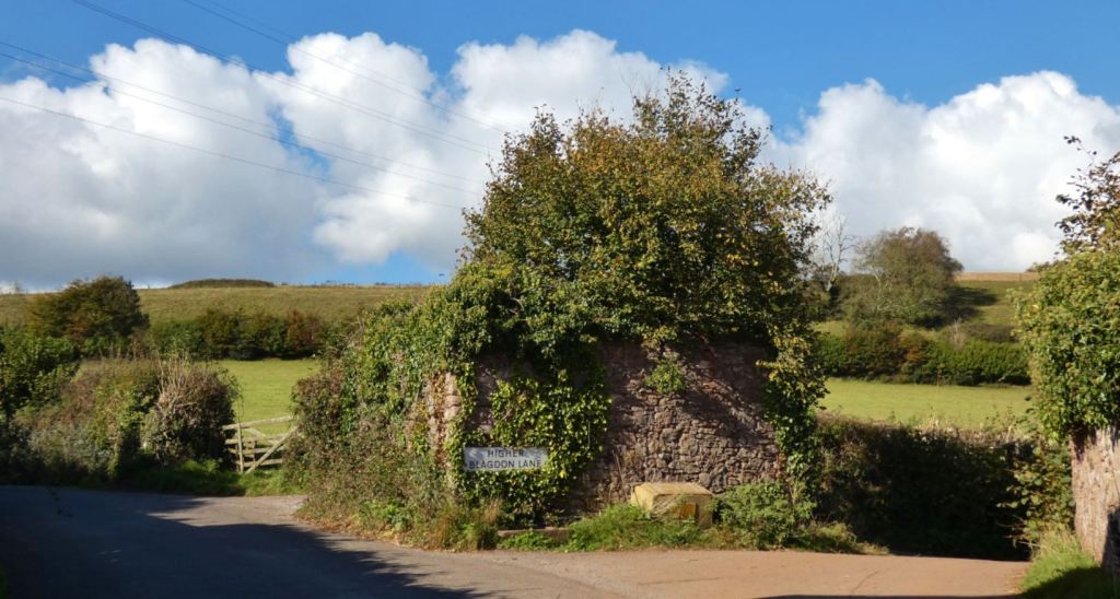
As you progress, you will know that the junction between Blagdon Road and Butts Hill is close when you are able to make out a small, ruined stone building covered in foliage.

From here, you are presented with a couple of options: take a left and head down Butts Hill to Buttshill Cross, or continue on down Blagdon Road to Middle Blagdon, Lower Blagdon, and, eventually Collaton St Mary. I shall focus on the latter in the next part of my guide, but for now I will say that both ways have their value. In fact, the first part of your continuation down Blagdon Road offers some decent views back to Buttshill, where the farmhouses and the greenery beyond them can be seen.

Local, seasonal produce may also be available for sale at the farms located here. I believe they also provide turkeys for the festive period, but we have yet to try this.

Butts Hill up to Buttshill Cross

Starting at the ruined structure, take a moment to peer into the fields and down Butts Hill. It’s pretty stuff.


The ruined structure itself may not be much more than a former storage building, but it does still seem to act as a conduit for the water that flows from the stream up Blagdon Road. This is in evidence from the water trough connected to the building.

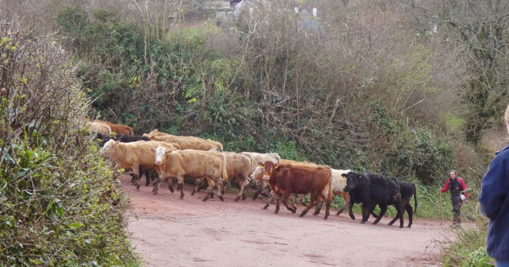
Butts Hill itself is a mix of industrial farm units and pretty cottages. Expect to see cows, chickens, lambs, and various other creatures depending on the time of year.


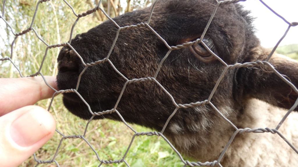
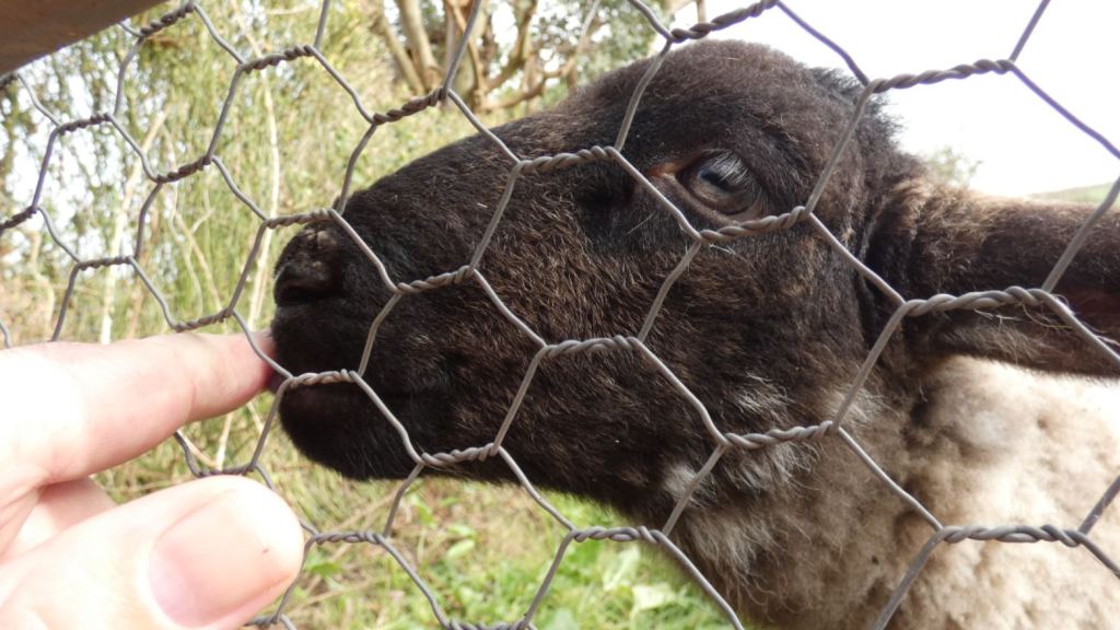
I should offer my thanks to whoever owns the pretty pink cottage on Butts Hill as I had the delight of saying hello to some of the friendliest lambs I’ve seen on one particular walk in 2021. They did not seem to live in their garden for long, but they were a nice distraction and provided a pure overdose of cuteness for a few moments.


Moving on down the lane, we pass some highly attractive cottages and farmhouses, as well as a small stream further up. Following more unsettled periods of weather, the small stream can grow and cross the lane at various points, so be prepared to paddle a little if you take a walk in a wet period!


Following the Rose Cottage, we pass a traditional white cottage with more chimneys than you can shake a stick at!


Next, a more modern country house, perched up to the left with Buttshill Copse acting as a backdrop behind it.

Beyond this, we approach the end of the lane and must tackle a steep climb up to Buttshill Cross. Before this, take a moment to appreciate both the view on to the old farm building and, slightly later, the glorious greenery of the field to the left, with its stream, its backdrop of the beacons, and occasionally its resident livestock.


While said livestock is usually confined to the field, you might occasionally find yourself in a sticky situation when they are being transported from place to place.


One final steeper climb and we have finally arrived, once again, at Buttshill Cross, from which we can take a further journey down through the valley or on up to the beacons, both of which are gorgeous walks themselves (click for more information).


Once again we reach Buttshill Cross, a truly central location in this guide. I again hope that this guide provides inspiration or guidance to anyone interested in exploring this beautiful area of Paignton and that it has perhaps informed some people as to what may lie a mere few minutes from their doorsteps.
Thank you for reading! Parts four and five to come soon!
Coming up…
4) Entering from Collaton St Mary
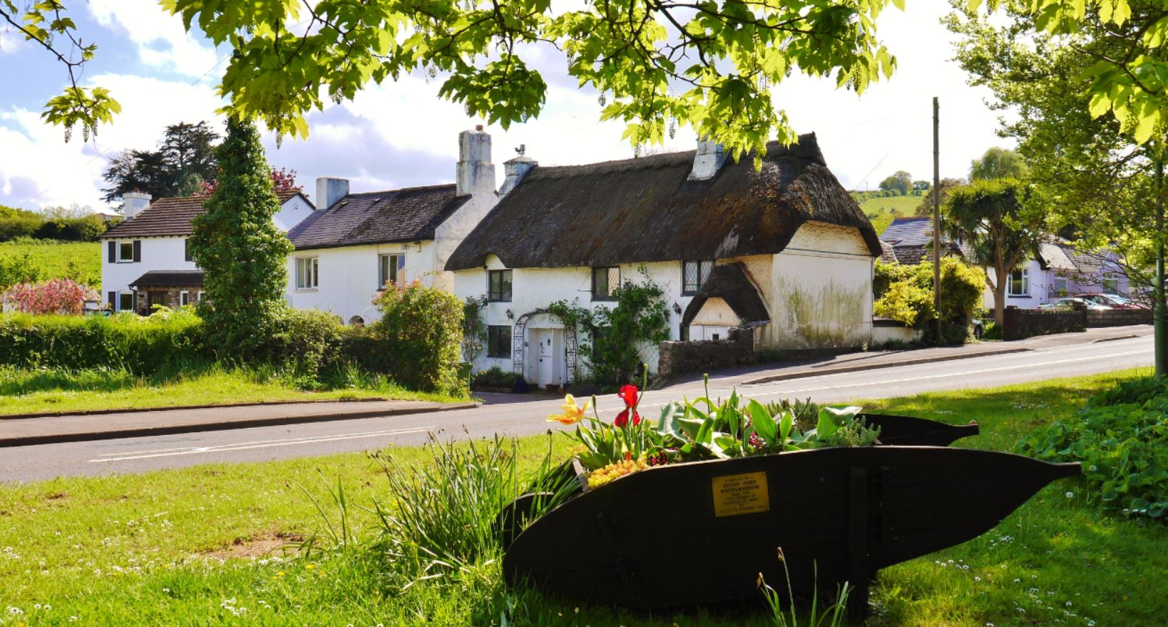
Possibly the widest entrance to the lanes, the southern end of Blagdon Road that is bordered by Collaton Primary School and the Collaton St Mary church is a safe way to head into the countryside (providing you remain aware of any potential passing traffic – Blagdon Road is probably the ‘busiest’ road in these lanes).
5) Entering from Great Parks / Luscombe Road (QED)
What was once a quiet hill that sunk into the valley, the entrance at Queen Elizabeth Drive / Great Parks is now much more popular due to the development of the housing estate to its north, and is only likely to become more popular due to the new housing development that at the bottom of Luscombe Road/Lane. It does make me sad that this beautiful area is soon to be surrounded by even more houses, but I suppose the current batch of new houses are at least being built on land that exists between existing houses and are not extending further into the valley.

hey I’m trying to find info about a spot I found in the afton area heading towards the castle in an area called tenners bottom, it’s some old ruins in the woods ? Any ideas ? I’ve got some photos I can send
LikeLike
Hi! I can’t say I know much about it myself, but looking at the map I see that Tenner’s Bottom might be within the private land controlled and forested by (possibly) The Forestry Commission? I know that there are various areas of woods around there that are clearly marked as private and where it is signposted that trees are chopped?
LikeLike