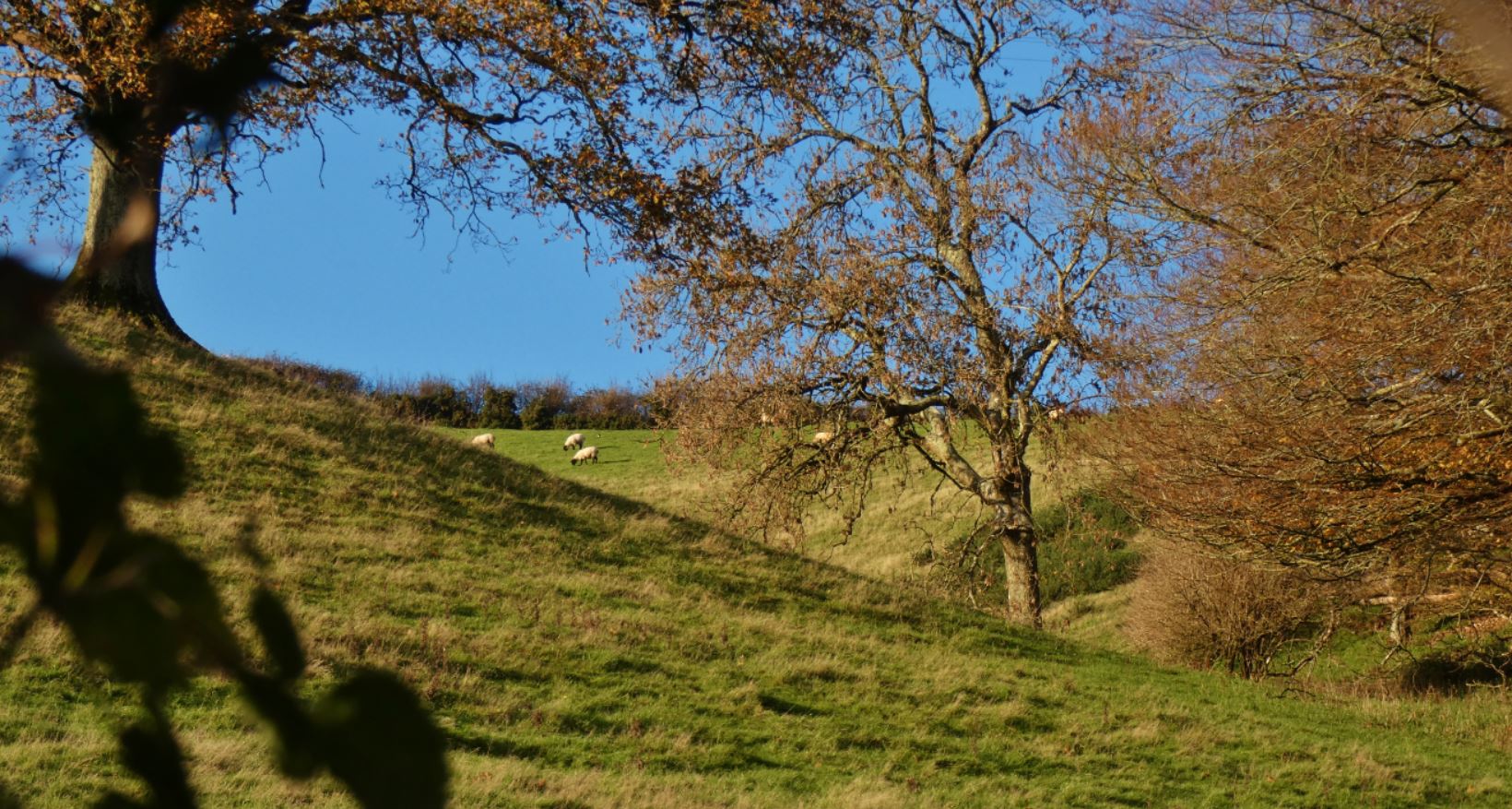
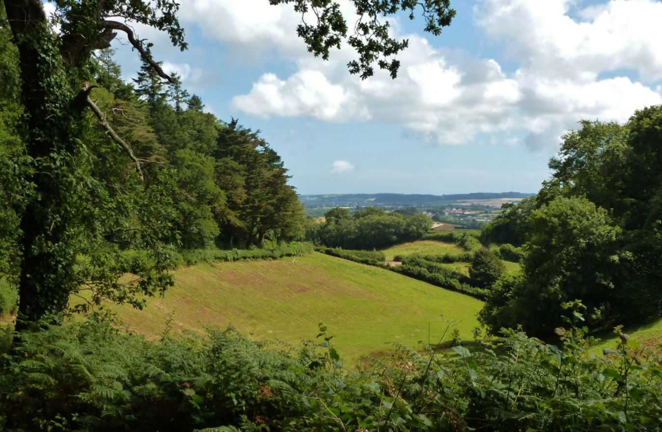
Having grown up in Foxhole (Paignton), I was blessed to have some of the finest, greenest Devonian countryside right on my doorstep as a child. Regular walks down the country lanes and having the valley visible from my road (and even my back garden) formed something of a connection between myself and the fields – whenever I come home from one of my longer periods away or think of Paignton, the association I make is with this area and not, as the guidebooks, tourists, or internet promote, the blue seas or caravan sites. The mostly unspoiled beauty of the Westerland Valley and the areas around the two metal towers known locally as ‘the beacons’ deserve more attention, particular in a time when more and more local people are experiencing their beauty and tranquillity during the Covid-induced lockdowns.
Walking ‘down the lanes’ has very much become a regular occurrence in 2020 and 2021 for me due to the ongoing pandemic – working from my bedroom at home has resulted in me looking for ways to keep fit (and sane), so I have probably been for more walks down the lanes in this period than all other years of my life put together. It has been my gym, my meditation, and a place from which I have taken more photographs with my camera than any other. Here, I am going to attempt to show my collection of photographs (both recent and over the last ten years or so) and, hopefully, provide some useful insight into the area for walkers now that I feel I know pretty much every little nook and cranny of the area!

Map imagery in this post courtesy of Google Maps and OpenStreetMap (© OpenStreetMap contributors).
Firstly, I shall qualify the lanes for the purposes of this guide. With its eastern border more or less following King’s Ash Road, the southern border reaching the main Totnes Road, and the northern edge following the older Totnes Road (the one that connects Marldon with Totnes via Berry Pomeroy), many of the lanes fall within an area known as the ‘Westerland Valley’, with many of the primary lanes running with lush, verdant fields hugging the land on either side. Many people will have seen this area from afar on their drives – perhaps glancing out of a car window from King’s Ash Road or Totnes Road, although when I mention the area to some of my local friends and acquaintances, few are aware of the bounty of farm land and farmhouses, streams, beautiful country houses, British berries and woodland plants, and local wildlife that they have on their doorstep. I hope this little guide opens some people’s eyes to what we have nearby and perhaps even encourages some to take a stroll to see for themselves. Enjoy!
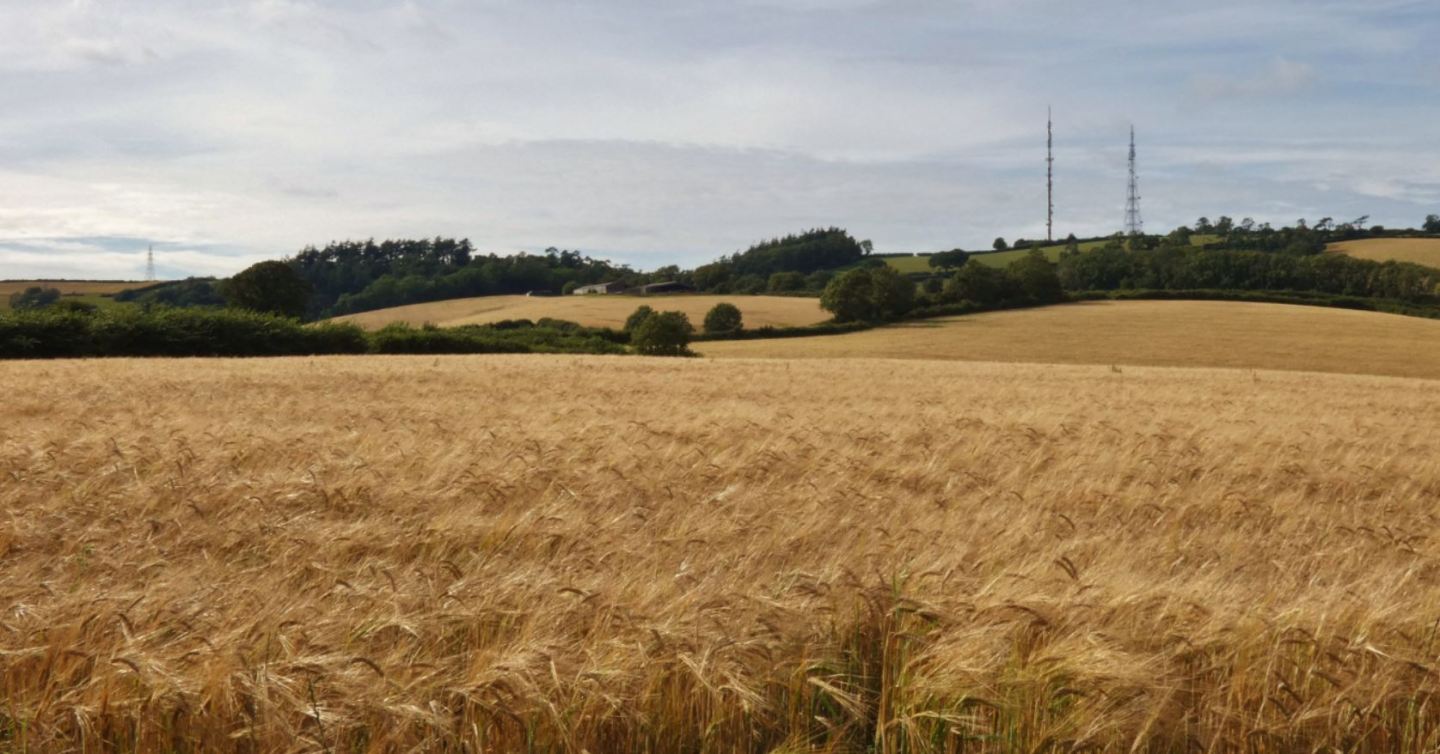
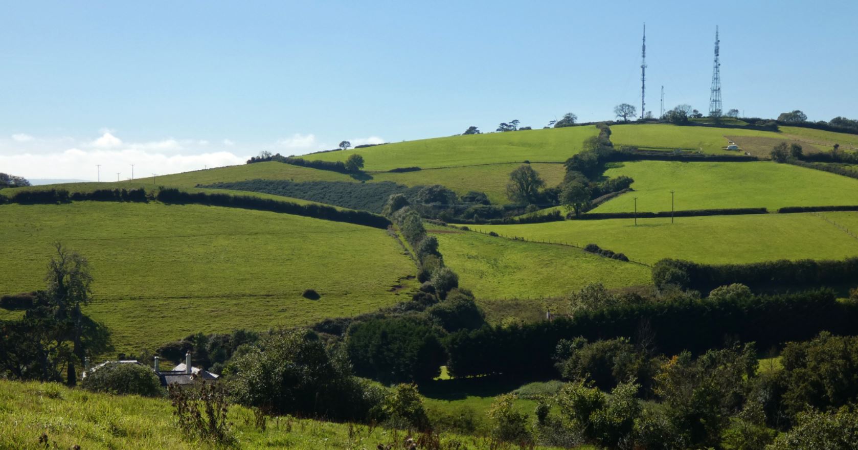
The Lanes at a Distance
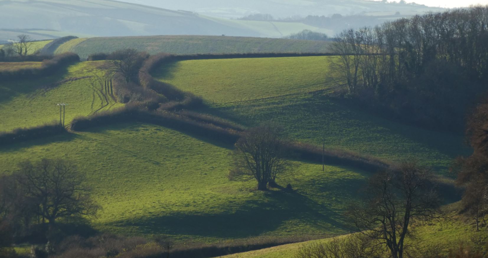
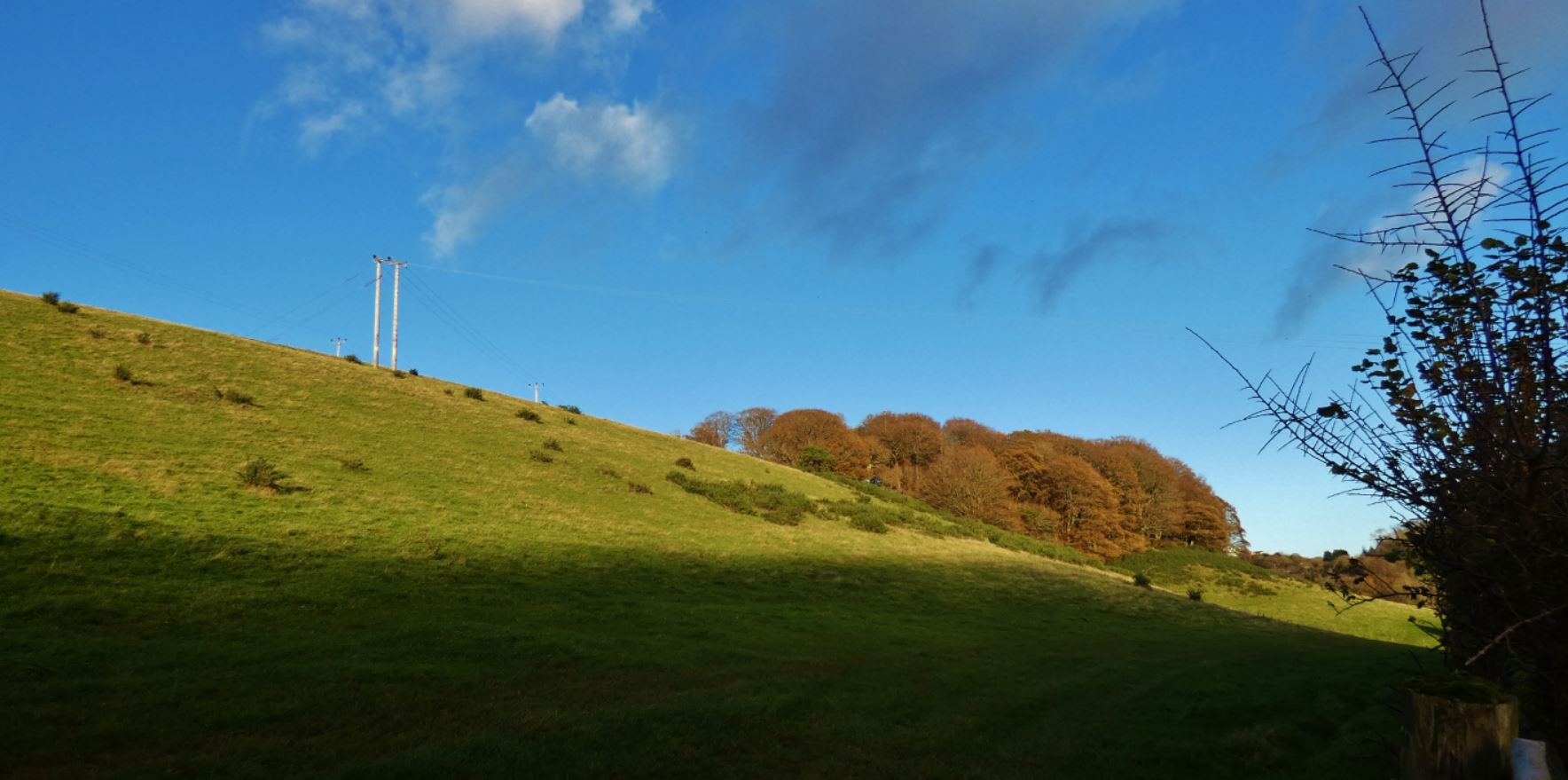
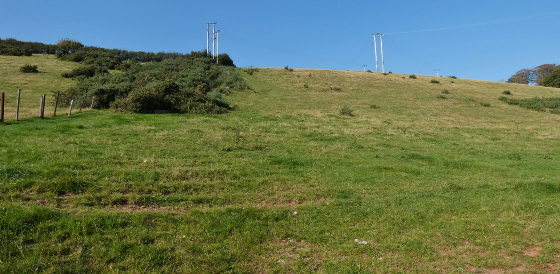
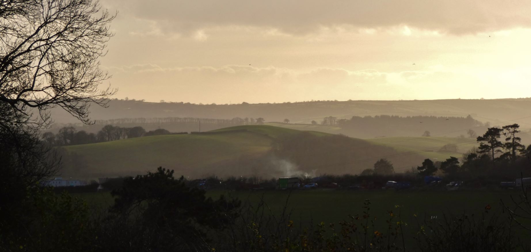
It stands to reason that, due to their purpose, the beacons would be constructed on the highest land in the area, and indeed the towers can be seen from great distances away – not only is there an uninterrupted view of the field at the foot of the beacons from Paignton beach, there exists the possibility of looking back on this area from as far away as Dartmoor, Totnes and the River Dart, and beyond.

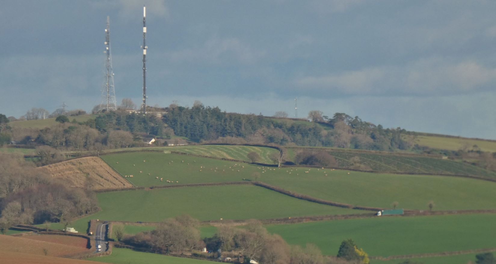

Therefore, logically, on a clear day, the views from the fields near these towers are unparalleled in the area. Haldon Belvedere (nearer Exeter) stands out to the north, Dartmoor provides a stunning backdrop further west, and of course Tor Bay is a blue treasure covering most of the east. I will, of course, provide more pictures of all of this later on in the guide.
How This Guide is Structured – Five Entrances (On Foot)
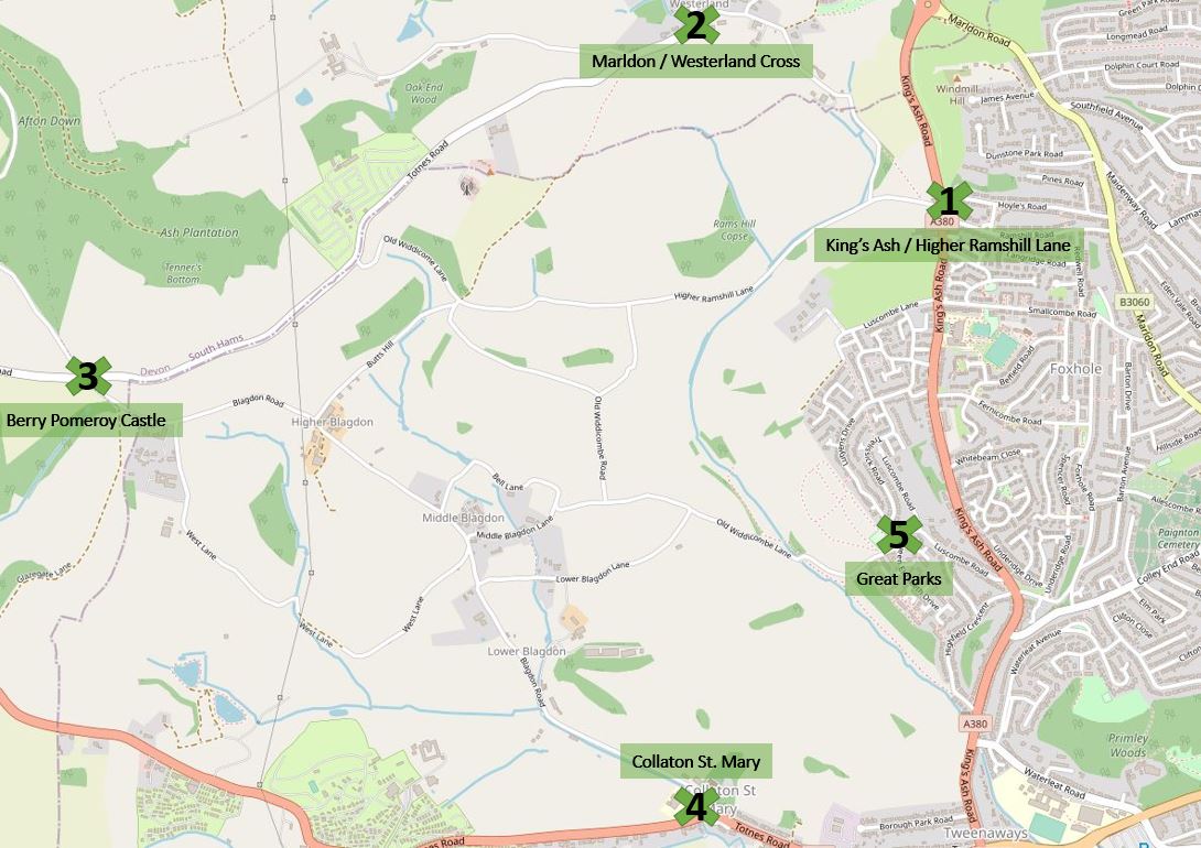
I will divide this area into five smaller sections: the areas close to and running from 1) King’s Ash Road (entering opposite Ramshill Road / Hoyles Road), 2) Marldon / Westerland Cross, 3) Higher Blagdon – in particular, from the junction opposite the lane that leads to Hangman’s Cross and Berry Pomeroy Castle, 4) Collaton St. Mary and Lower Blagdon, and 5) the entrance from Great Parks / QED / the newer estates close to Luscombe Road. These areas may overlap somewhat as we get to the centre of the region, but I will do my best to remain clear in which parts I am referring to!
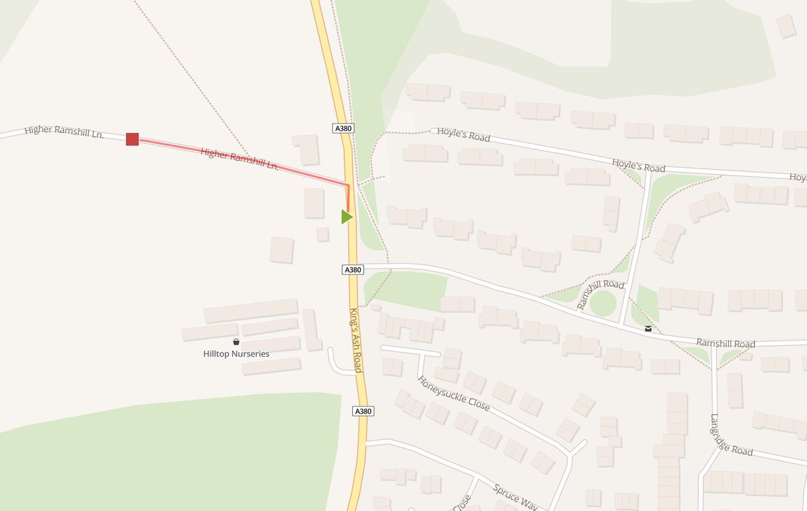
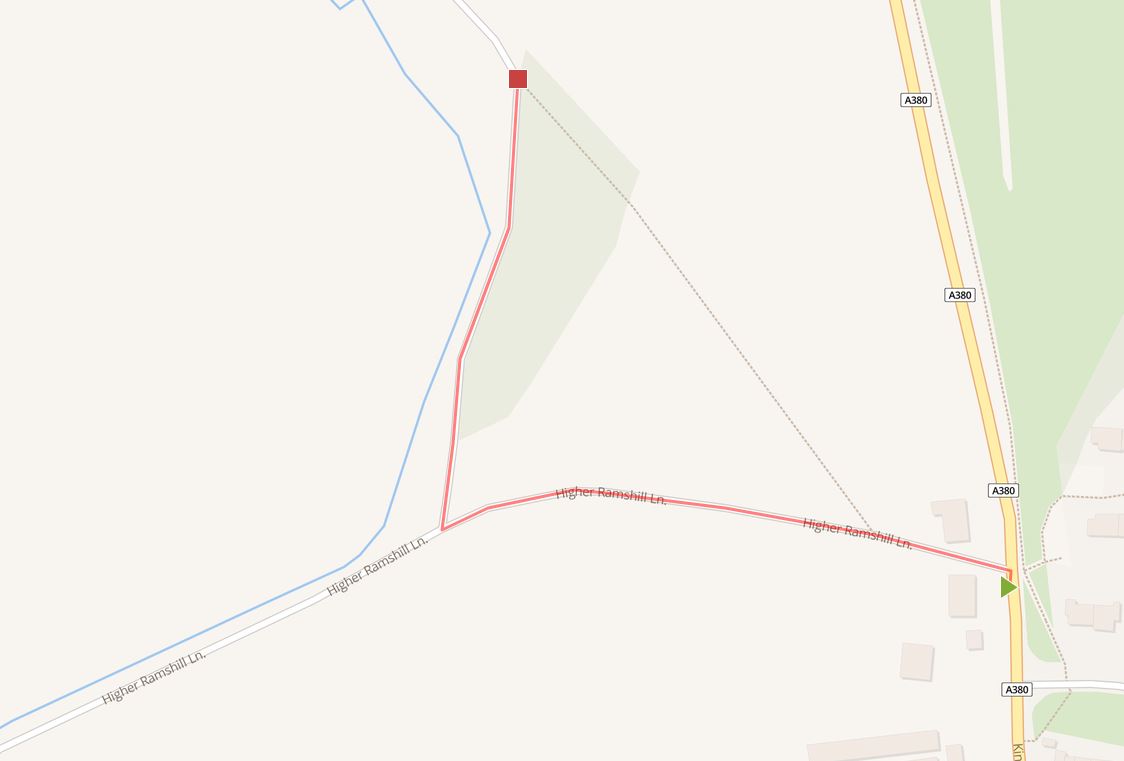
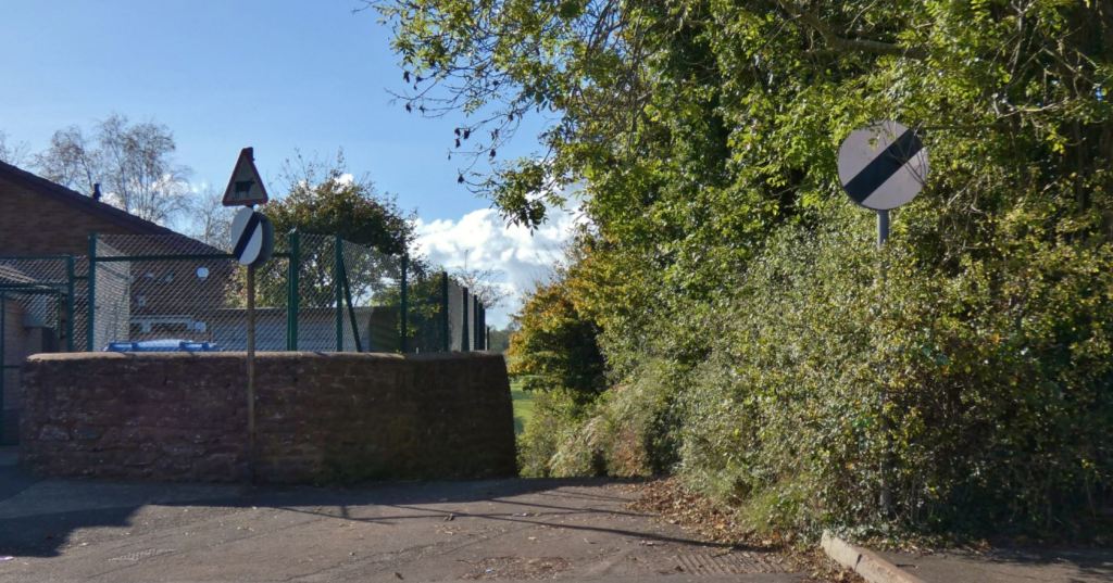
PART ONE – Entering from King’s Ash Road

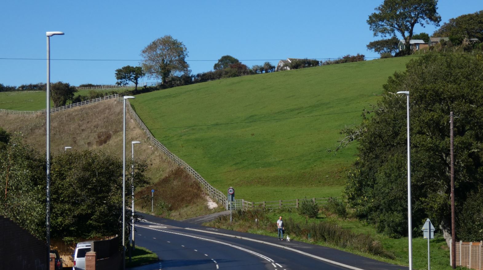
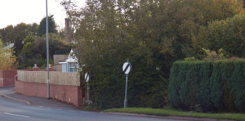
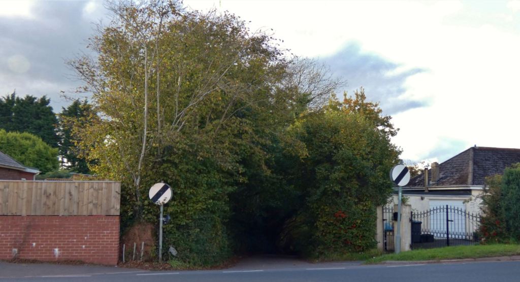
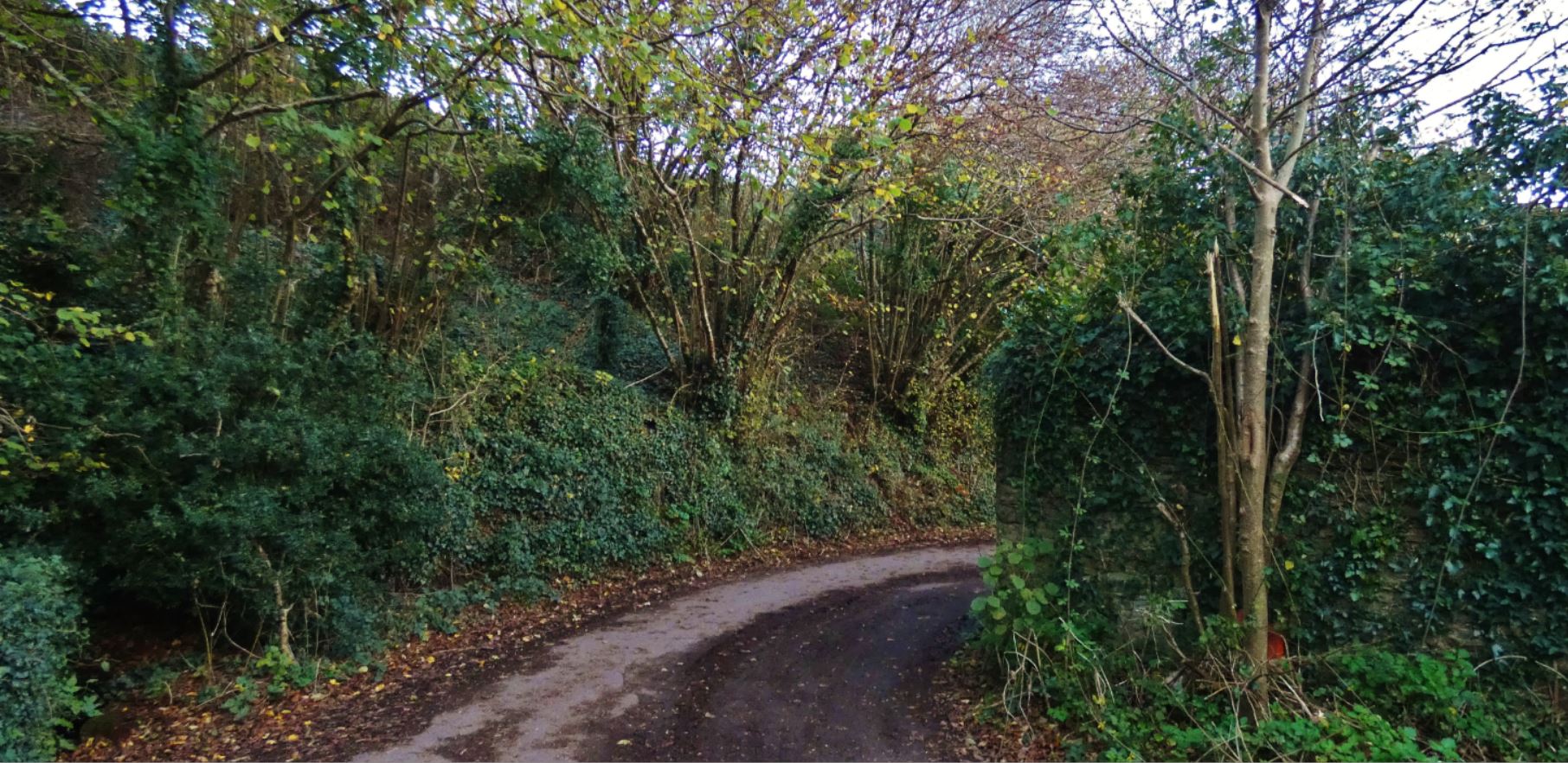
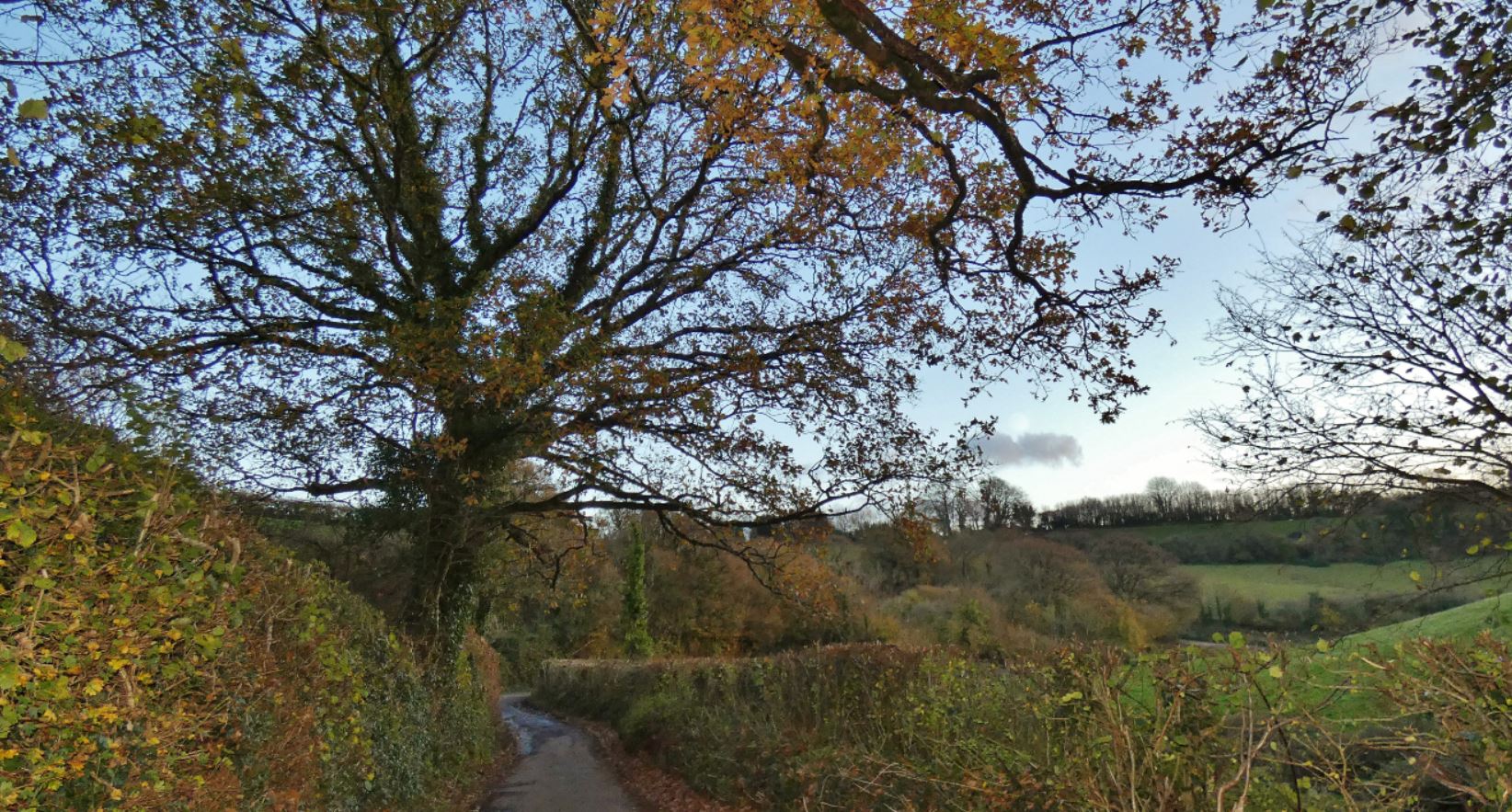
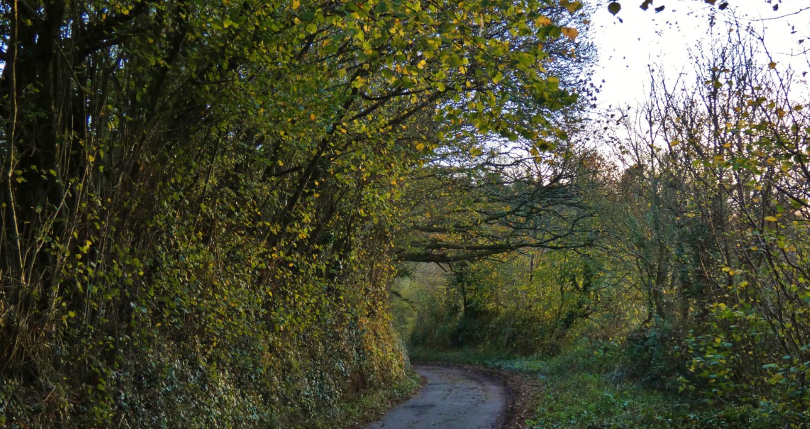
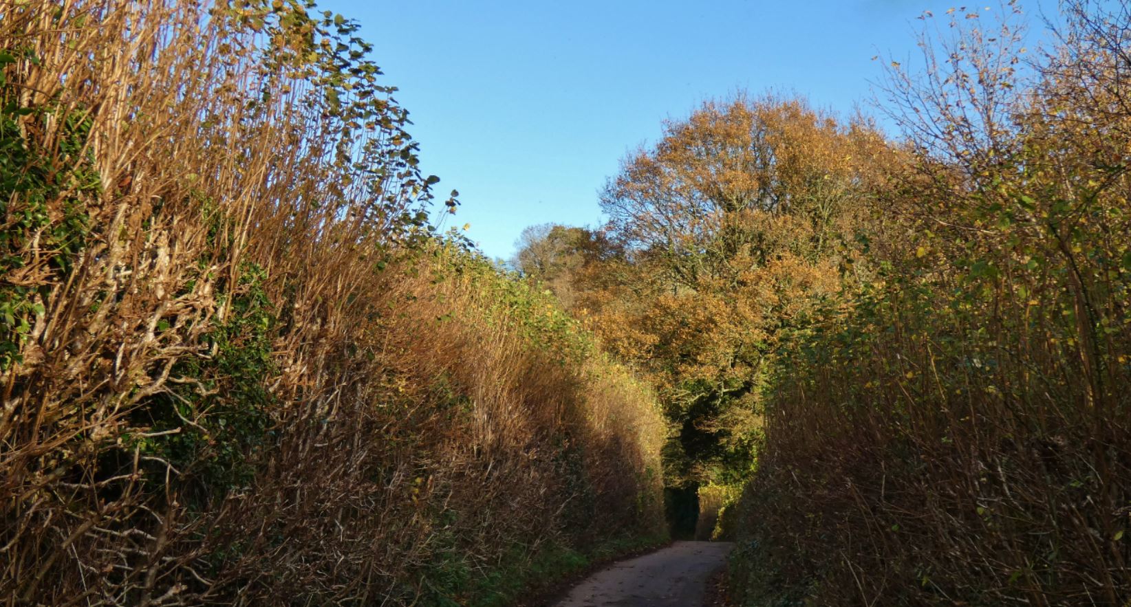
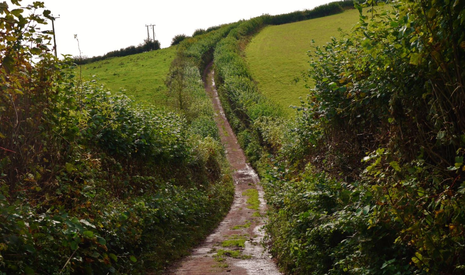
Having grown up in two different houses in Foxhole, the gateway to the lanes has always been the entrance from King’s Ash Road for me. Directly opposite the end of Hoyles Road and Ramshill Road, the downhill slope known as ‘Higher Ramshill Lane’ is a tunnel of trees that always evoke childhood memories to me – within seconds, you feel as though you have escaped the traffic of the main road and the civilisation that lies in the housing estates to its east.
King’s Ash to Cruel Cross
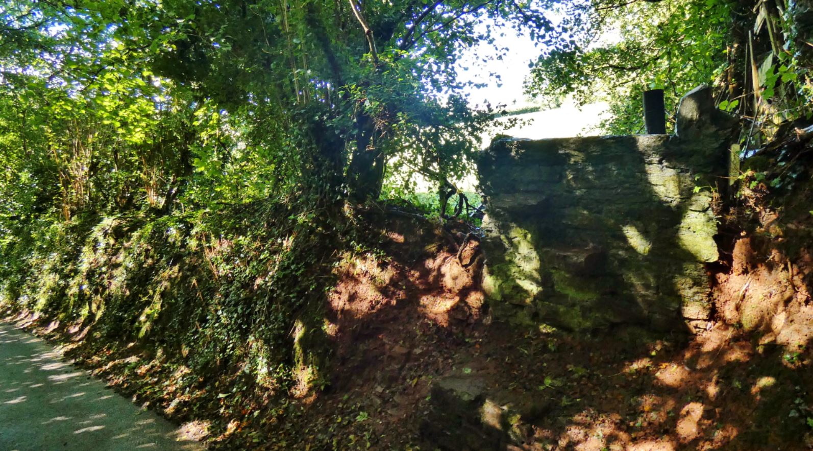
Within seconds of entering the lanes, a mystery presents itself to your right; a relic from past decades that is seemingly no longer used. Two stiles connect the lane with the field on the other side: one older stone stile embedded in a wall that is now all but gone, and a second, perhaps more recent wooden stile tucked in behind in the wire metal fence.

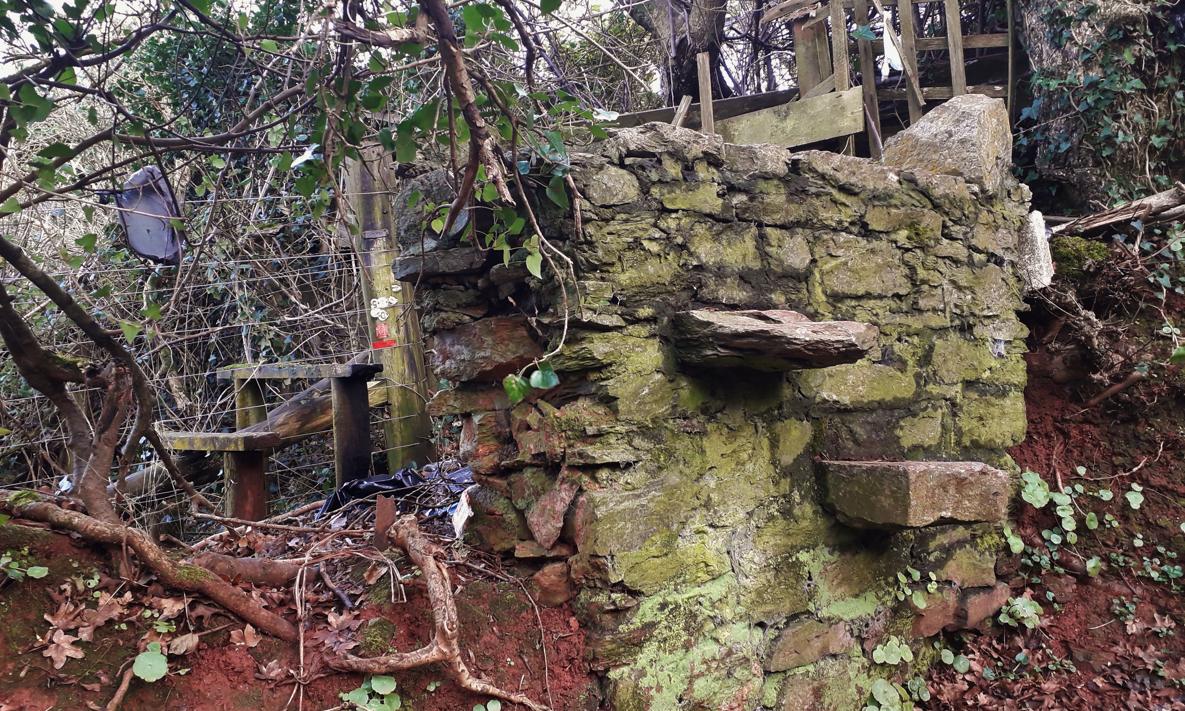
Despite most historical maps and some current online maps showing a footpath across this field, I have never seen anyone walking through this field, there is no clear exit on the other side of this ‘path’ (on the lane heading to The Old Farmhouse), and no signage exists in any way. I would love to know whether passing through is still permitted as I feel I have walked every square inch of the region and I would never want to get on the wrong side of any farmers!


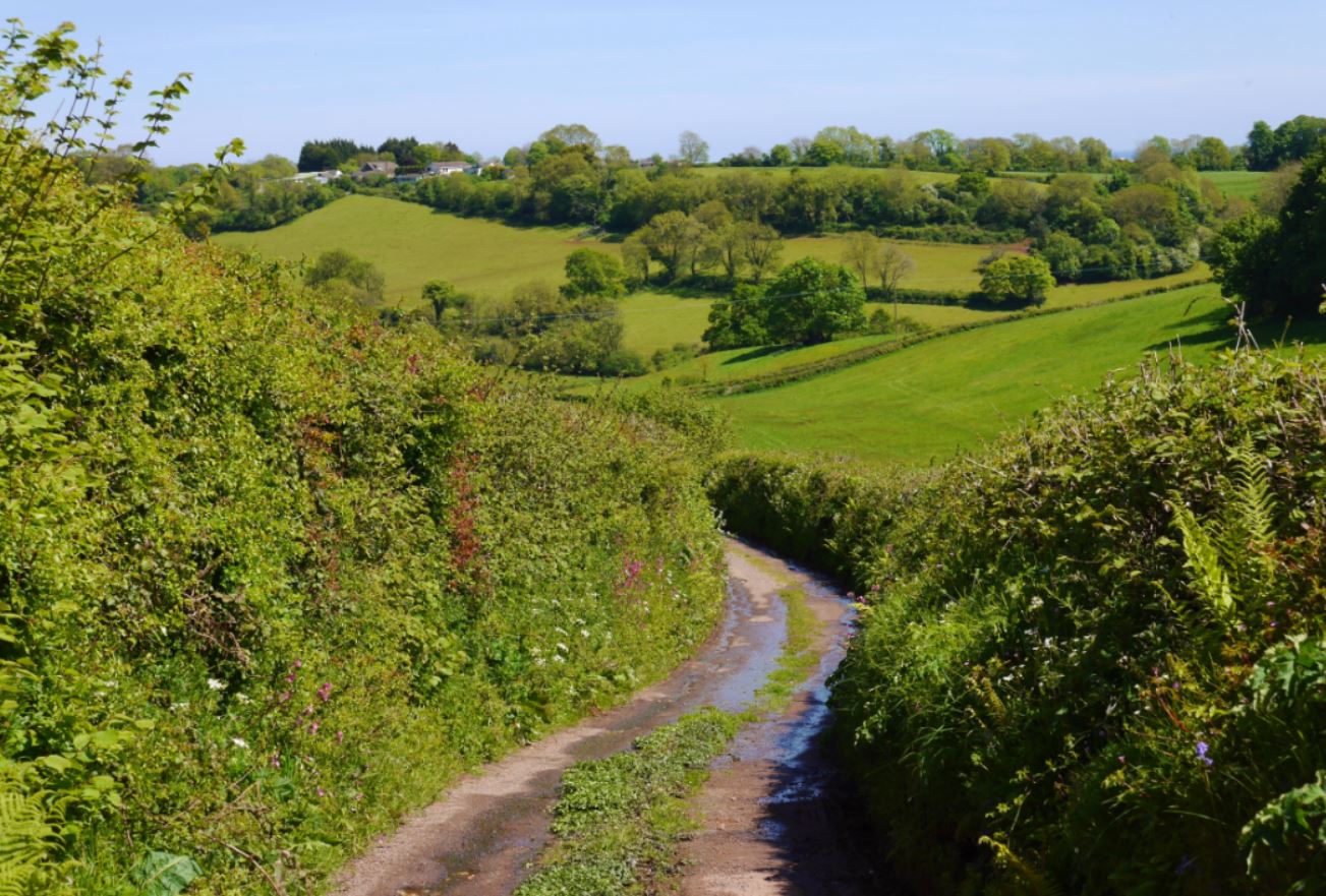
Now that we have covered our first ten metres or so of the lanes, it is time to continue downhill to our first checkpoint with possibly the coolest name in the whole area.

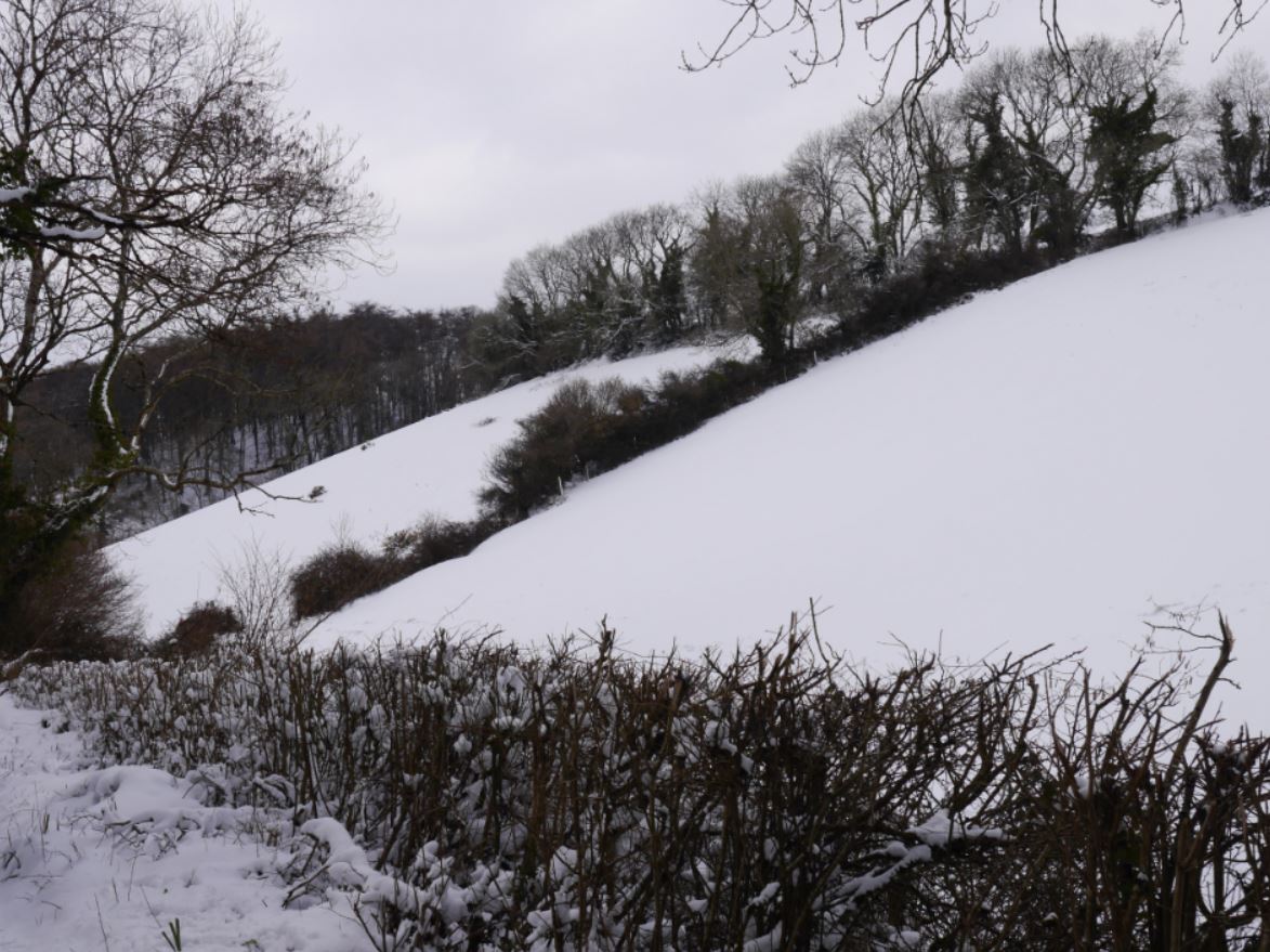
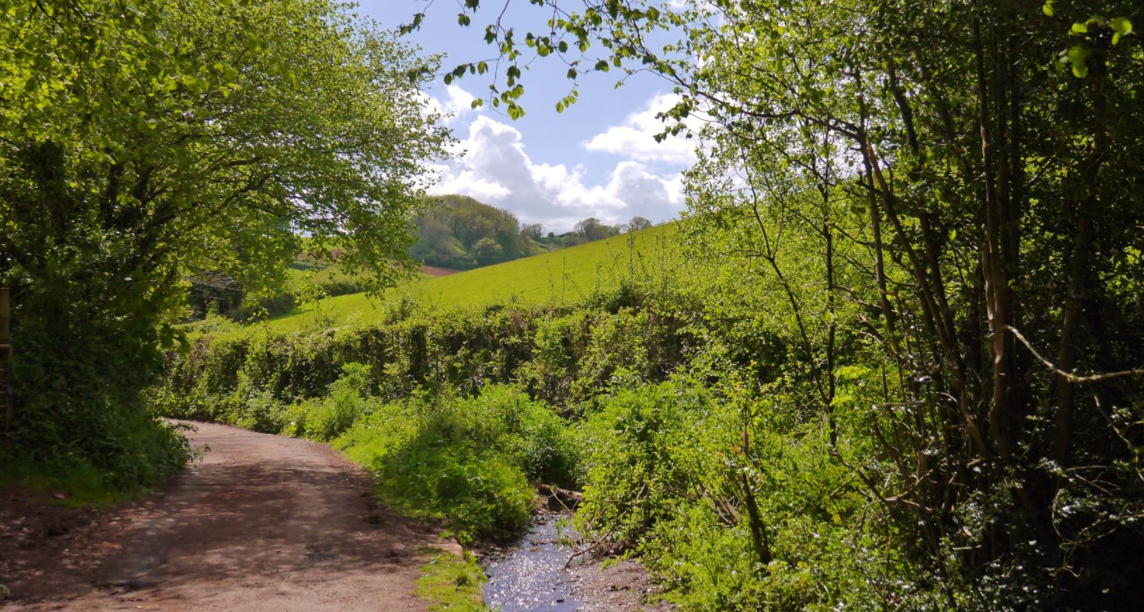
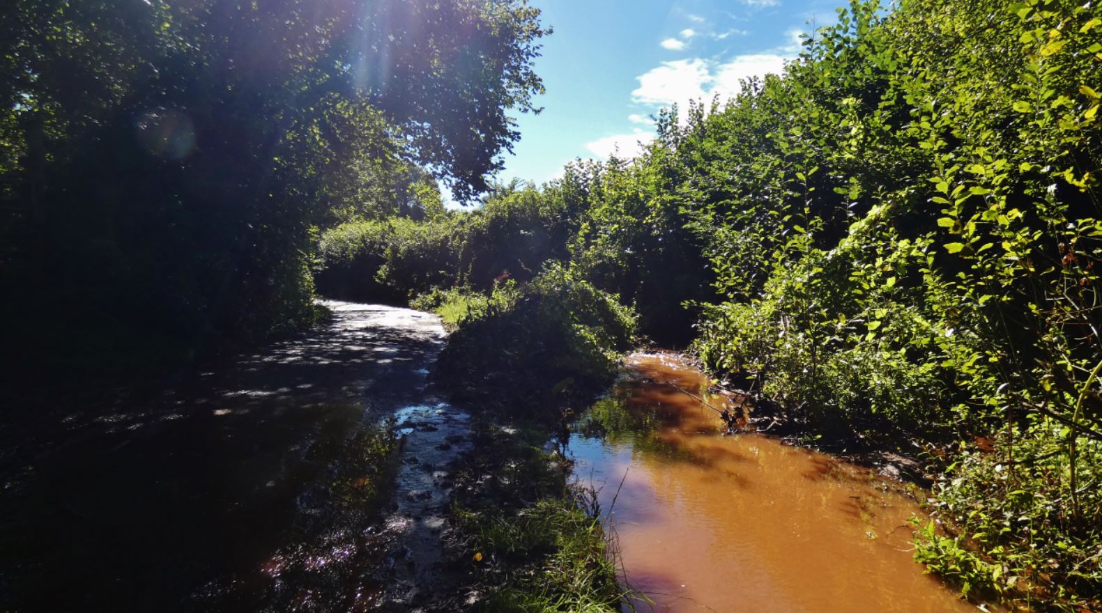
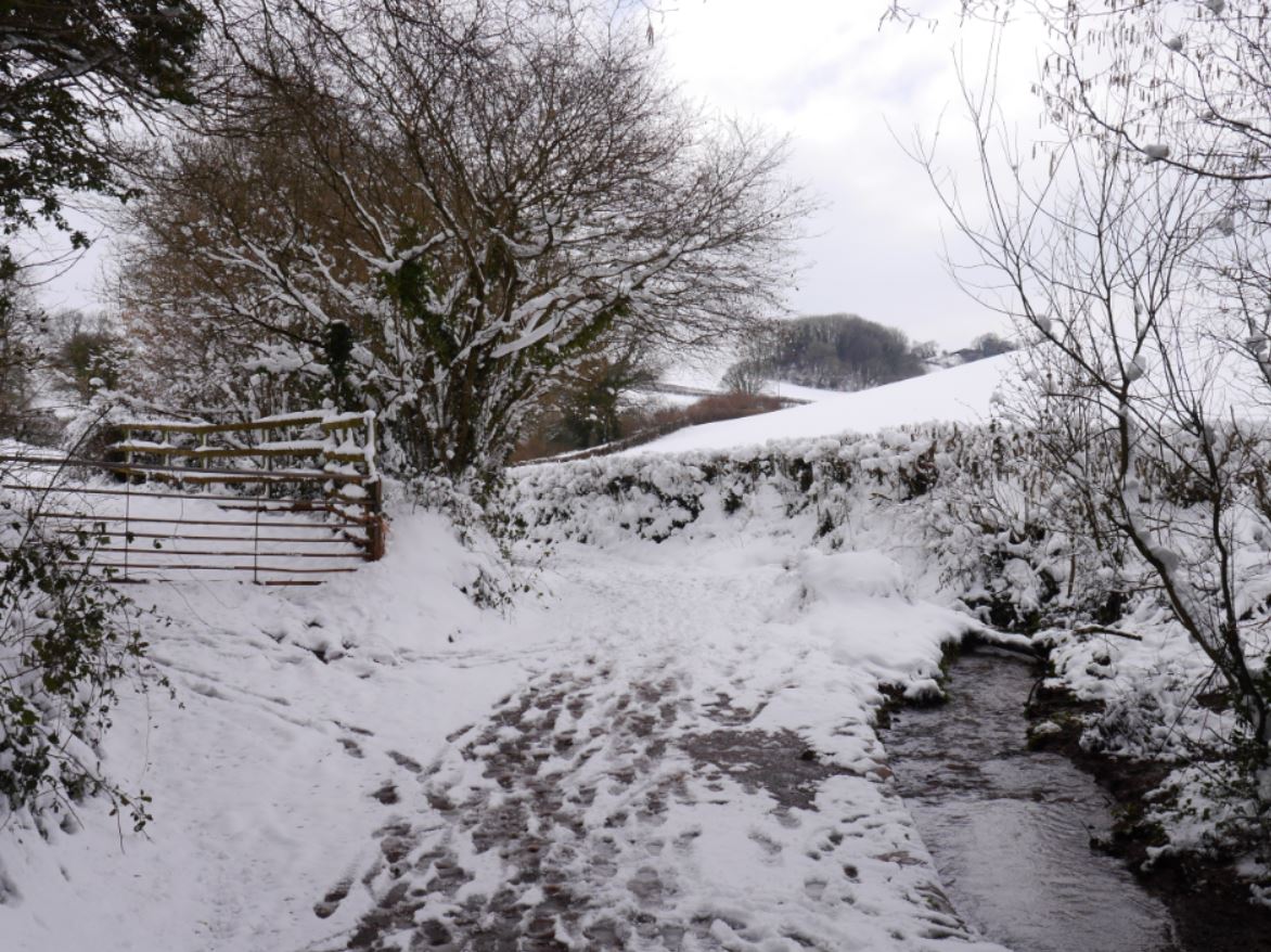
Depending on the season, this walk downhill can be mildly slippery but exquisitely beautiful – a complete tunnel of trees that can look fantastic both from the perspectives of looking uphill and downhill. See below for views of the same hill on beautiful days across all four seasons:
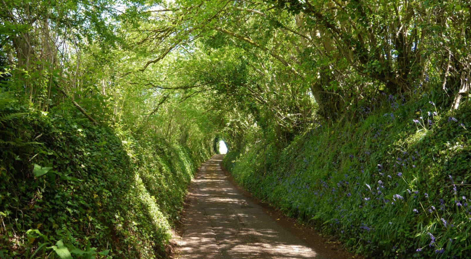
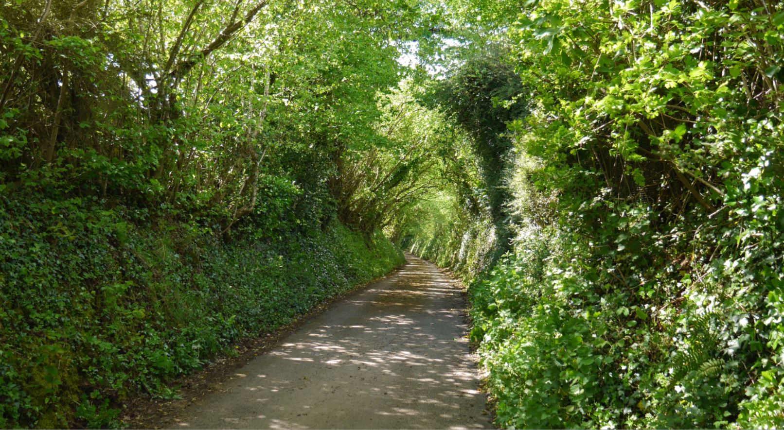


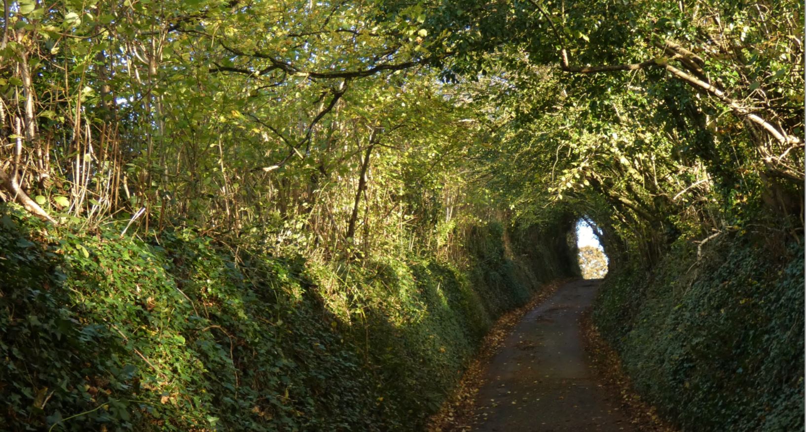


In the Spring, it is not unusual for the hedgerows to be full of bluebells – in the autumn, the lane takes on a far warmer colour tone. Heavy snow is fairly rare in this area, but when it falls, the area is just stunning. I’ll include more photos as I continue the guide.

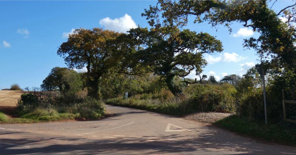
At the bottom of the hill, we encounter the first choice of our walk: to continue straight ahead in the direction of the beacons, Blagdon, and Buttshill Cross, or head right towards Marldon and Lower/Middle/Higher Westerland. The fantastically named ‘Cruel Cross‘ must have a wonderful background to have earned such a name – I only wish I knew what it was!


Cruel Cross to Marldon
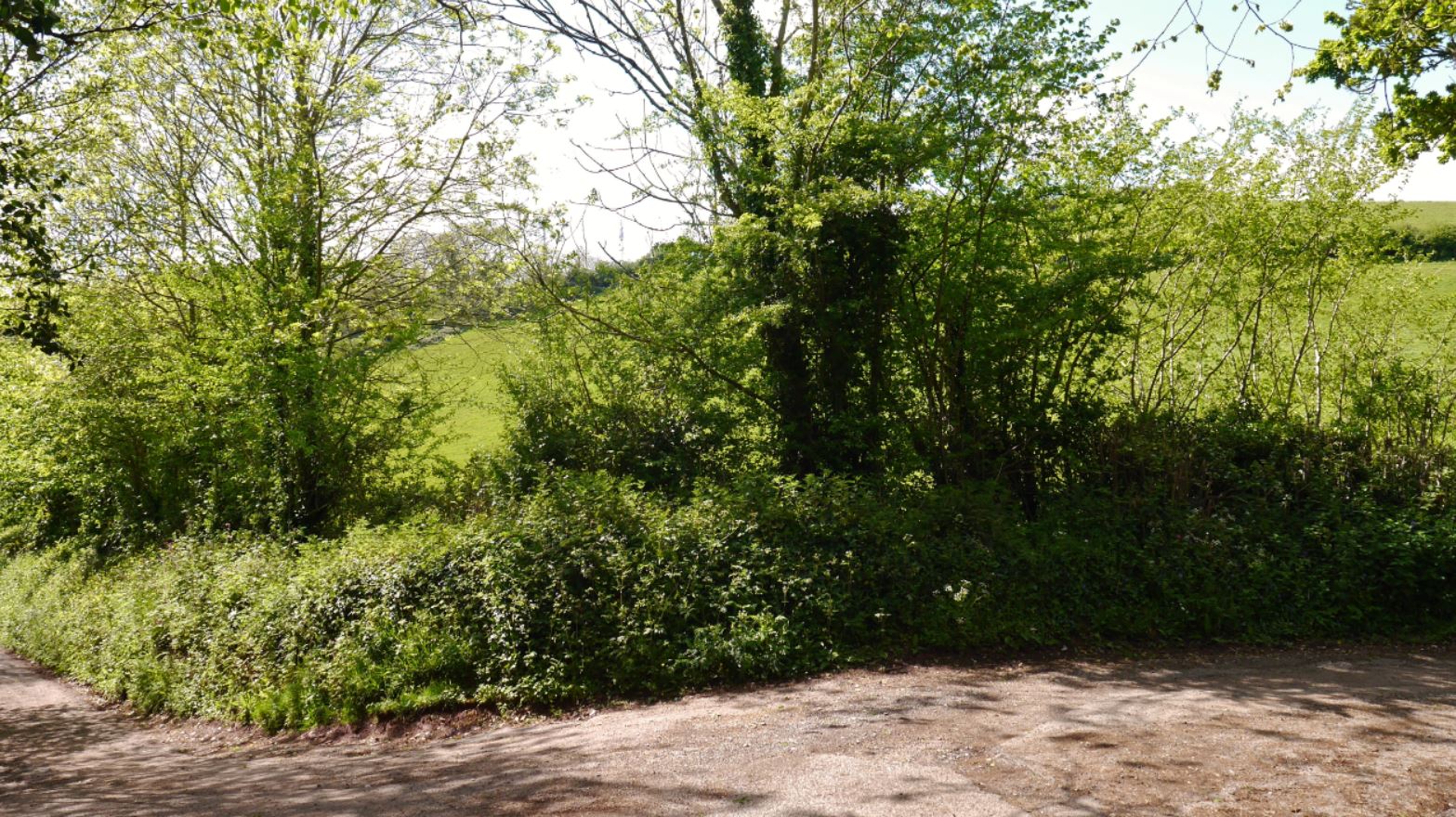
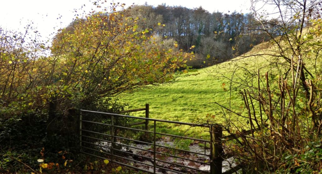
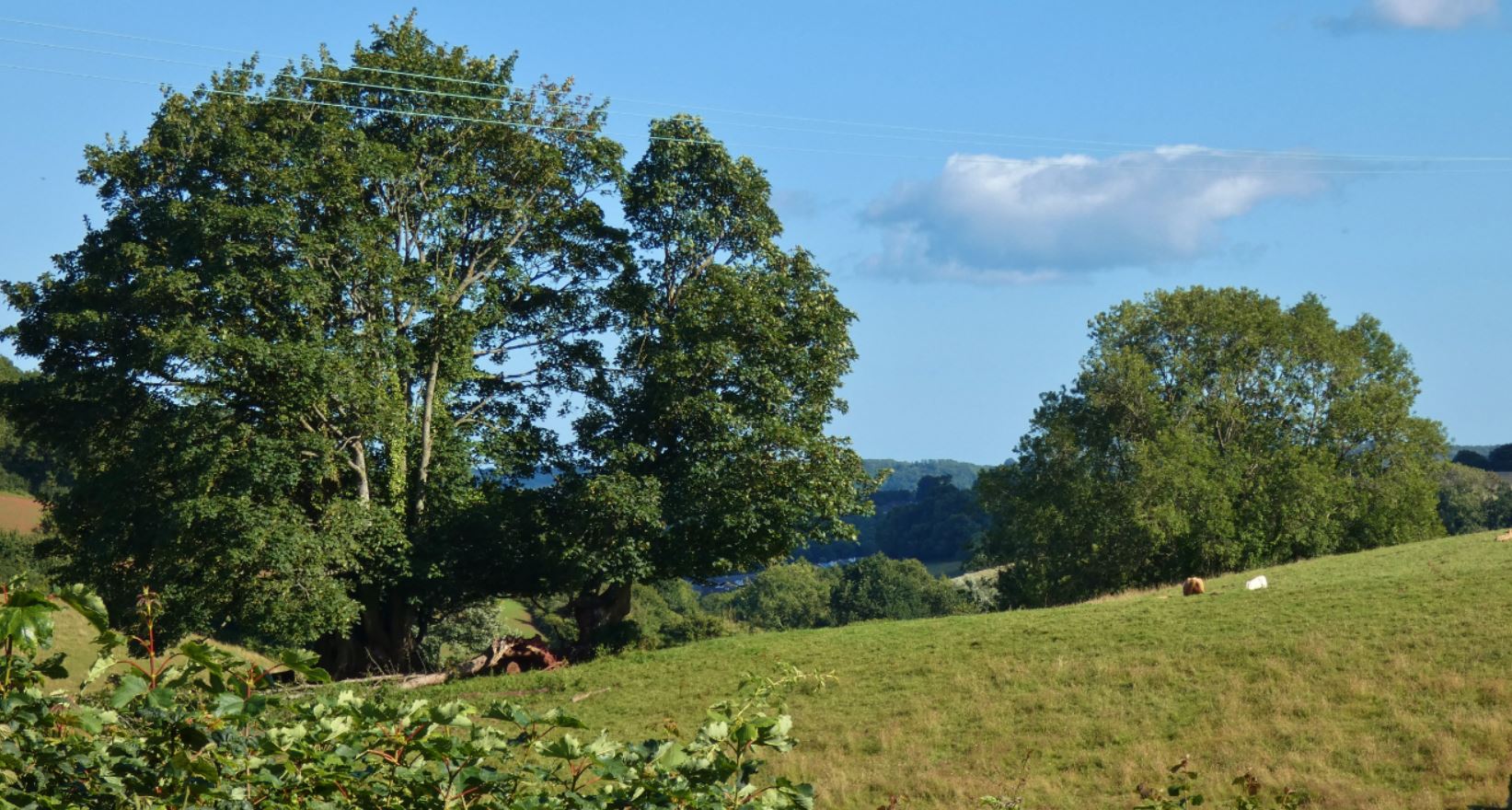
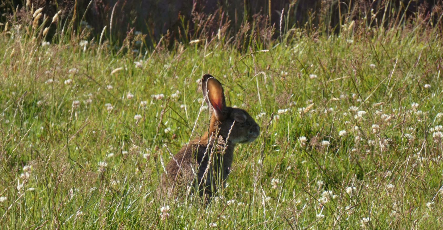
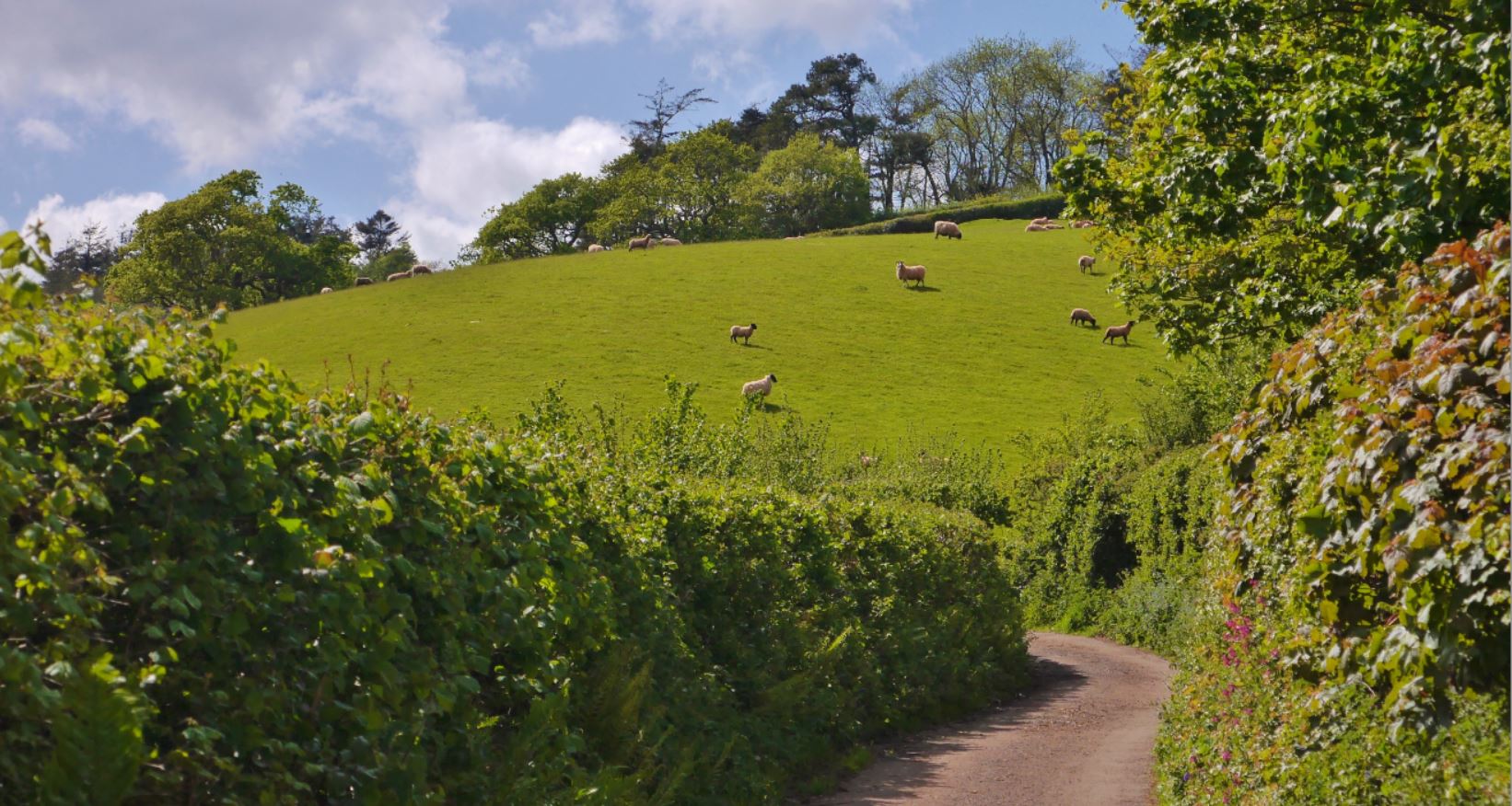
Although the right turn leads to areas that I cover in the next part of my guide, I shall include this lane here. For a shorter circuit to and from my home, I frequently head right, head in the direction of Marldon, and it never lets me down. First of all, take a moment to enjoy the view across the valley and the big field at the metal gate. You will often see pheasants and rabbits here, as well as the stream crossing the farmer’s entrance to the field.


Now let’s see what you can see when you turn right at Cruel Cross and head down this lane. One thing you will hopefully not see is this:
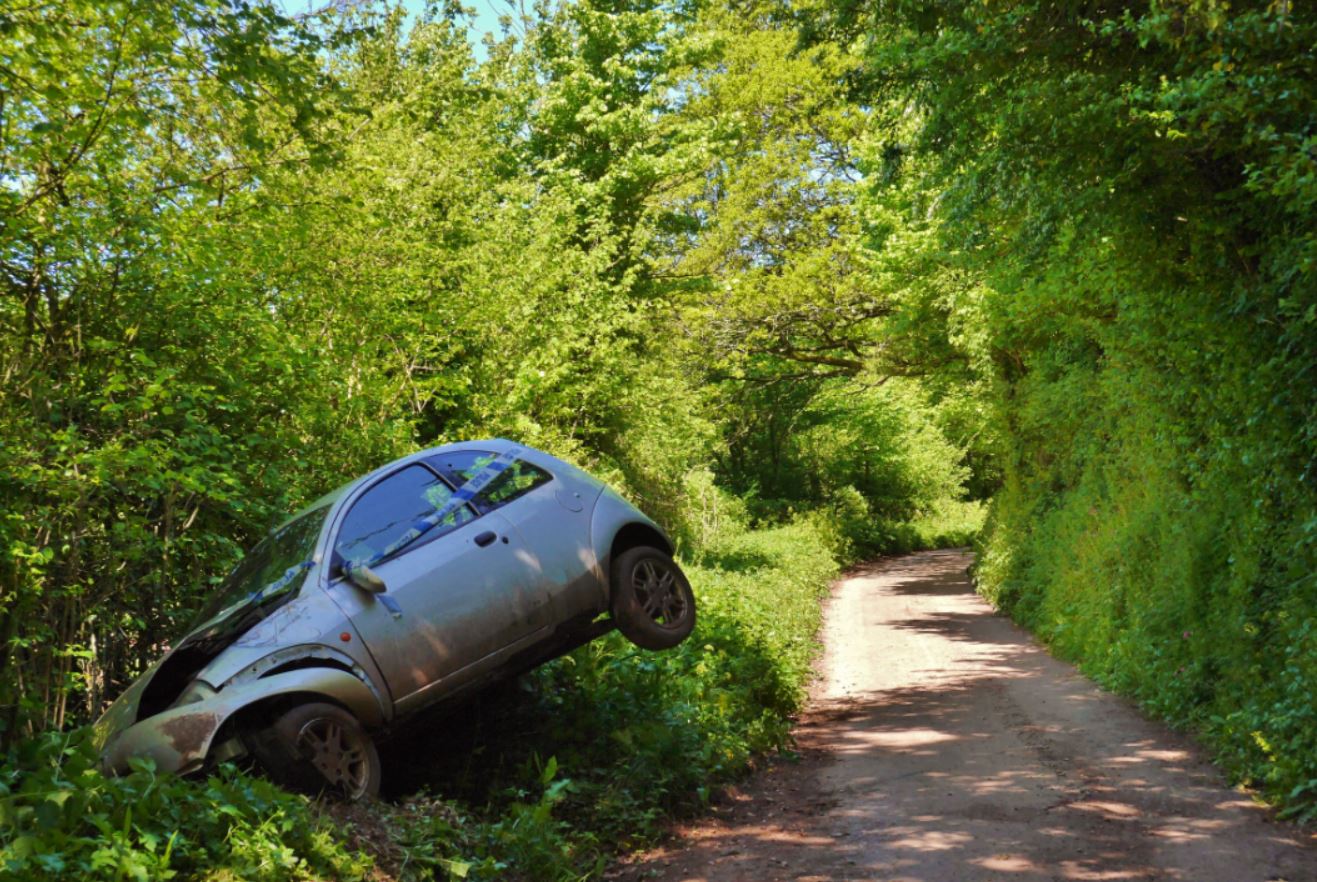

I still don’t really know how this car found the speed or angle to end up like this, but I have only witnessed such a scene once down there!
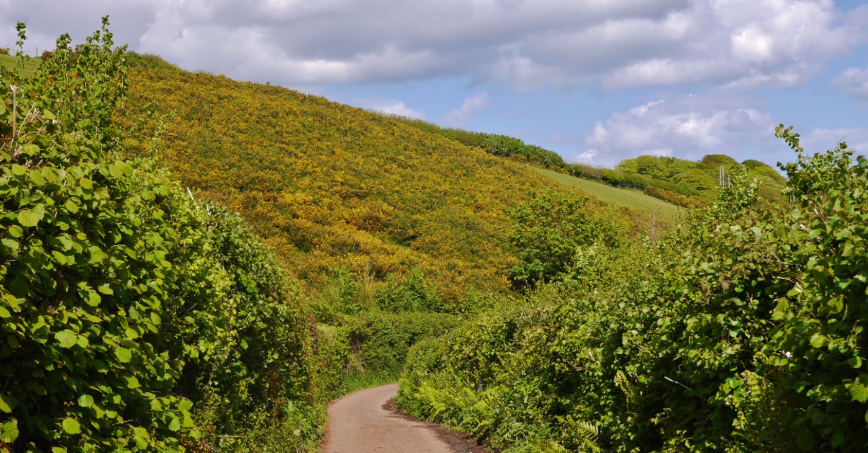
Anyway, further down the lane, you’ll find views of the fields and farm animals, plenty of birds and hedgerow plants, and some streams flowing down into the valley. The first real building you come across is The Old Farmhouse and a set of wonderful looking residences that appear to be renovated / new barn-style buildings. You will know you are approaching this when you find a very old, mossy wall on your left and you may hear running water coming from straight ahead.
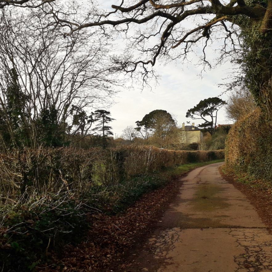

Between The Old Farmhouse and the end of this lane, there are some quite stunning houses, large farmhouses (remember to say hello to the horses if you see them!), and, as always, plenty of green fields.
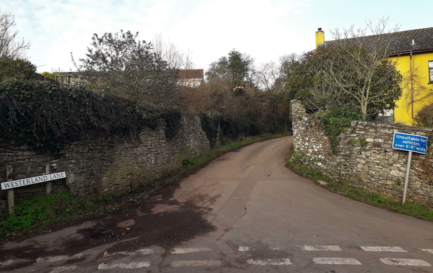
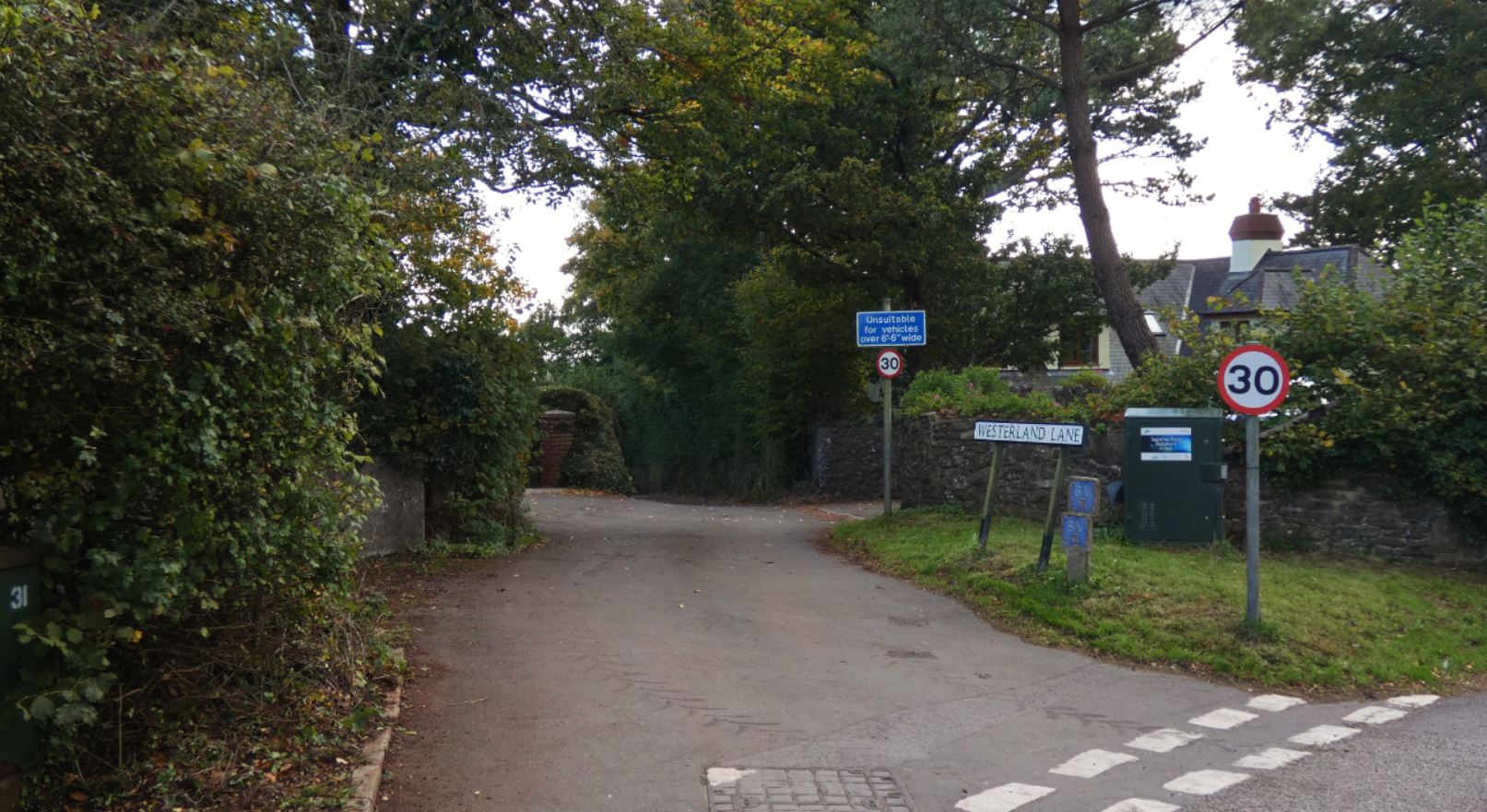
There are two right turns before the end of this lane; namely, Leader Lane and Westerland Lane.


Leader Lane is accessible by vehicles, but don’t expect to see many cars as you reach the middle of this lane since it can be quite muddy and uneven due to an abundance of tree roots, as well as getting particularly narrow. This lane connects to the park that leads to Churscombe Cross, the Harvest petrol station, and Ye Olde Smokey Inn.

Westerland Lane is a paved lane and leads all the way up to Totnes Road via some houses and, at the time of writing, a new development at the bottom of the hill.
It is at this point when we reach Totnes Road, and this crosses over with the second part of this guide, which shall focus on reaching the beacons from Totnes Road as well as showing the entrances to the aforementioned roads from Marldon.
Cruel Cross to Buttshill Cross

Let’s return now to Cruel Cross and head straight on where before we headed down the lane to our right. We are now heading further down into the valley, further away from any traffic noise, and into the real beauty of the area.


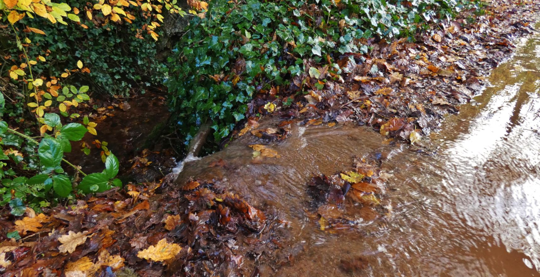
One of the first things you will hear as you walk on is the sound of running water to your right. This is a stream that initially runs at a lower level to the lane but soon emerges into a small pond that is fed by another stream running down the fields.

If you are particularly lucky (as I was in the later stages of 2020), you might even find the fields here smile back at you as you look upon them.

Over the years, this small pond was a great place to visit as a child to paddle in the water, and in later years many a pet dog has delighted in splashing around in the water! The constant flowing water also has a relaxing quality to it if you take a moment to pause and enjoy the area.

It even looks beautiful in particularly wintery days!

The stream continues to run, initially under the road via a small tube and then down on the left of the lane, far down at the side. Before long, it continues its course towards the Great Parks / Luscombe area (covered in part 5 of this guide), although sadly it is not possible to follow it all the way on foot as it runs through (presumably private) fields.
On particularly rainy periods, the stream takes matters into its own hands and takes the lane itself! A walk might become a paddle for a short time, but this is only ever a short distance as the water drains back into the next part of the stream in the form of small, temporary waterfalls to the side of the path.


We now depart this pond and head further into the lanes.


As the stream runs away to the left through the field, we start to climb a slight hill to the right.
This hill ascends to a small junction where Higher Ramshill Lane meets Middle Ramshill Lane, a dipping lane that I shall go into later on and links into some areas I discuss in part 4 of this guide.
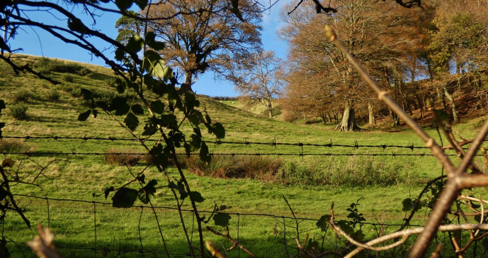
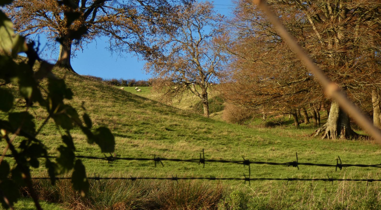


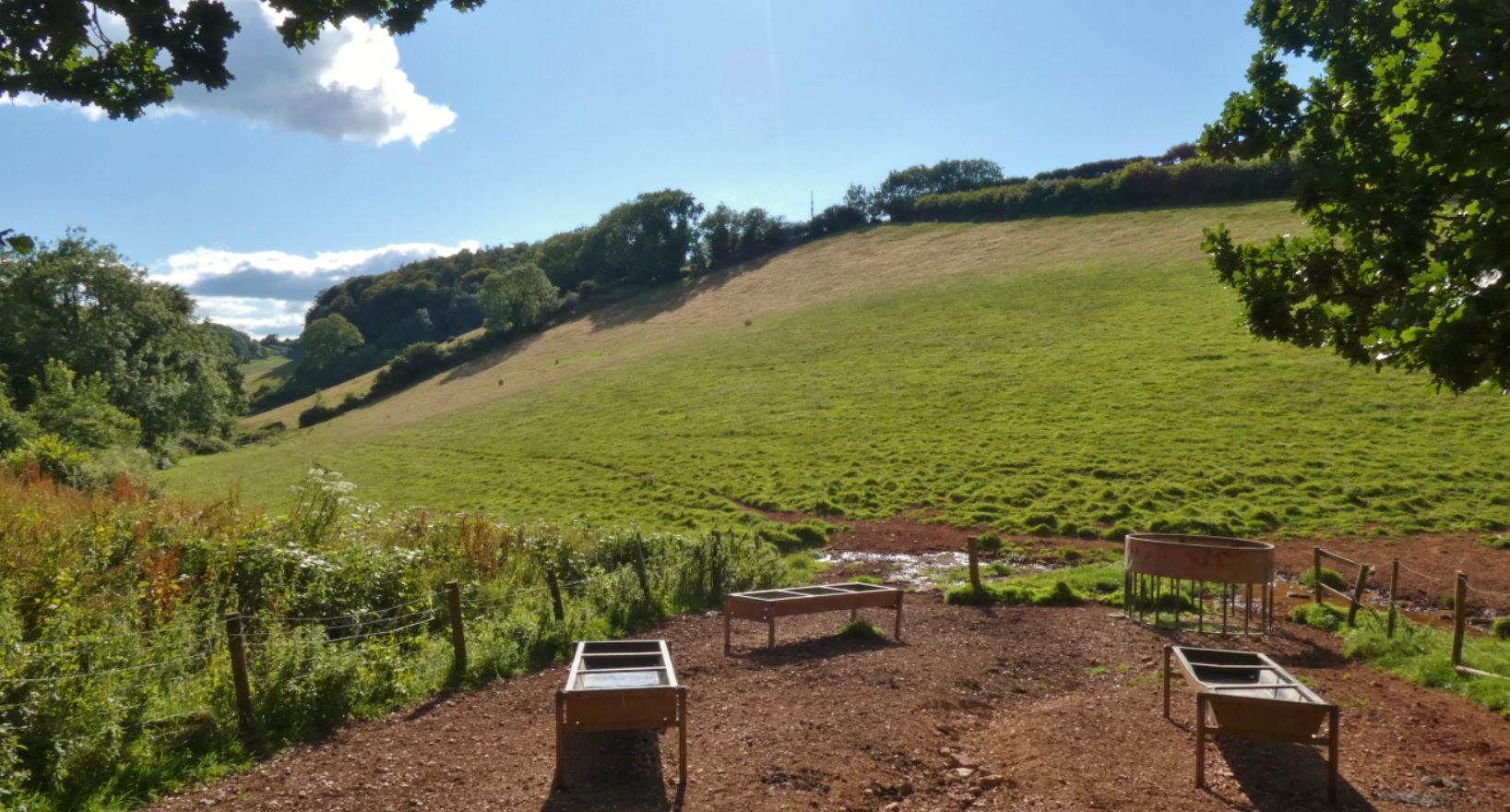
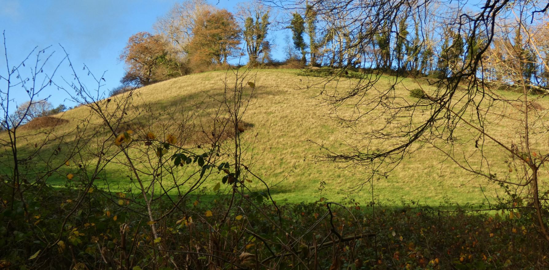
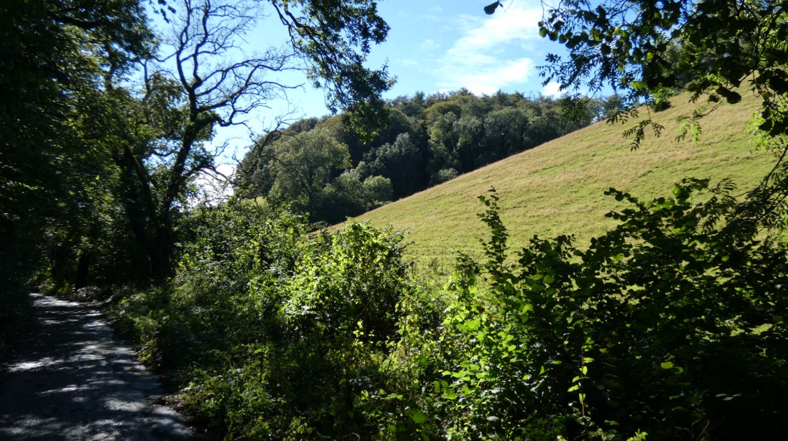
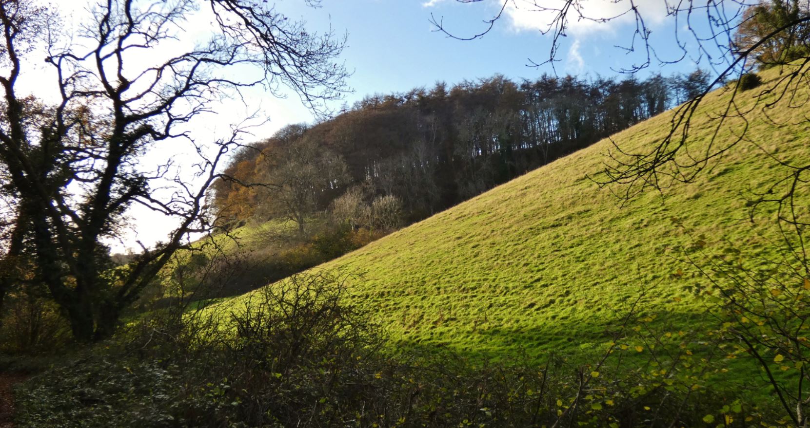
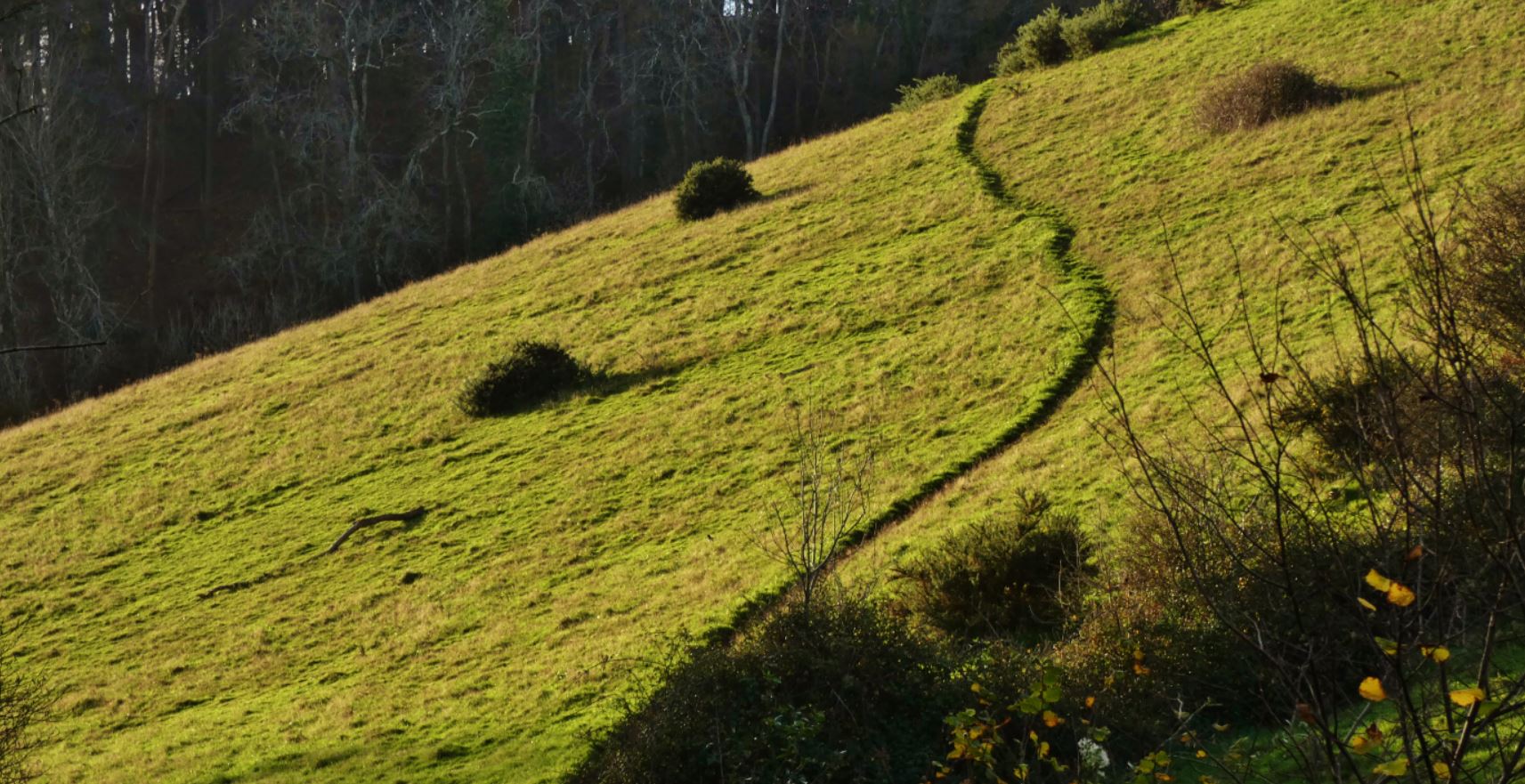
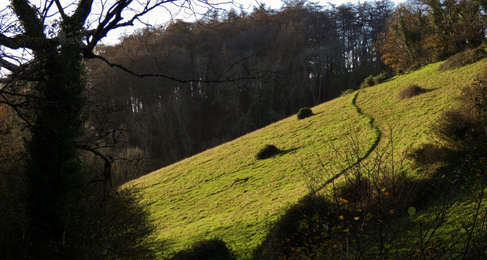
This junction is a perfect place to catch your breath and take in the views that begin to emerge. Firstly, at the metal gate, the lush green of the steep field to the right is worth a moment, and you may even be lucky enough to catch any number of pheasants, rabbits, sheep, or any other animals that have stopped by. Turning back, a view of where you have just walked is clear, and you may also now be able to see over to the countryside down by Great Parks.


Below, you will see how the view of the field at the metal gate varies across the four seasons.


…and, why not, a few more angles of this beautiful place!


If you choose to continue onwards and do not turn left into Middle Ramshill Lane, expect a slightly steeper climb to come. Not to worry, though – if at any point you need a rest, turning back and looking over the area you have already climbed is refreshing in its own way, and the destination at the top of the hill – Buttshill Cross – is a great place to pause, take a breather, and decide where to explore next.


Buttshill Cross – a name that contrasts somewhat with the earlier ‘Cruel Cross’, is a point with no fewer than five lines attached to it.

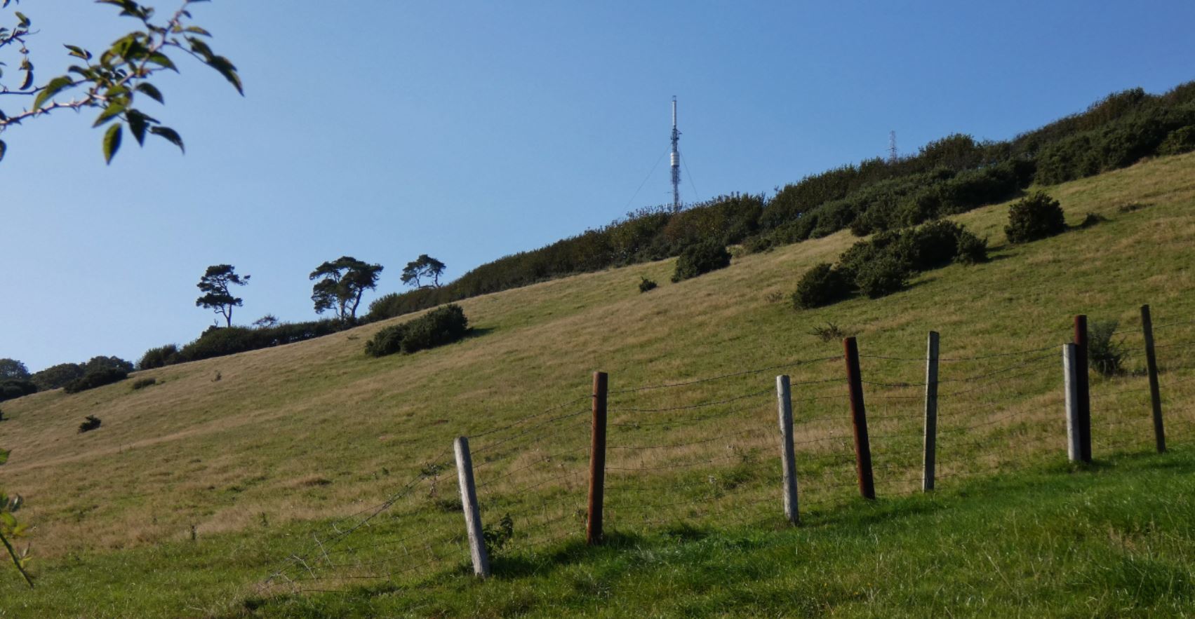
The first, possibly behind a closed metal gate, but perfectly accessible to walkers and a public footpath, leads up to Beacon Hill and, quite frankly, some incredible views of Paignton and beyond. I shall go into much more detail on this region in part 2 of my guide.

Continuing northwest is Old Widdicombe Lane, which takes you directly to Totnes Road and the Widend Touring Park. While this lane is pleasant enough, and continues to offer beautiful views down over the fields (as well as a different perspective on the beacons), it is something of a dead end for walkers as the Totnes Road at this point is not at all pedestrian friendly, offering neither a footpath nor much space to stay safe to fairly continuous traffic.

The views are still worth it, though, if you do use this part of the lane to perhaps extend a walk by heading up to the junction and back:


The two remaining exits to Buttshill Cross (excluding the hill we arrived from in this guide), head south and south west, respectively. Heading south is Old Widdicombe Road, and leads straight to the other end of Middle Ramshill Lane (the dipping road mentioned earlier) before continuing on to either Blagdon, Great Parks, or Collaton St. Mary. I shall cover this in more detail in the various other parts of my guide.
Should you head south west, however, down Butts Hill, you will find some beautiful farm houses and eventually end up in Higher Blagdon. I shall cover this in far more detail in part 3 of this guide, and provide a range of photographs too.


That completes the first part of my guide! We may only have covered a short distance in terms of kilometres, but in terms of personal memories and the sheer pleasure that can be derived from exercising in this area, I feel it deserves some close attention. Moreover, now that we are perhaps looking at options closer to home for exercise and an escape from current problems and issues that are rife, why not head here tomorrow and experience it for yourself?
Coming up…
2) Entering from Marldon – ‘The Beacons’
Further north, heading in from Marldon village, the area around Ye Olde Smokey House / the Harvest petrol station, or perhaps the area around and beyond the Marldon Christmas Tree Farm, the lanes can either be accessed via Westerland Lane (further north on Totnes Road) or Westerland Cross. I usually approach these from the opposite direction (from ‘Cruel Cross’, which I shall mention later) in order to head further into Marldon or perhaps up to the beacons, but many a good walk can be made from either of these entries.
3) Entering from Berry Pomeroy Castle direction / Totnes Road

Should one be heading towards Blagdon from the lanes nearer Berry Pomeroy Castle (a gorgeous area that I shall cover at a later date), one can enter this area on Blagdon Lane, which is far further down Totnes Road than the entrances mentioned above. The newly renovated ‘Beyond Escapes’ (Barton Pines) complex is something of a feature at this end of Blagdon Road, but to me the treasures still remain outside of the complex (and I shall describe them later on). Maps suggest that the Old Widdicombe Lane is a viable way to enter the area, and although it is indeed attractive, it is much harder to stay safe as a pedestrian in this area. I occasionally extend my walks up to the end of Old Widdicombe Lane, look left and right (up to the entrance to Widend Touring Park) but am reluctant to endanger myself as the road has little protection or shelter for the walker at this point.
4) Entering from Collaton St. Mary
Possibly the widest entrance to the lanes, the southern end of Blagdon Road that is bordered by Collaton Primary School and the Collaton St Mary church is a safe way to head into the countryside (providing you remain aware of any potential passing traffic – Blagdon Road is probably the ‘busiest’ road in these lanes).
5) Entering from Great Parks / Luscombe Road (QED)
What was once a quiet hill that sunk into the valley, the entrance at Queen Elizabeth Drive / Great Parks is now much more popular due to the development of the housing estate to its north, and is only likely to become more popular due to the new housing development that (at the time of writing in October 2020) at the bottom of Luscombe Road/Lane. It does make me sad that this beautiful area is soon to be surrounded by even more houses, but I suppose the current batch of new houses are at least being built on land that exists between existing houses and are not extending further into the valley.

Wonderful journey bringing back memories from when I was a child growing up in Marldon and Paignton. Fabulous photos and I look forward to your next installment.
LikeLiked by 1 person