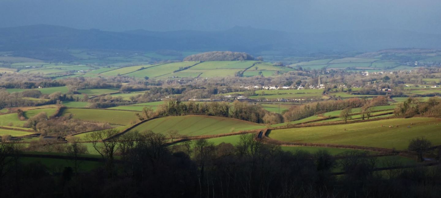
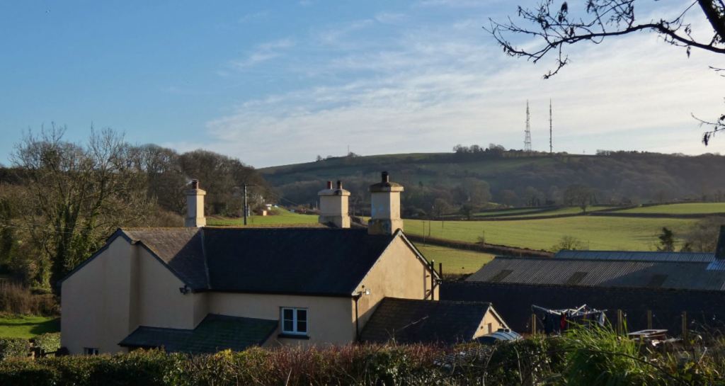
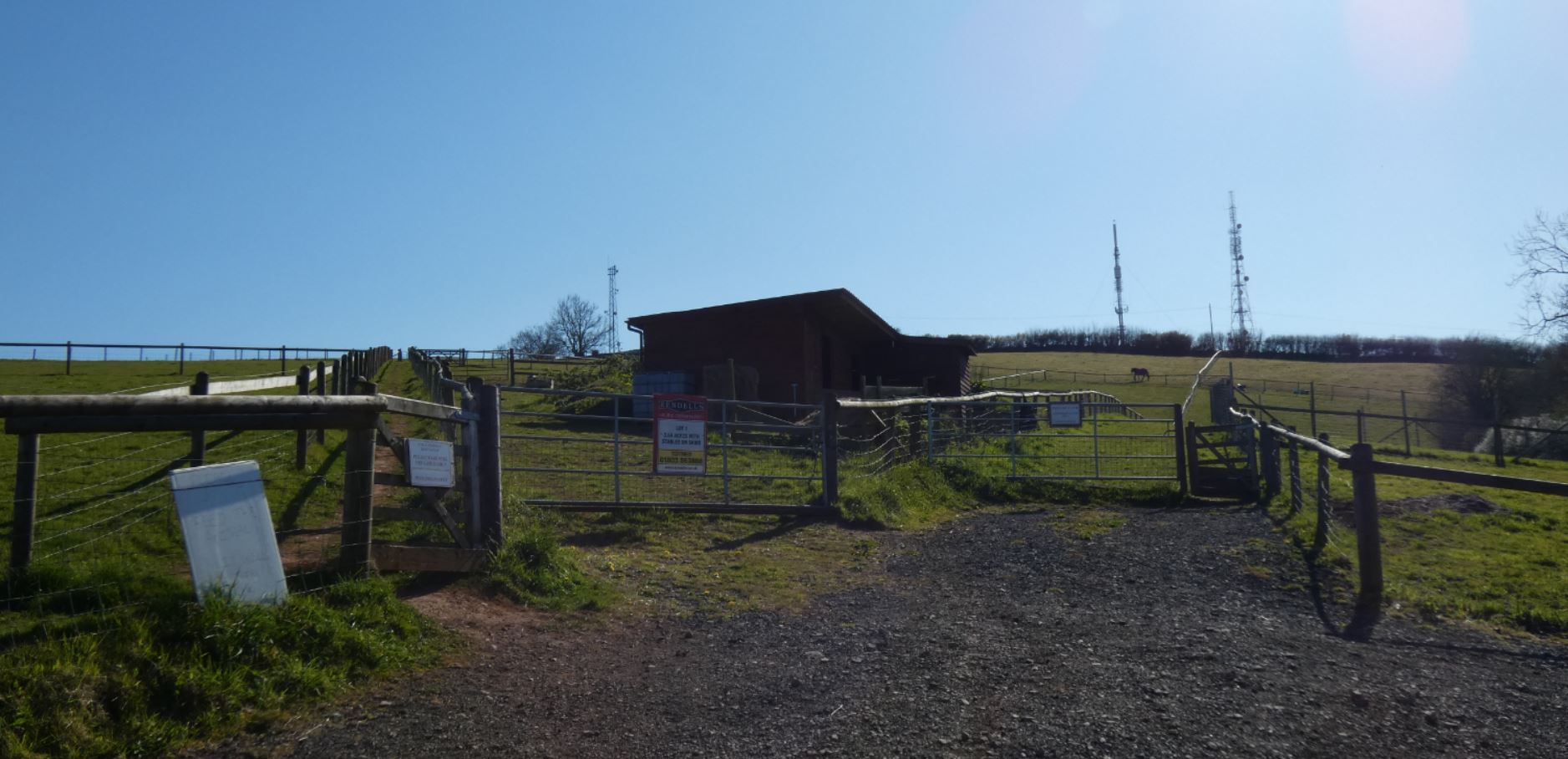
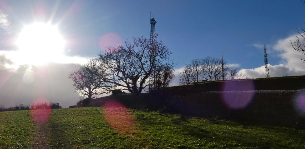
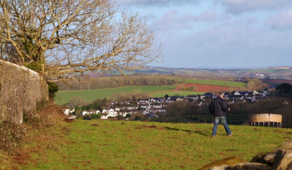
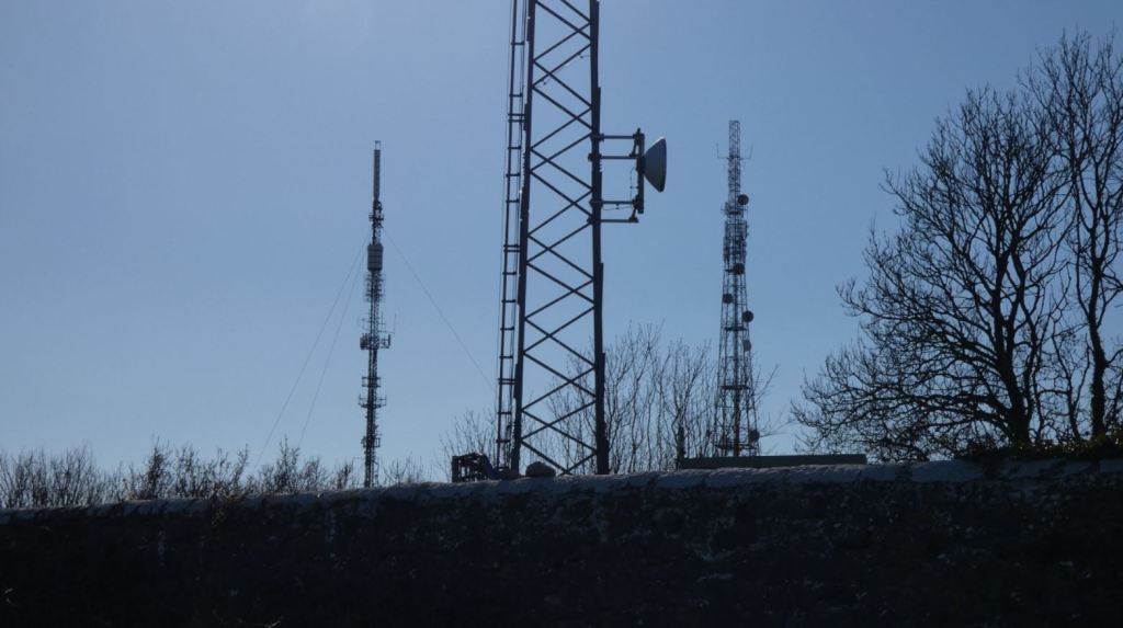
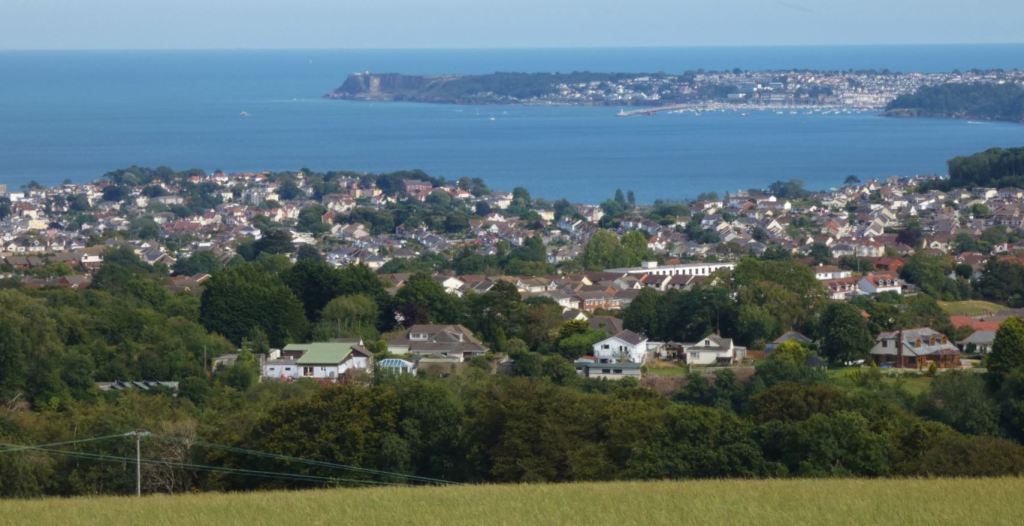
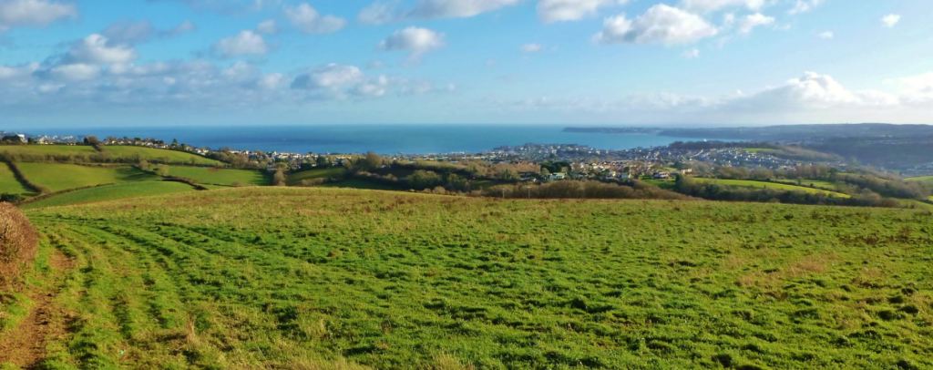
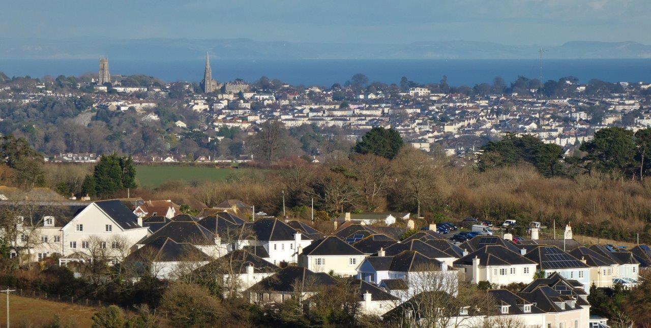
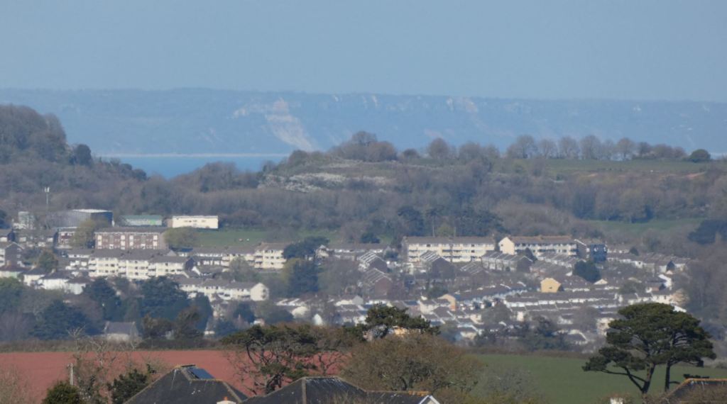
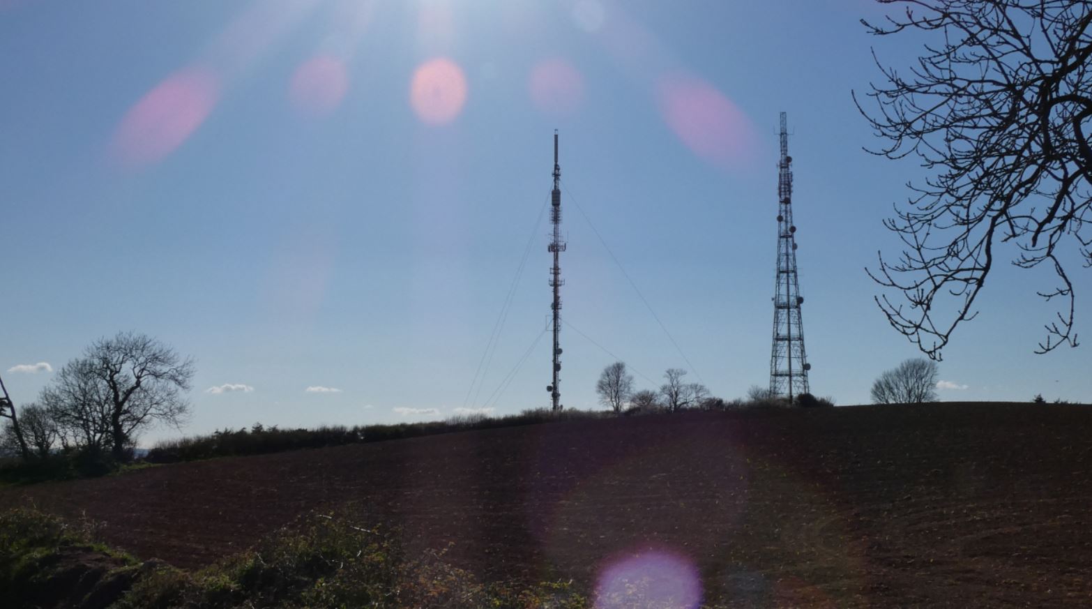
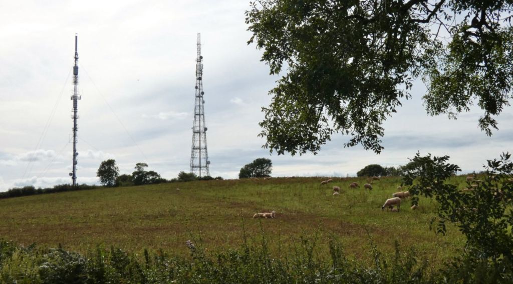
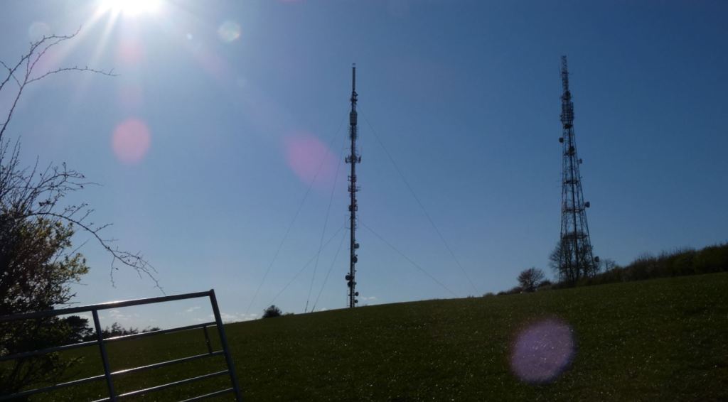
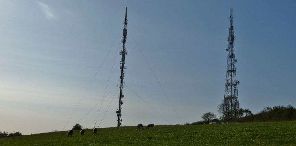
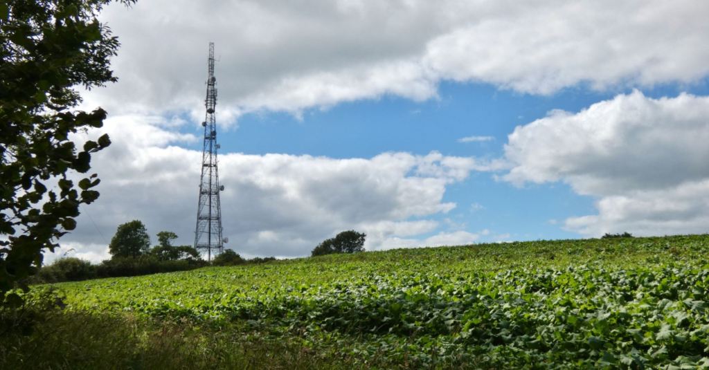
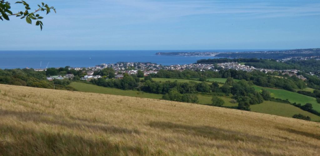
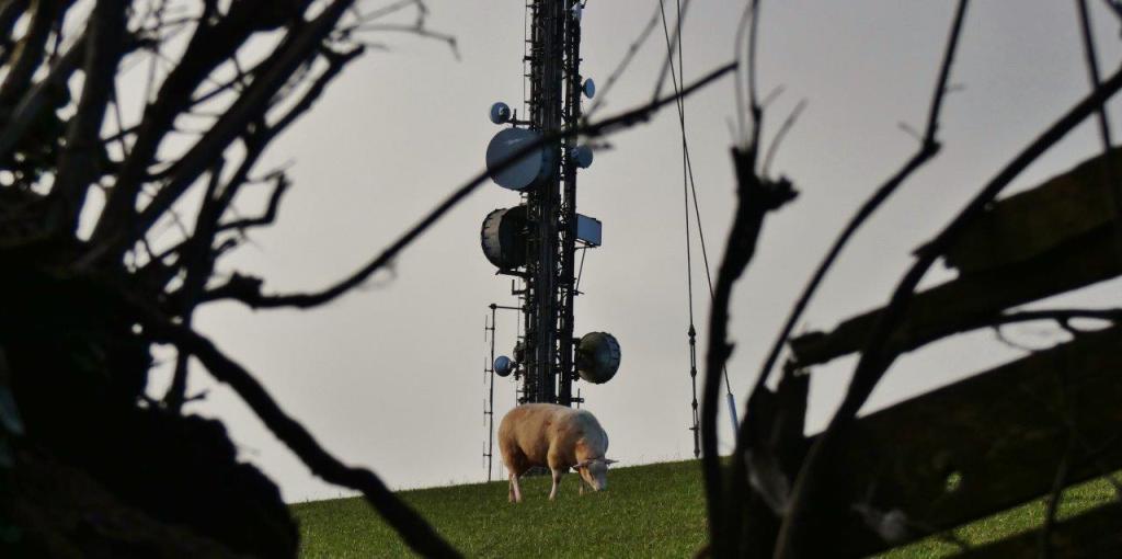
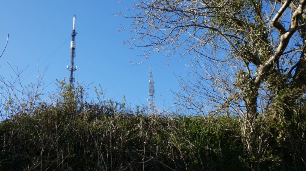
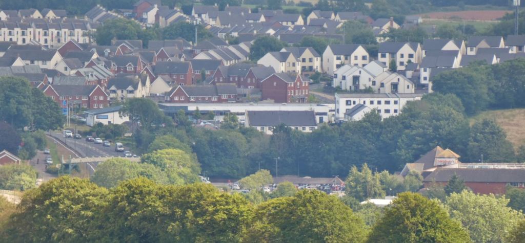
Imagine you could spend a warm day and night outdoors, absolutely anywhere, in the town or city where you live. There are no logistical limitations or restrictions, and you get all the mod cons to make your time a pleasure – simply consider the location and its surroundings in its purest form. For me, in my hometown of Paignton, I can’t think of many better places to be than the subject of this part of my guide on the lanes: the fields up around Beacon Hill, high above Paignton, provide unspoiled views of the town, the bright blue of the sea on a sunny day, and the vibrant greens and browns of the surrounding countryside, fields, and, in the distance, Dartmoor. While these metal towers themselves are do not offer much in the way of a particularly aesthetic value, they mark a place that should be regarded as an undervalued focal point in the region.

Head to the banks of the River Dart around Ashprington; to Totnes, Ipplepen, Denbury, Newton Abbot, and beyond to Dartmoor; to the hills beyond Torquay and the higher ground south of Brixham – from simply so many places and distances in Devon can the beacons themselves be seen, meaning by definition that they are a point from which so much can be observed in the opposite direction, whether with the naked eye, a decent camera zoom lens, or a pair of binoculars. In Paignton, they are incredibly easy to get close to as a walker (going right up to them is neither necessary nor possible due to the towers themselves lying on private ground), and in this part of my guide I hope to cover this particular area as comprehensively as I possibly can, offering the best photos I have from all my walks up and around there, and I will hopefully provide those who have never been enough information and inspiration to go as well as possibly reviving memories for those who have perhaps been some time ago but have not returned for some time.


It could be some kind of a proximity bias what with growing up near them all my life, but there are beautiful experiences to be had up on these fields, and I hope this guide inspires somebody to go up and take in the views for themselves.
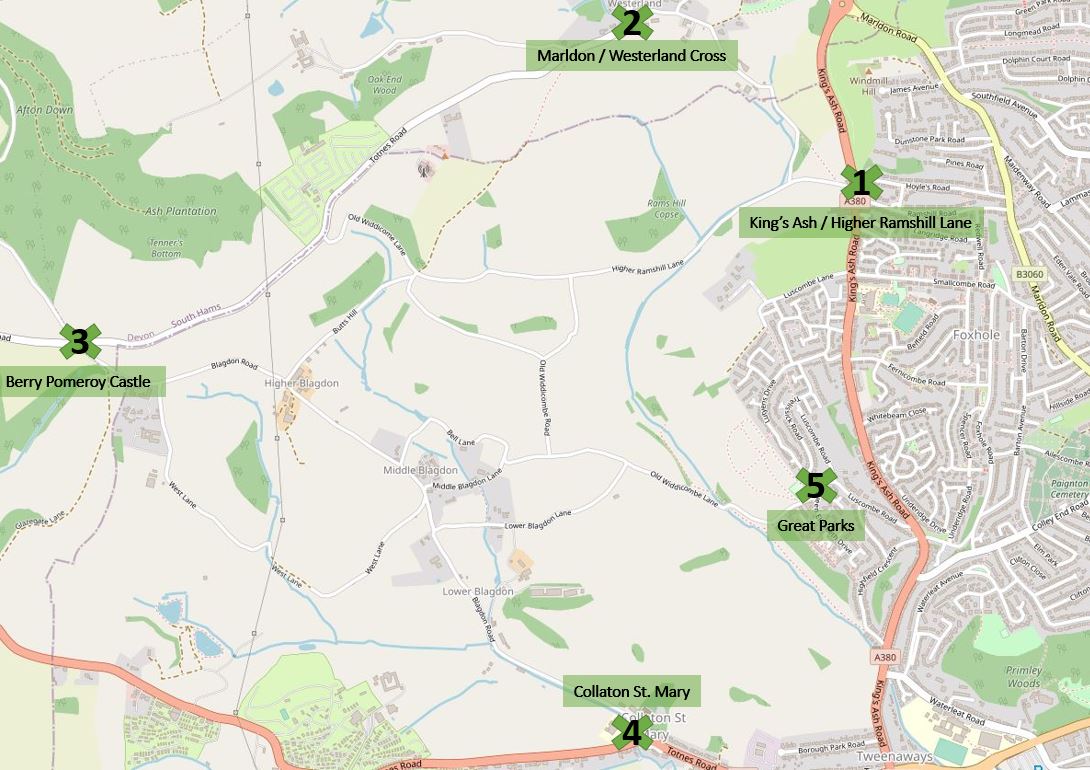
A Reminder – This Guide’s Five Entrances (On Foot)
Map imagery in this post courtesy of Google Maps and OpenStreetMap (© OpenStreetMap contributors).
Following on from Part One of my guide, which describes the lanes from the King’s Ash entrance, the walk up to Buttshill Cross, and the lane leading from Cruel Cross to Marldon (all of which I make reference to in this section), Part Two of this guide begins in the Marldon area and the entrances on the higher Totnes Road. Parts three, four, and five will follow (hopefully soon) after!
PART TWO – Entering from Marldon, Totnes Road, and Westerland Cross – ‘The Beacons’
Rather than starting from the beacons themselves, I shall begin by mentioning Marldon, a beautiful village located to the north of the area in question here, and an area worth exploring (and, note to self, writing about comprehensively!) and walking around. When Covid has finally gone, I look forward to walking to the Church House Inn for a pint of ale and perhaps even another on the way home at Ye Olde Smokey!
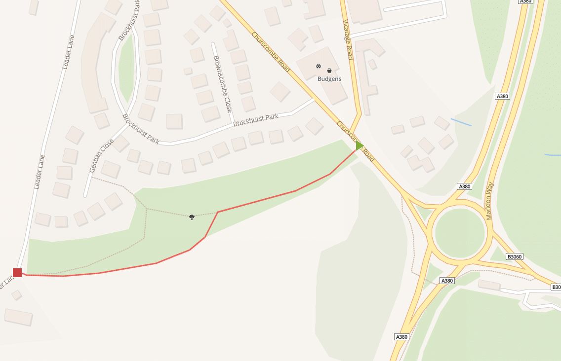
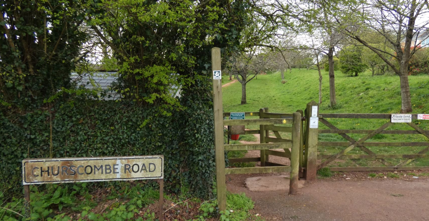
Speaking of Ye Olde Smokey House, I have thus far neglected to mention another entrance to the lanes that exists opposite the Harvest petrol station on Churscombe Road. Sitting below a relatively new (and relatively upmarket) housing estate, the Churscombe Cross field connects the road with Leader Lane, mentioned in more detail in Part One.

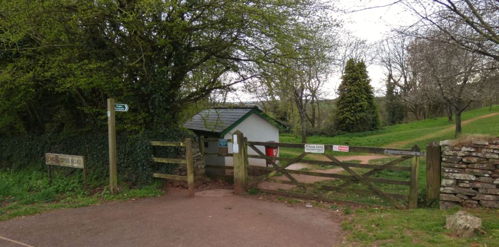
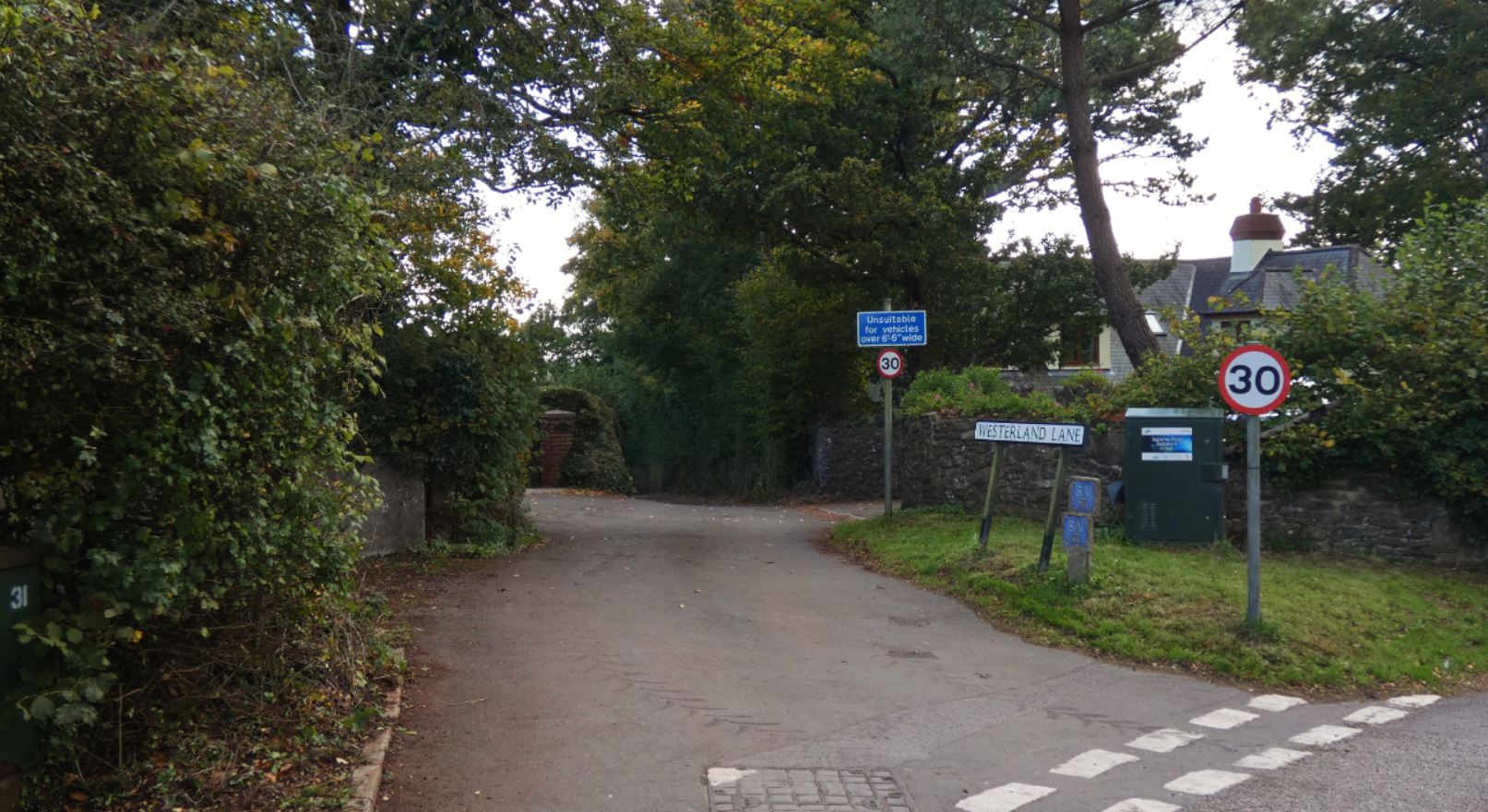
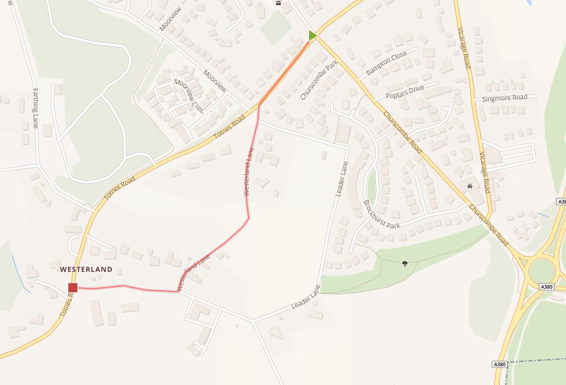
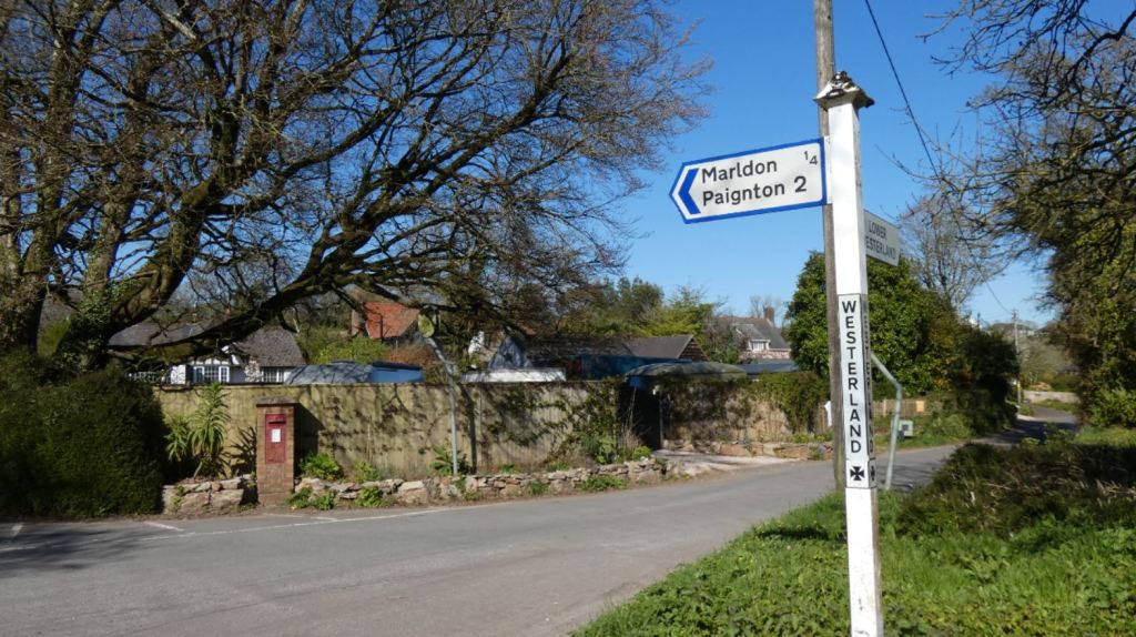
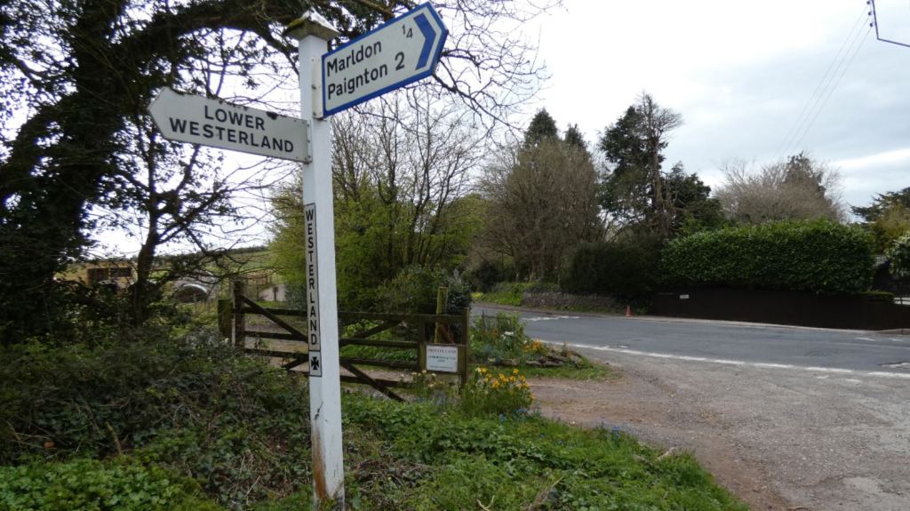
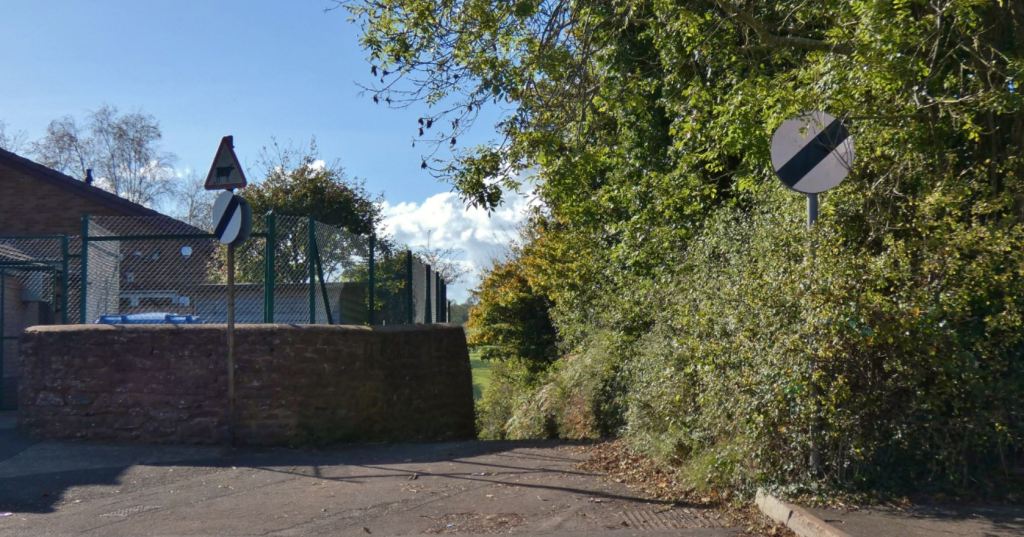
Close to the start of Totnes Road (for the purposes of this part of the guide, when I refer to ‘Totnes Road’, I am referring to the one that connects Marldon to Berry Pomeroy and not the larger Totnes Road that runs through Tweenaways Cross), which leads southwest from the top of Churscombe Road, we find Westerland Lane, which is again referred to in Part One. This is the safest way to get to the beacons if you are coming from Marldon since it bypasses a couple of tricky parts of Totnes Road that either require walking on a grass verge or indeed walking into traffic for a few awkward metres. More on this below.
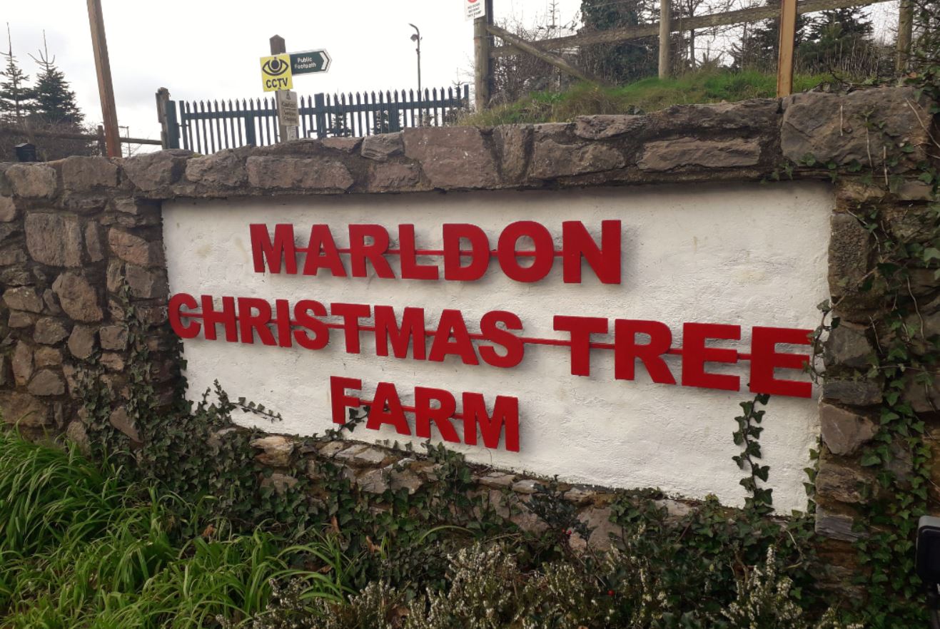
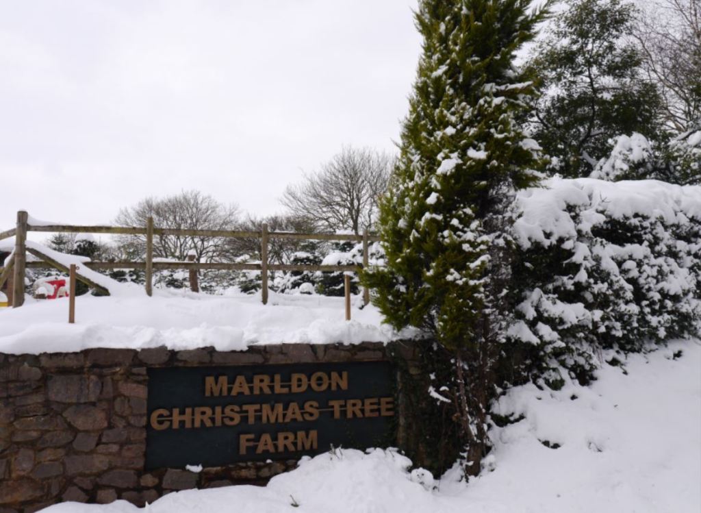
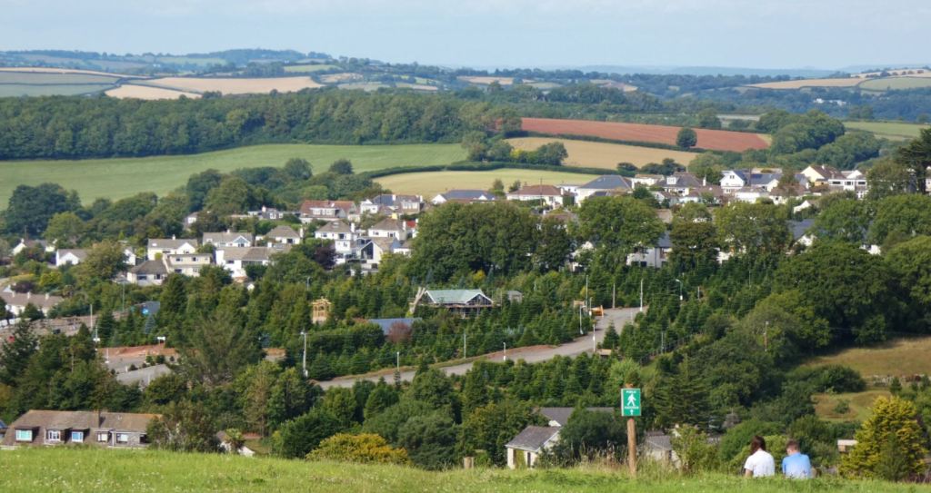
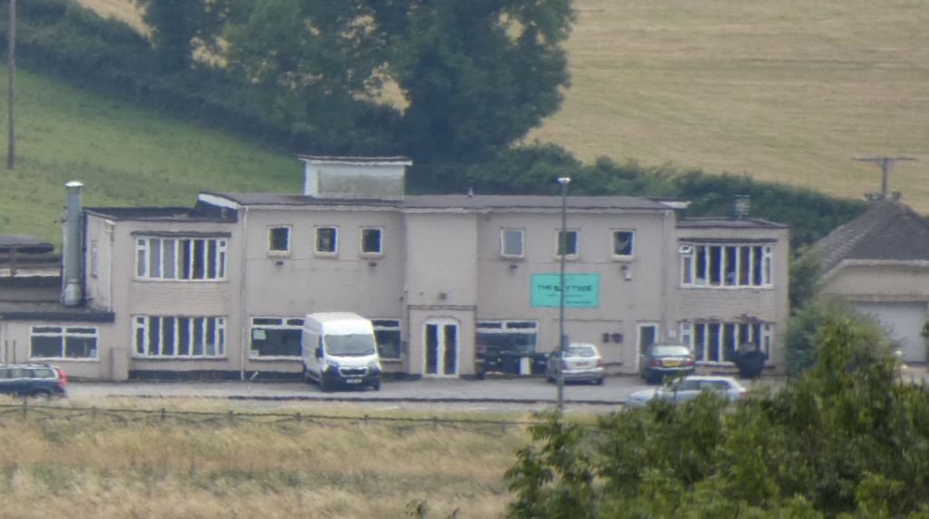
If you do choose to follow Totnes Road (which is perfectly doable – just with a couple of traffic-related challenges to negotiate), you’ll find the Marldon Christmas Tree Farm, which is closer to the area of interest in this part of the guide.

The Christmas Tree Farm is a particularly popular destination for families in the festive period. Fortunately (because this stretch of Totnes Road is not especially pedestrian friendly), it is possible to walk along a raised public footpath that runs just outside of the farm and can be accessed from the main farm entrance. The end of this section of footpath comes when you arrive at the steps and descend down to Farthing Lane.


The Christmas Tree farm is also, quite naturally, a beautiful place in the rare event that it snows heavily in Devon.


Standing at Farthing Lane (which is a gateway to a number of other beautiful walks by the way – I must write these up soon too), take special care when heading further down the road.

From this point, if you are still approaching the beacons from Marldon and have not taken advantage of the aforementioned Westerland Lane, you will unfortunately need to take a little care when proceeding. As there is neither a footpath nor a verge, it is advisable to walk into the direction of the oncoming traffic, stepping into one of the few driveways to allow traffic to flow past or simply standing tight against a wall when necessary. This should only last for around one minute (and is a section of road I have walked numerous times with few issues whatsoever), but it is something worth mentioning regardless.
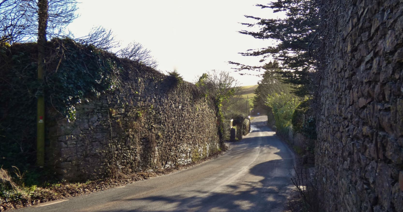
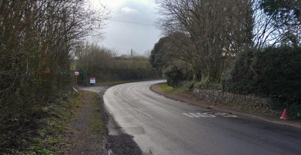
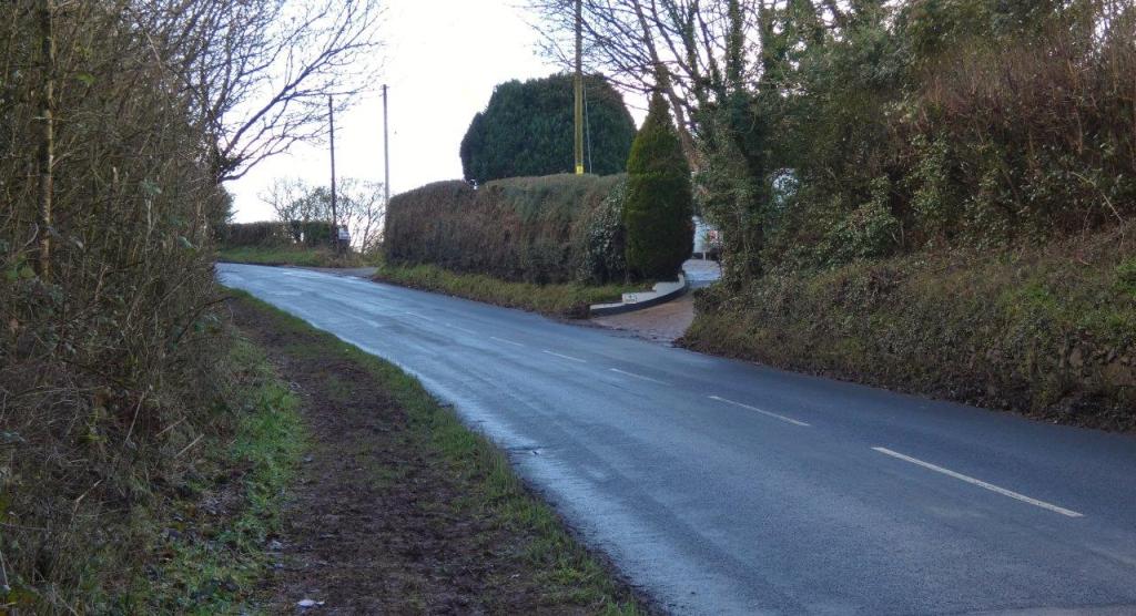
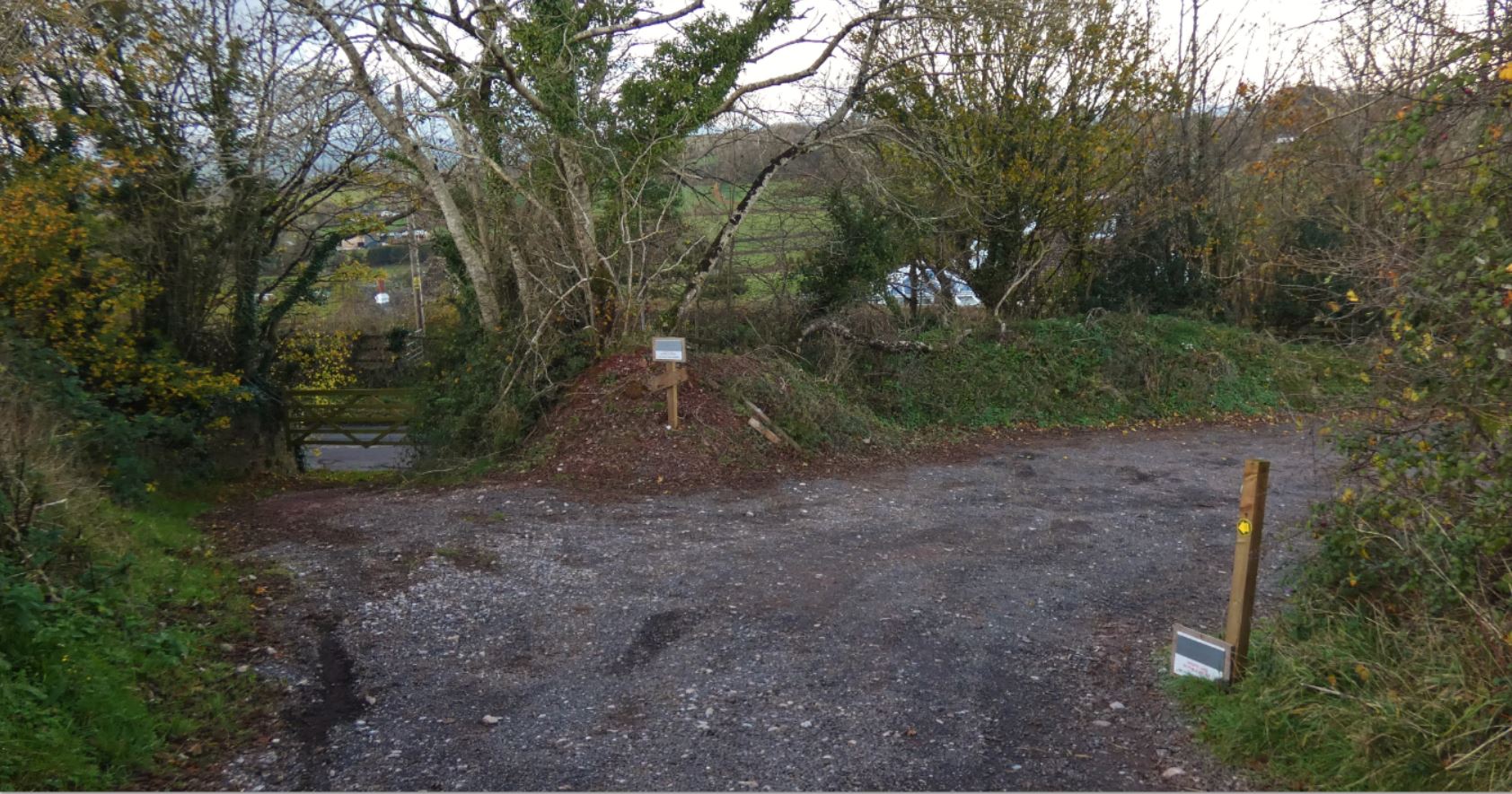
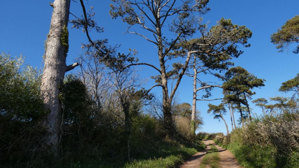
We are now at the part of Totnes Road where the road from Cruel Cross forms a junction. This is where I shall begin our walk up to the beacons properly as it is the only way up if you do not approach from Buttshill Cross to the southwest.


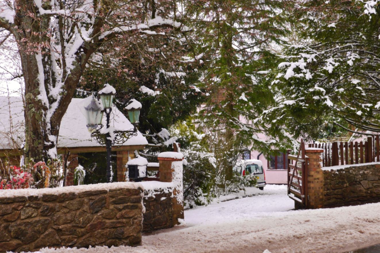
On one icy day the beautiful houses on this part of the road came into their own.
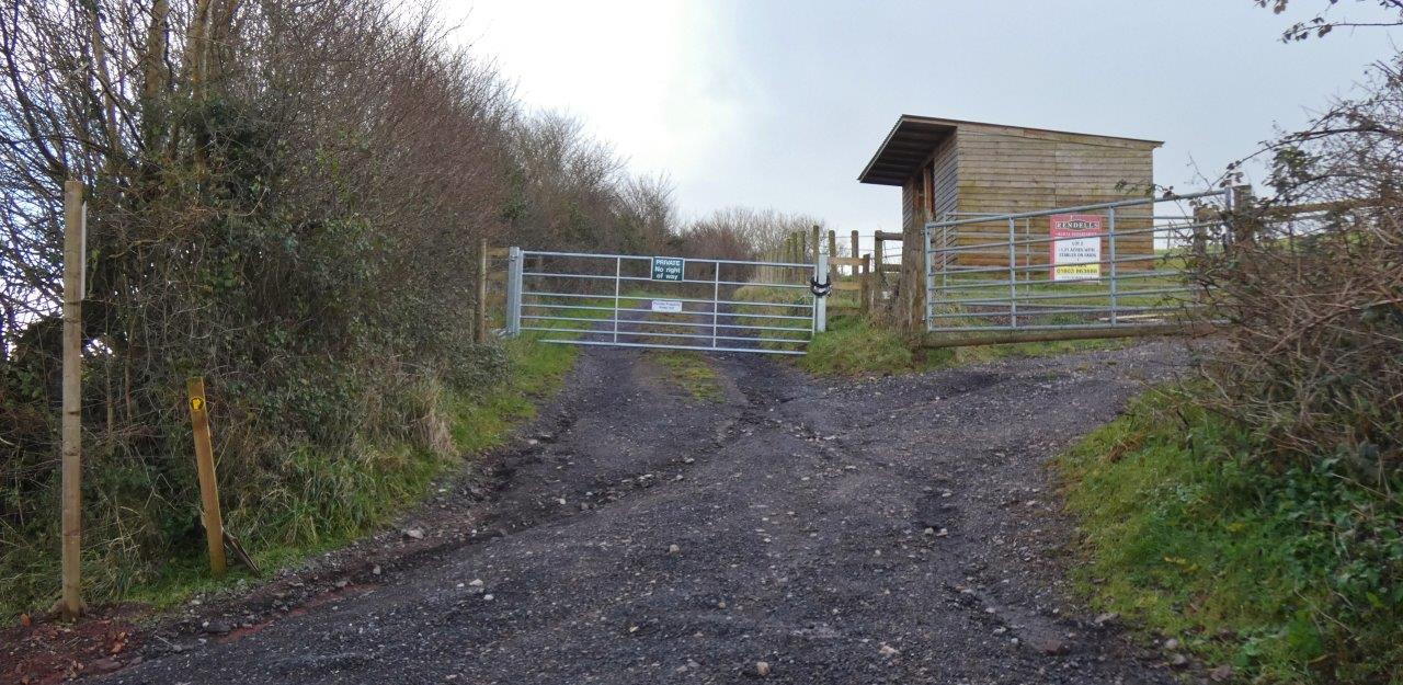
Getting to the beacons
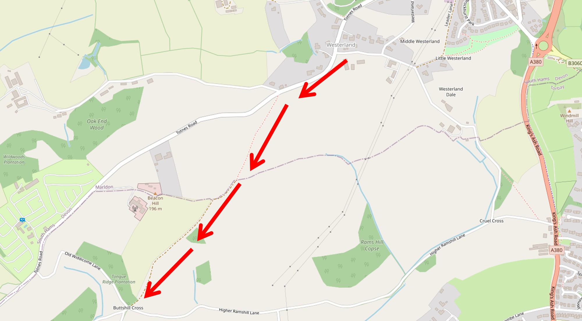
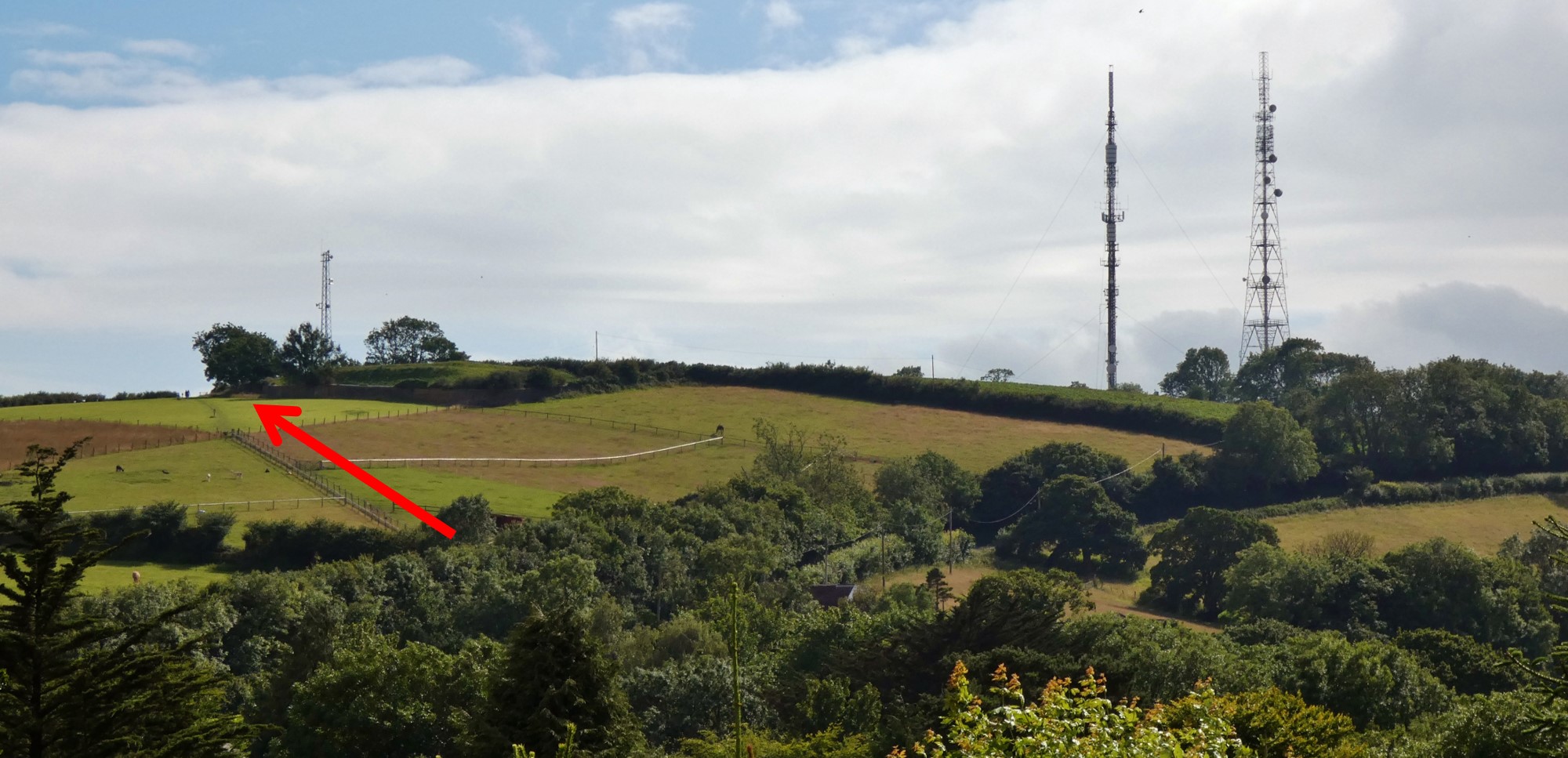
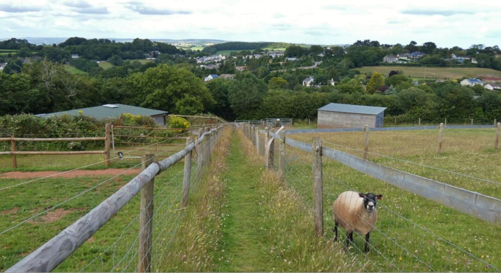
We begin at the point marked on the map below, Westerland Cross, which we have either arrived at from Marldon or Cruel Cross / the King’s Ash entrance to the lanes to the west.


Looking up Totnes Road (to the southwest) you will notice a pavement on one side of the road and a grassy verge on the other (the side with the farm). The side of interest to us is the grassy side, but if you don’t mind cross the road a couple of times and it is a particularly muddy day, you can use the pavement on the opposite side – just bear in mind that it sadly does not lead all the way up to the entrance we require.


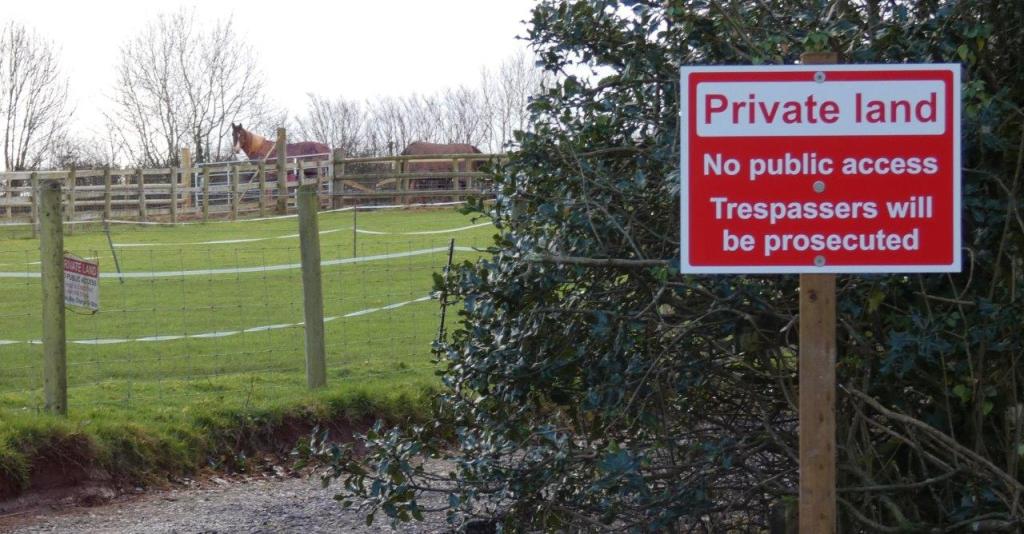
The verge is usually trodden enough to be noticeable as a viable way to get up the road (in the spring or summer it might even look like a conventional footpath) – do not, however, mistakenly pass through the entrance to the left as you look up the road as this is quite clearly marked as private property and cannot be used by the public, and additional signs have appeared at this entrance more recently, perhaps indicating that the owners do not want people using this as an alternative to the verge (which is fair enough).


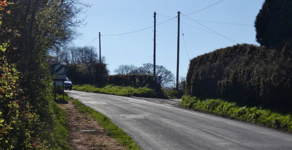
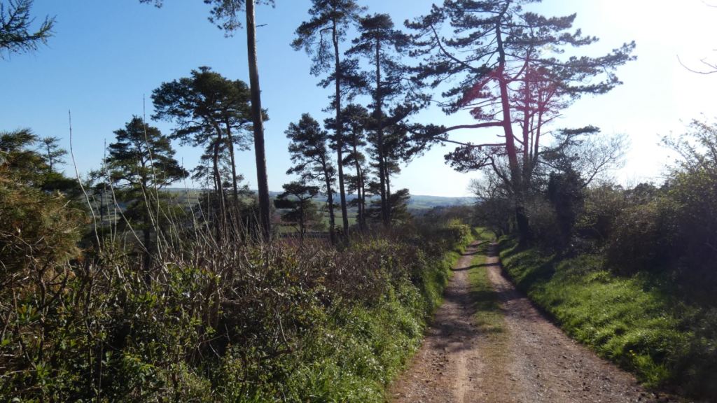
Follow the grass verge up the gentle incline. This is a simple, linear walk that lasts a only few minutes.


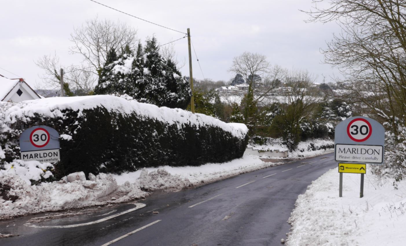
The climb’s end is signalled by reaching the road sign that thanks you for driving on the one side and marks the entrance to Marldon on the other.


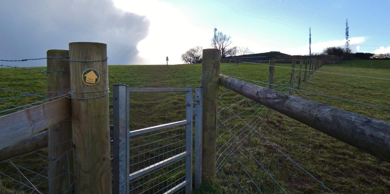
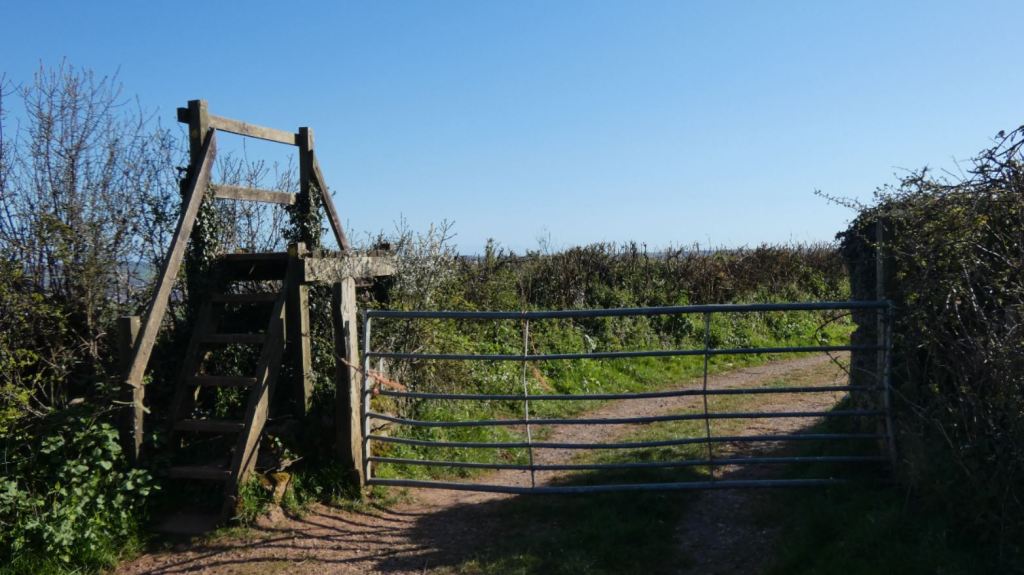
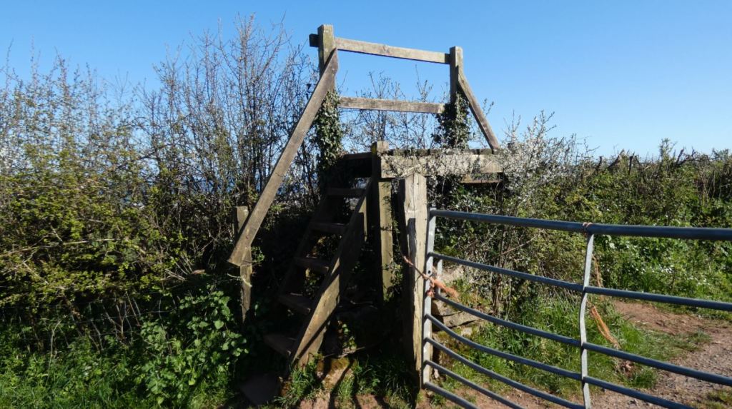
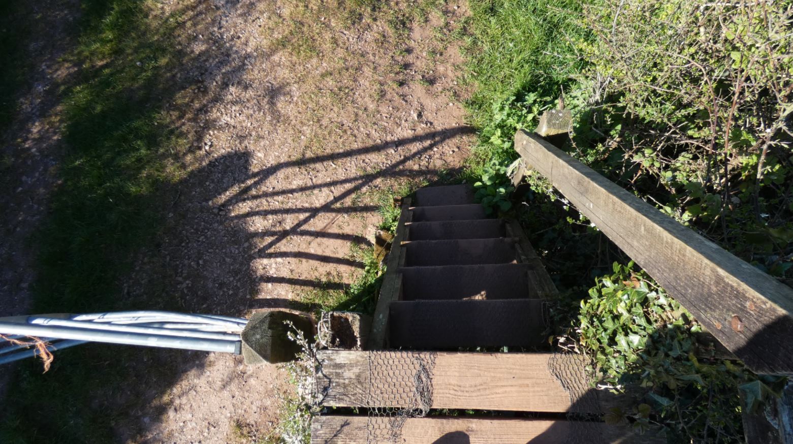
It is at this point that you should see some steps just beyond, and these are of interest to us.

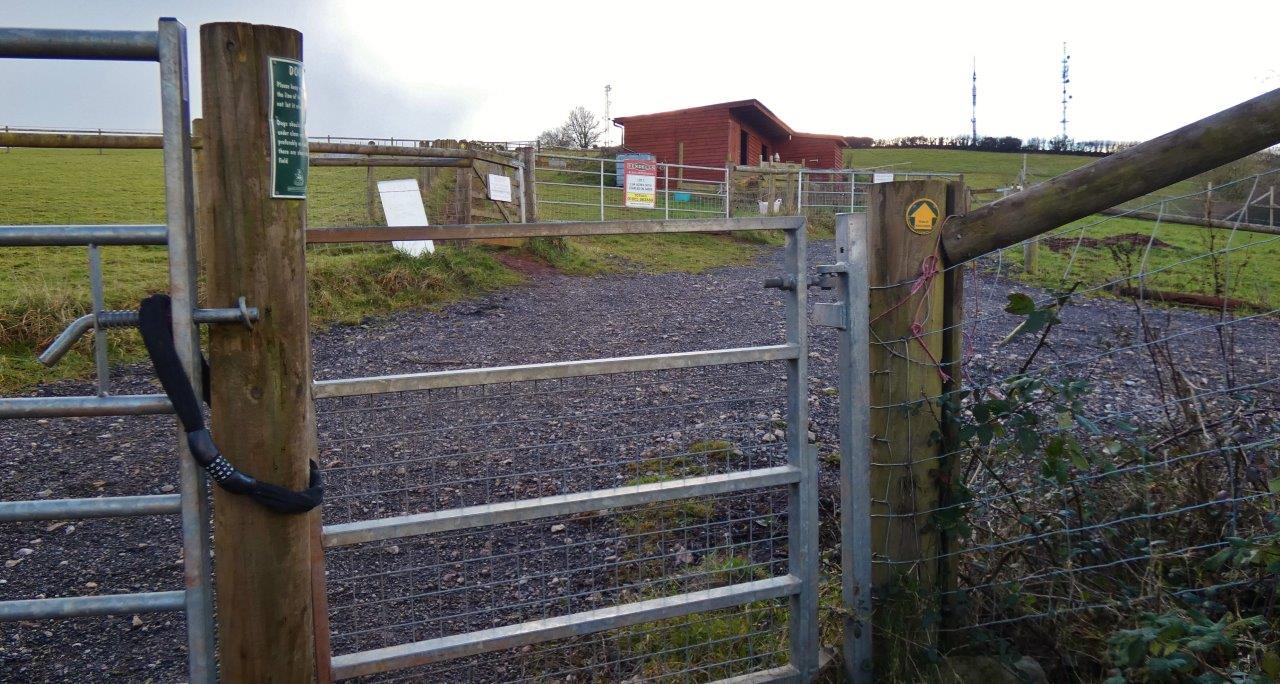
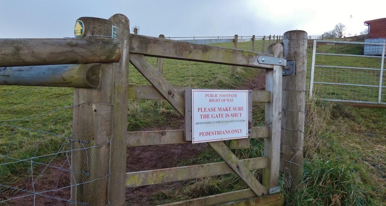
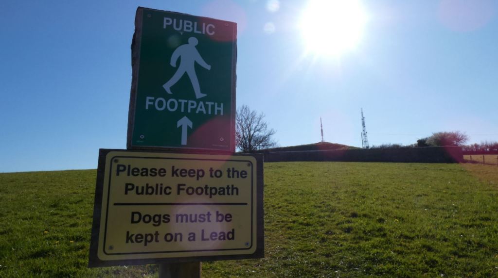
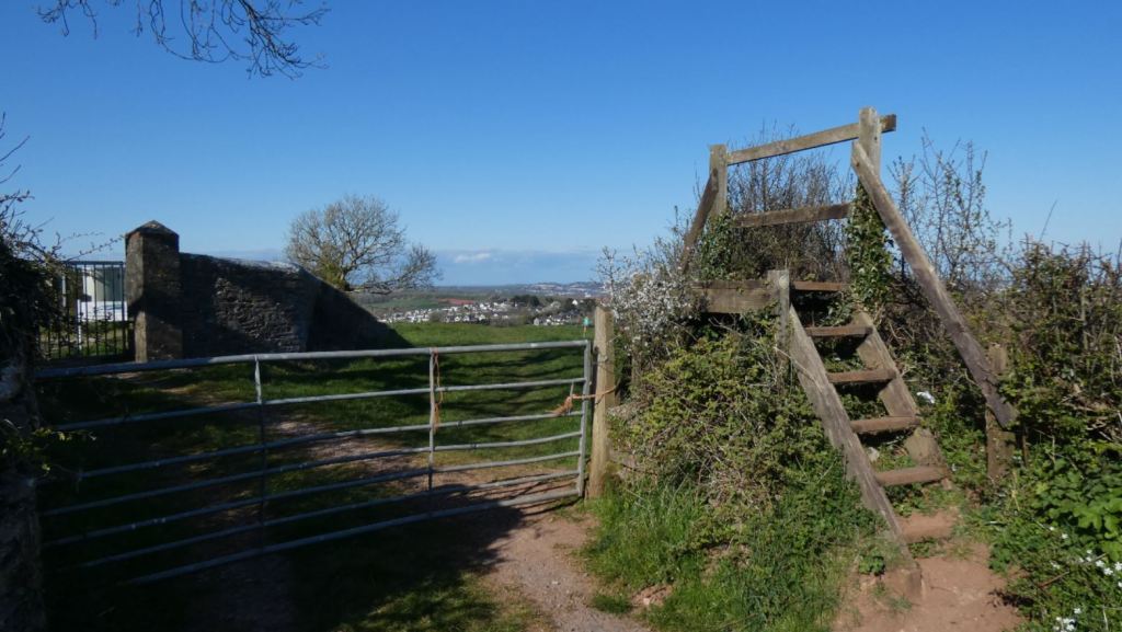
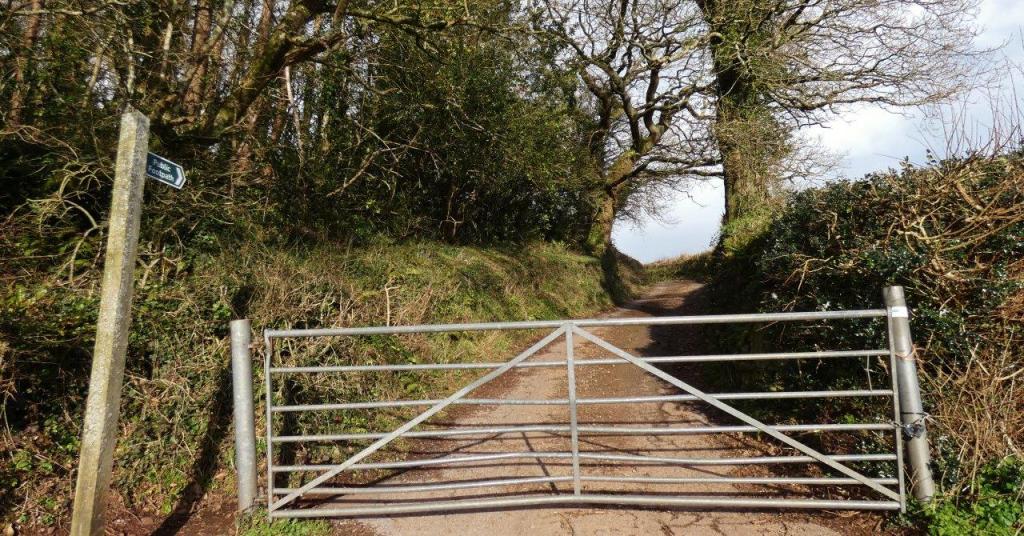
A short walk up these steps and, finally, away from the Totnes Road, will lead you to a larger gate to the right and a stile to the left. The stile is the option of interest to us, and is also clearly marked as a public footpath. There are clear indications of what can and cannot be accessed around here since the field has become a more active farming area in recent years, and it is easy to respect and follow the public footpaths without straying into private lands.

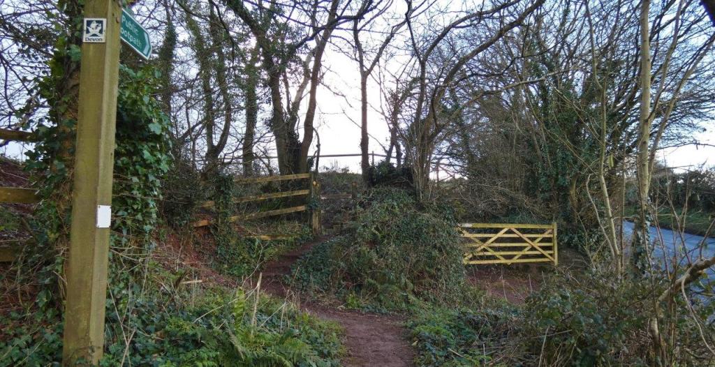
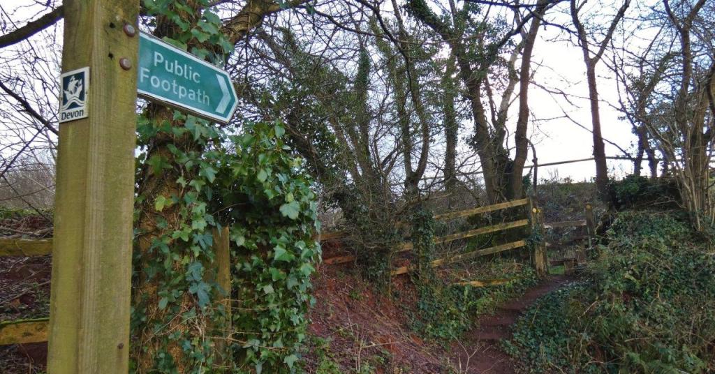

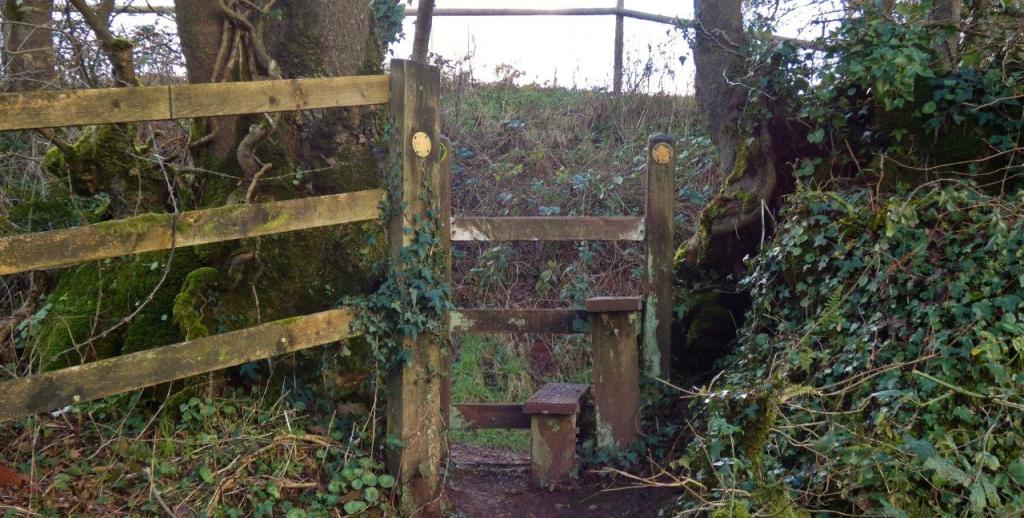

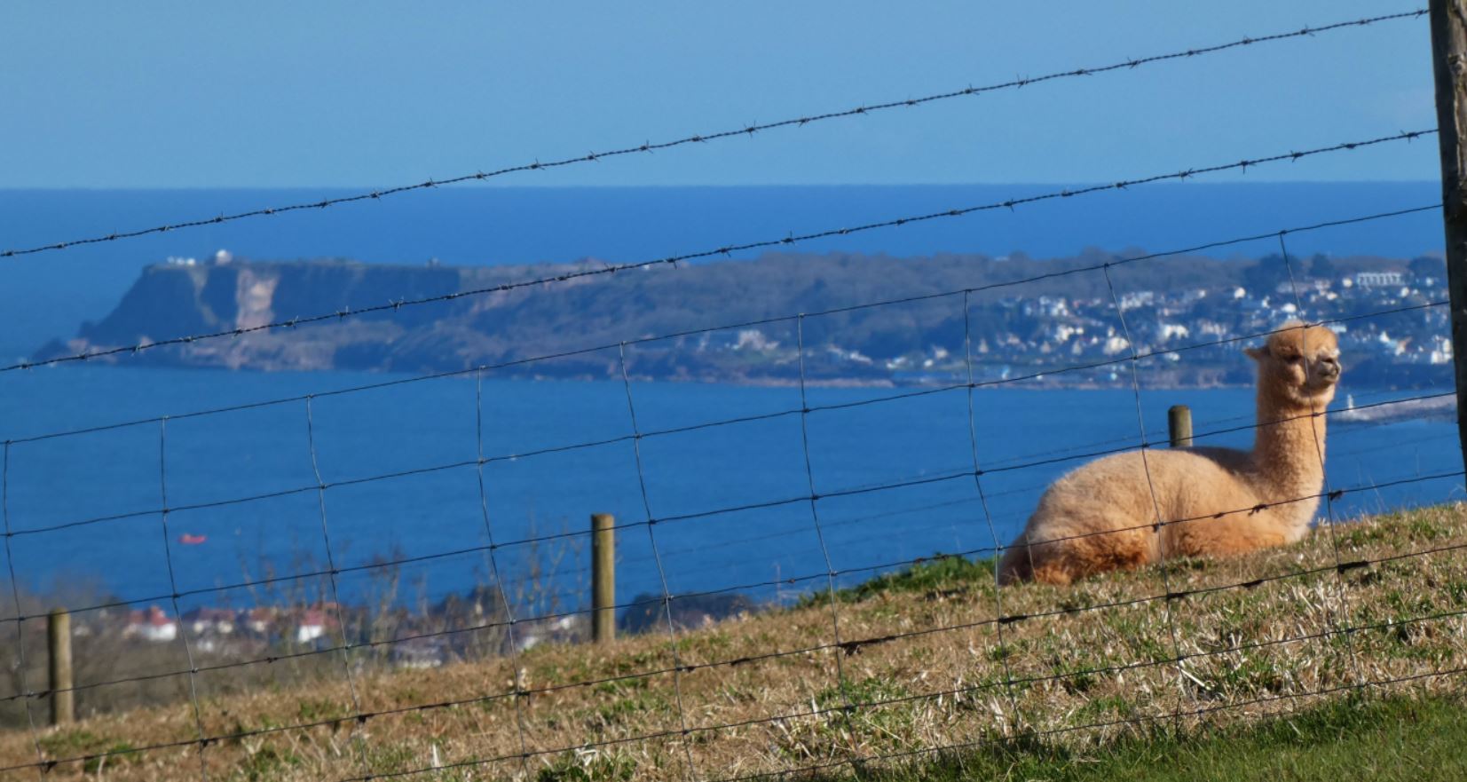
On the other side of the stile is a clearly marked gate that acts as a continuation of the public path. Passing through this will lead to the base of a hill and animal pens in which I have seen ponies and horses, sheep, and even alpacas.

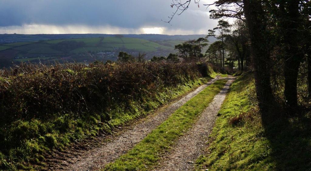
Climbing to Beacon Hill
Go straight ahead to the next pedestrian-only gate, which continues the public right of way and marks the start of a reasonably steep climb up the field.
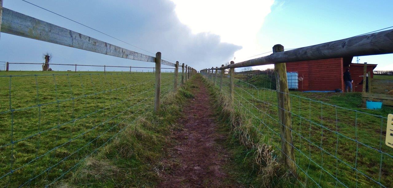
This part of the field was only recently transformed into this formation – some years ago, it was entirely open, and the descent from the beacons down to the stile might have involved trudging through some quite sticky mud and some quite long grass.
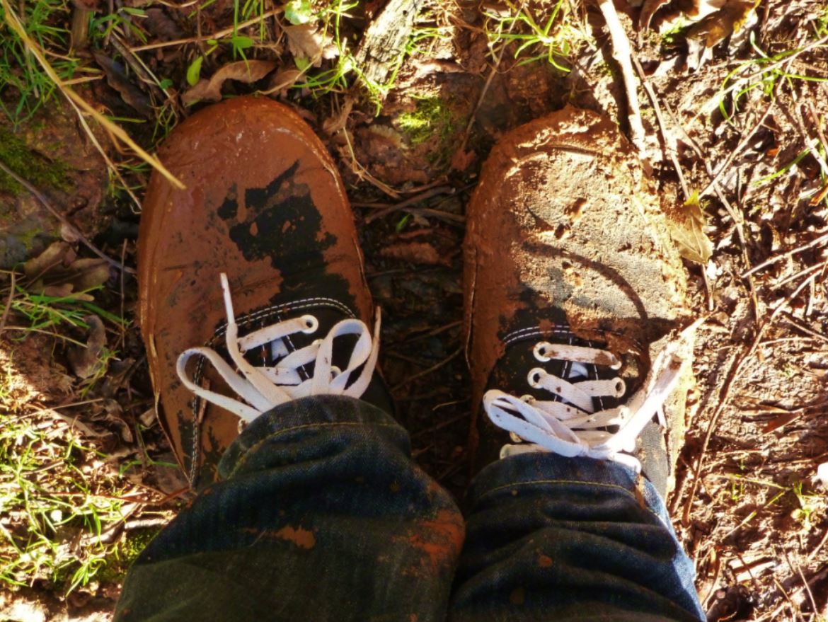
Nowadays, the field is far more restrictive in terms of what can be walked through yet beneficial as the footpath is generally easy enough to climb (it can be a bit slippery in wetter periods, but nothing like how it used to be) and also more interesting as you get to say hello to animals that did not use to live there!
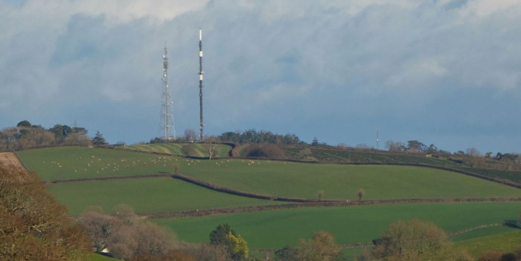
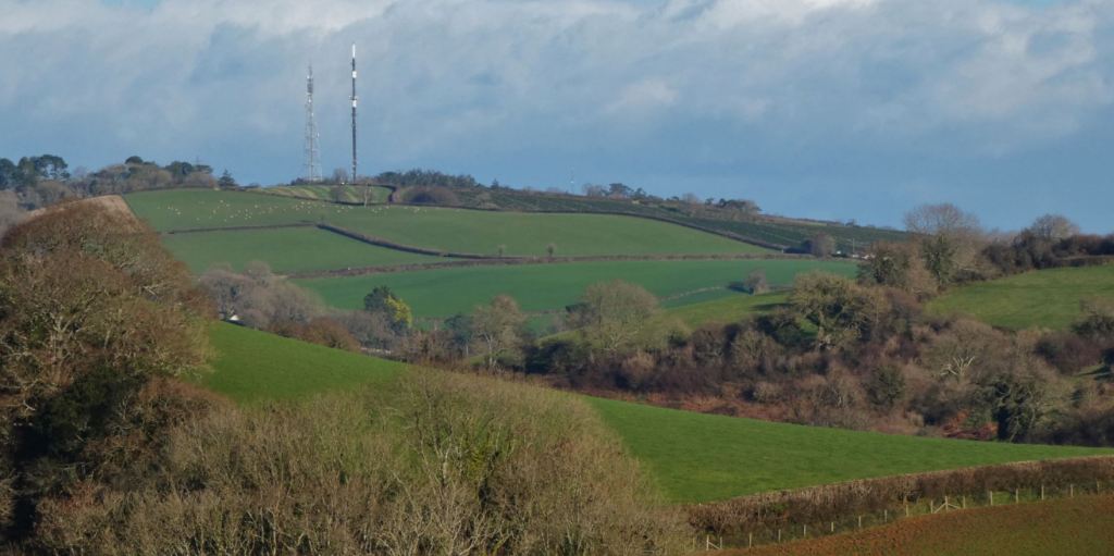
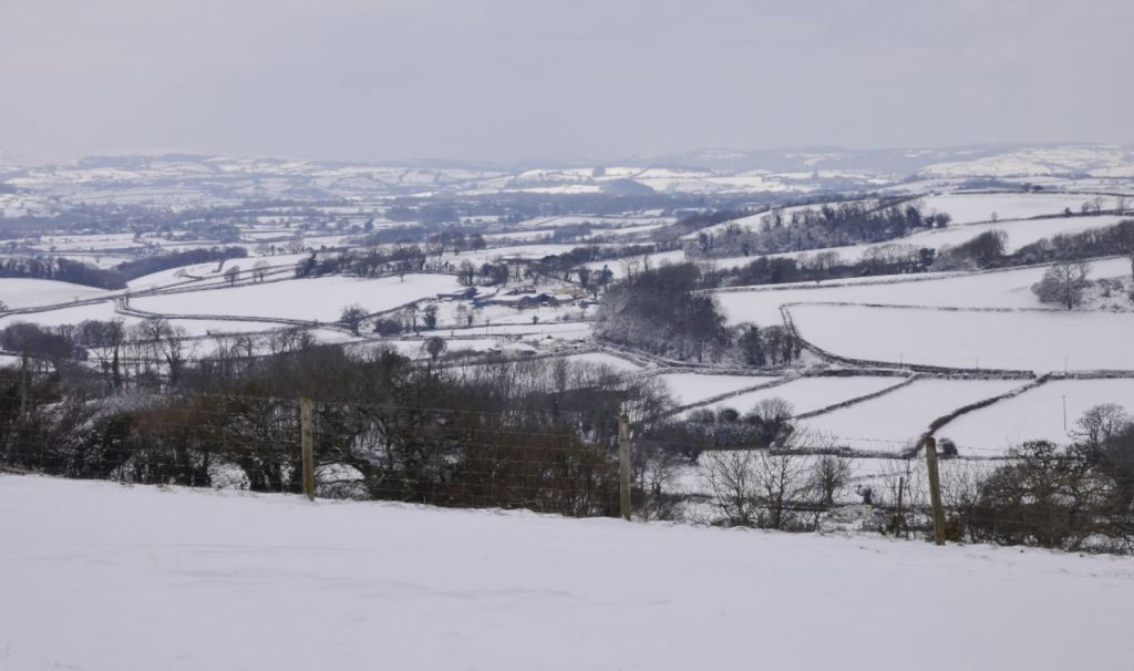
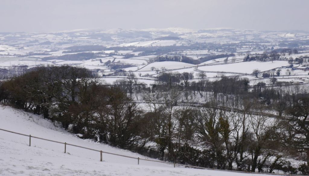
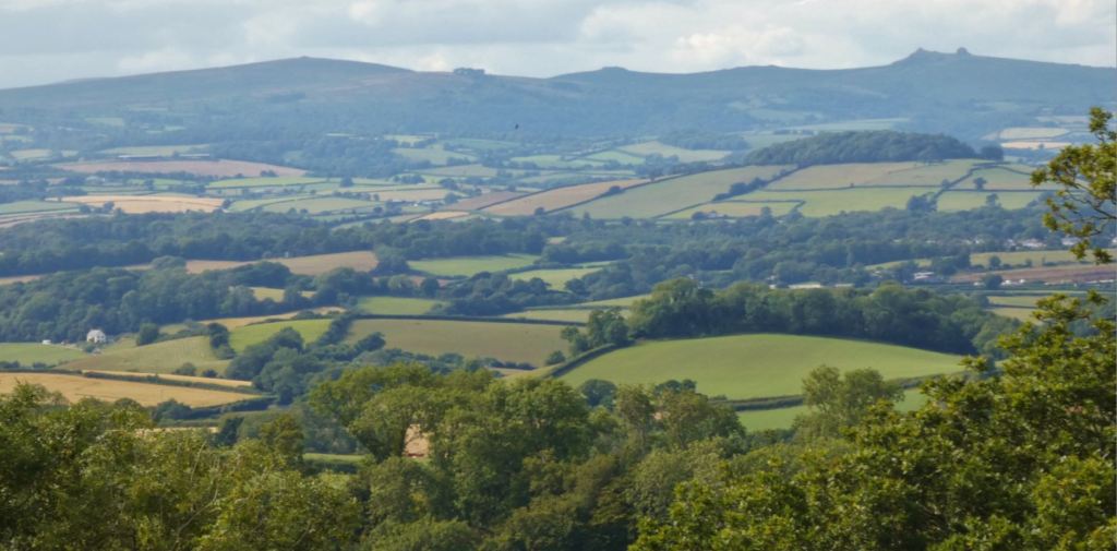
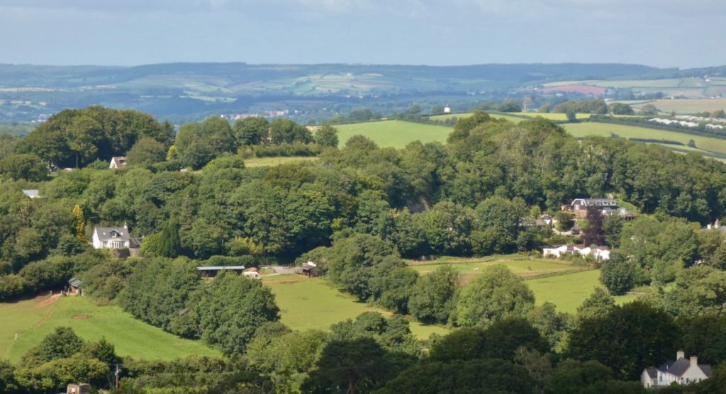
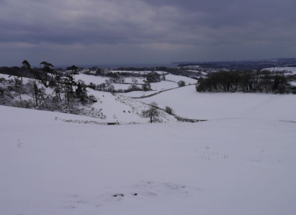
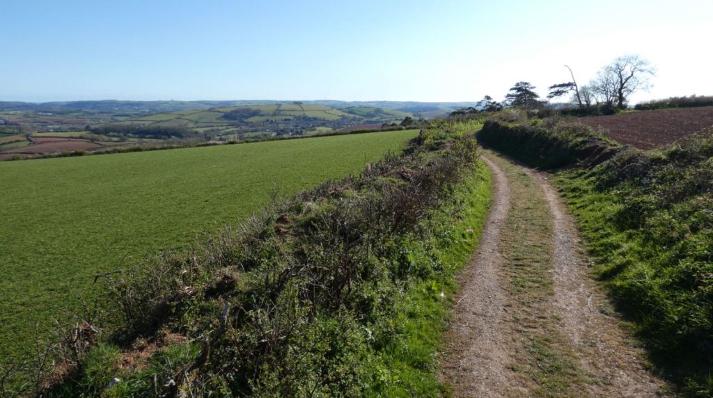
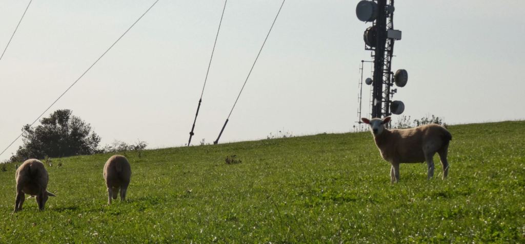
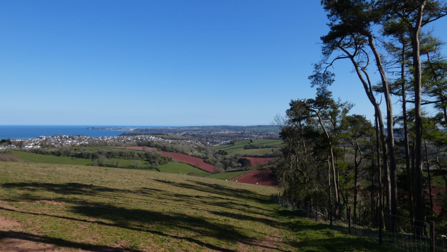
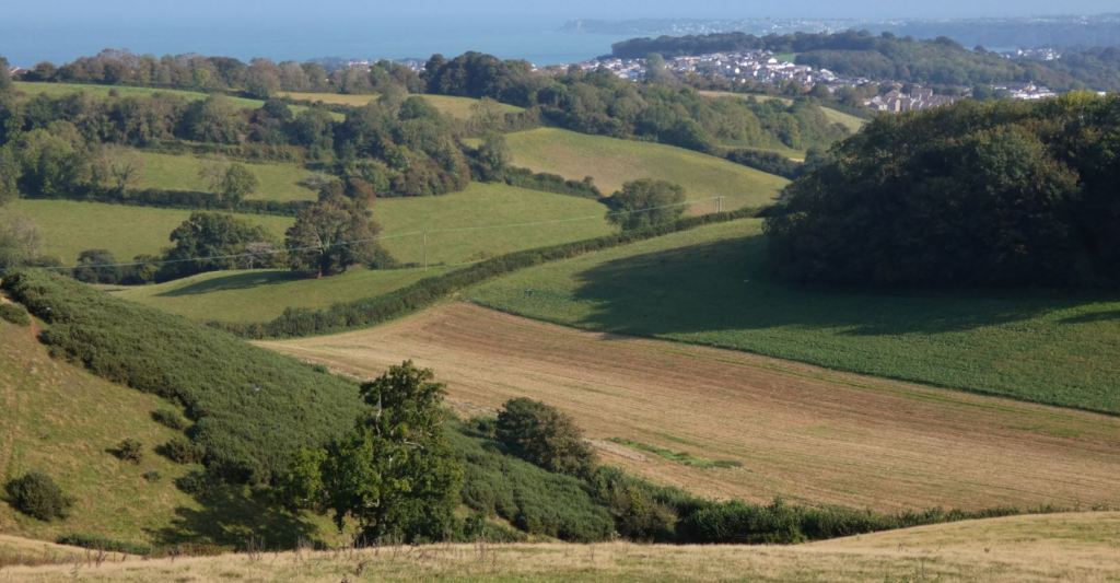
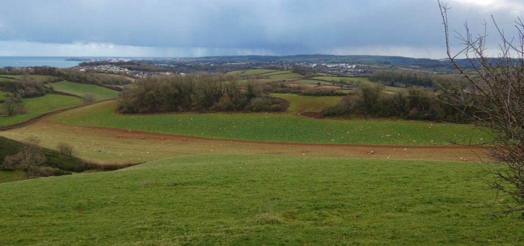
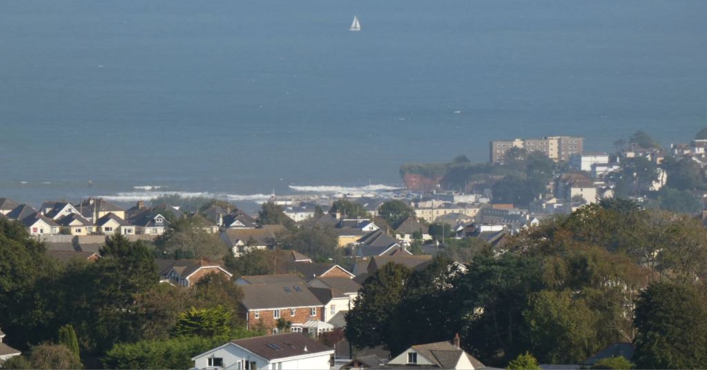
The climb itself looks something like this from a distance:
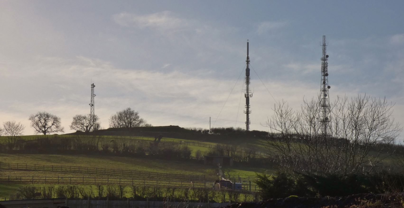
As you can see, going through this field does not actually take us all that close to the masts; instead, we climb up to a high point that borders a third, smaller mast inside of a wall along with a covered reservoir.

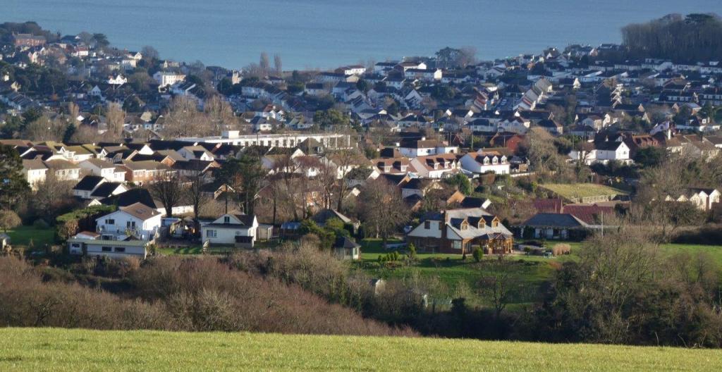
If this is your first time walking up this slope, I would recommend pausing every now and then. Not only does this allow you to catch your breath (well, in my case anyway) but turning around will also enable you to witness the views that are beginning to emerge. As we climb, we are better able to look out over Marldon, Dartmoor, and, eventually, Paignton and Torquay.
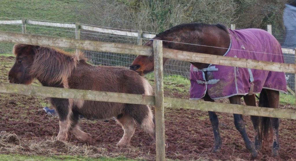


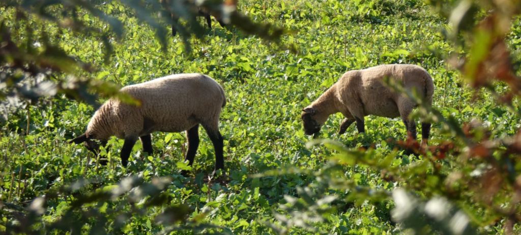
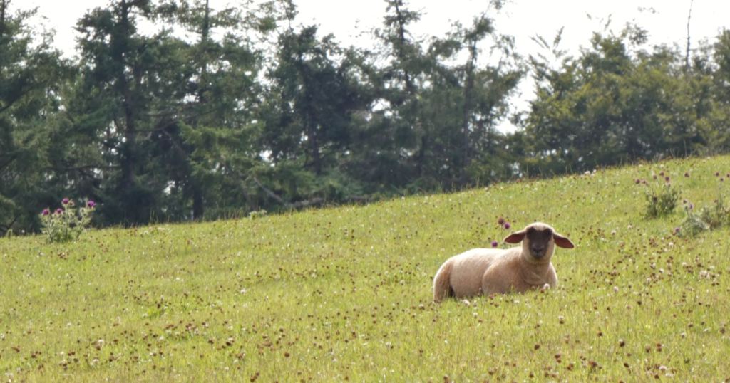
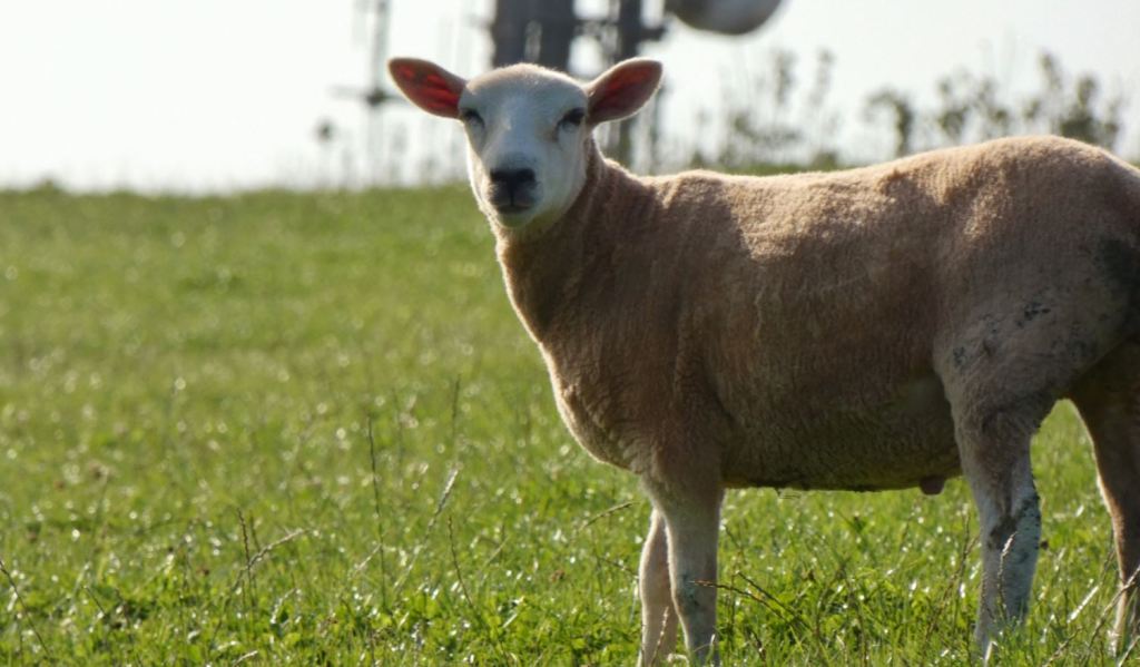
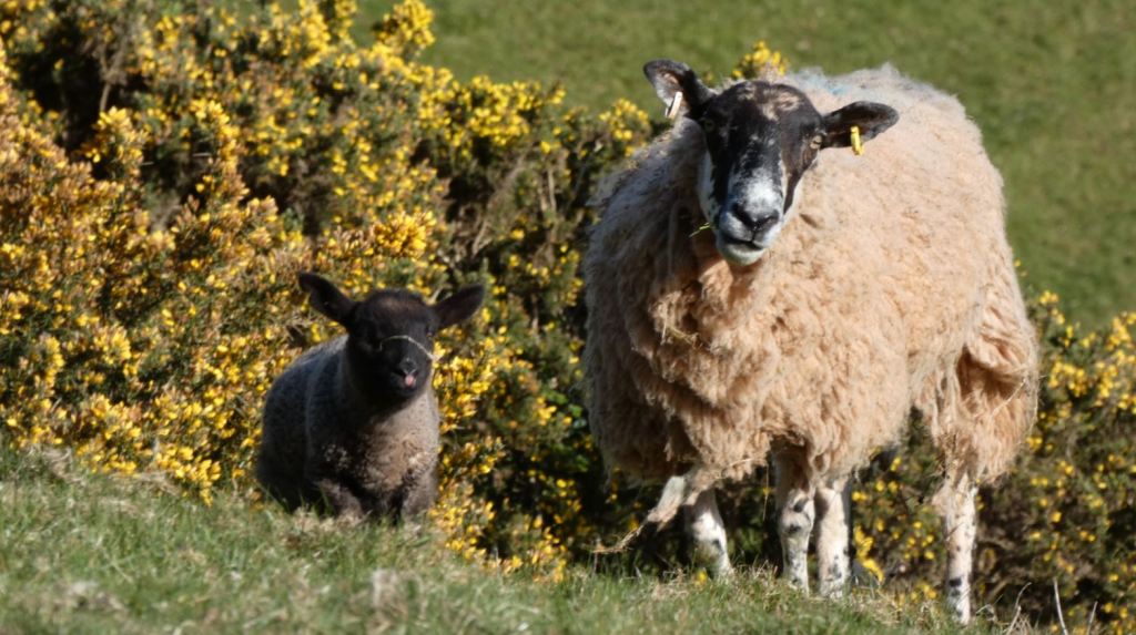
Quickly, a view across to Ipplepen, Denbury, and Dartmoor emerge (more on these views later). In recent years, it has also been quite a treat to see alpacas on the left of the hill – these friendly-looking animals, along with their sheep pals, frequently provide the opportunity to take amusing, occasionally unique pictures.


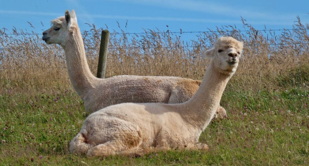


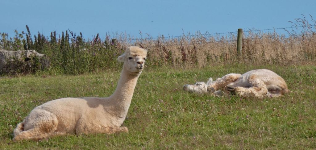


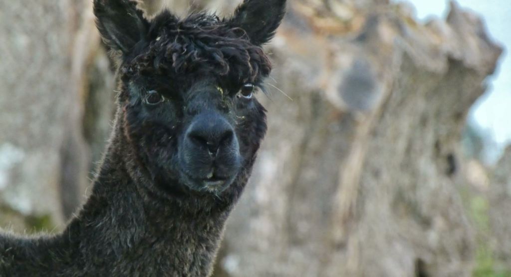


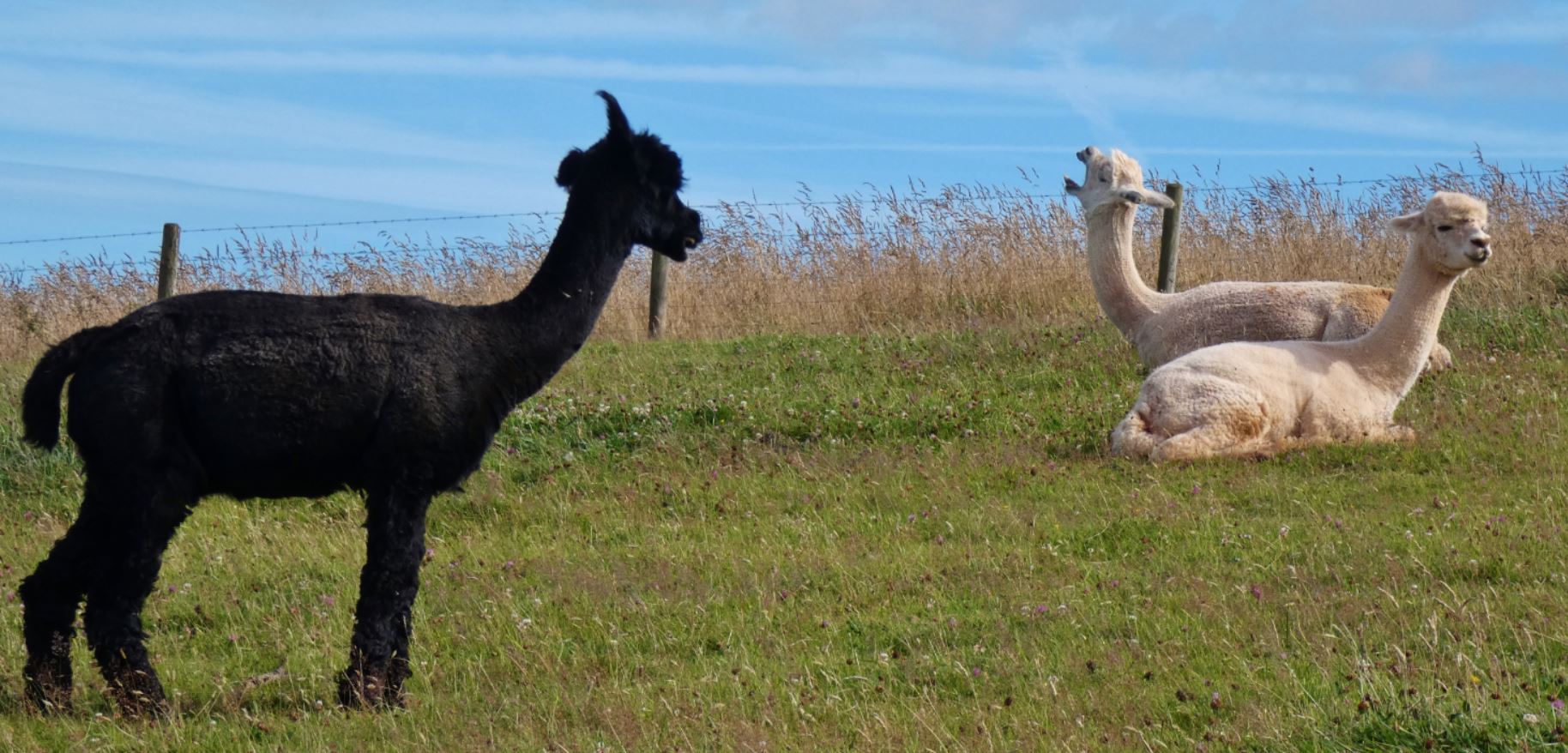
Along with the alpacas, you may see sheep…


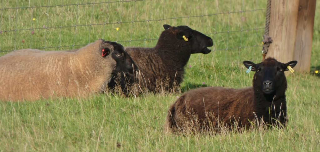
…ponies/horses…


…and maybe even a goat.

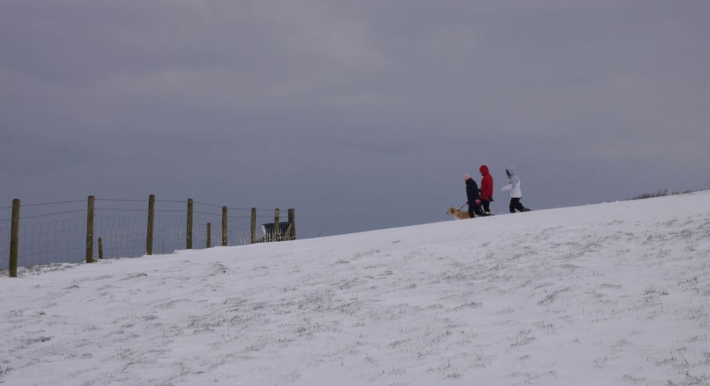
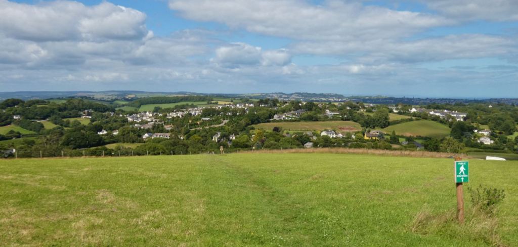
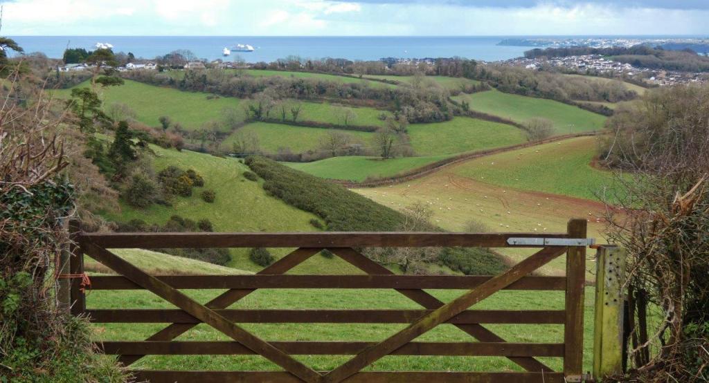
The final gate (for now) opens up to the open field, through which one can walk and enjoy the views. Although the whole field is accessible, it is recommended that the middle path is stuck to by pedestrians.

The Main Field
…and here we are! How does one possibly produce a guide that makes a field sound like an interesting place to visit?
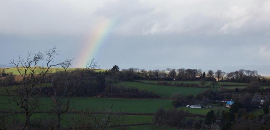
First of all, while I would recommend visiting at any time of the year for the fresh air and the chance to dive into nature, the extra joy to be derived from the views will depend on the weather. Obviously a clear day provides uninterrupted views for miles and miles, but there is something to be said for experiencing one of the highest points in the bay when the weather is a little less clement (or perhaps even a mixture of weathers, resulting in a great place to spot rainbows), as I shall show here!

Before moving on to the wonderful vistas, let’s begin with the field. As mentioned before, it has undergone some changes over the years, becoming less wild and open in recent times. The animal pens occupy most of the lower end of the field now, providing a passage for the public footpath as required, and the upper end of the field, although open as before, has recently seen signage added that requests that walkers stick to the middle of the field and keep dogs on leads (presumably to avoid catastrophes between excited dogs and farm animals).

It was once home to farm animals such as cows, contained large metal cattle feeders and troughs, and would become quite overgrown at times (which, I have to say, was quite beautiful in the autumn as a foreground to a sunset).


One sad thing that seems to have happened, however, is the disappearance of this tree:

I imagine its cutting back was necessary, but it is sad to see something so large and so striking be diminished.

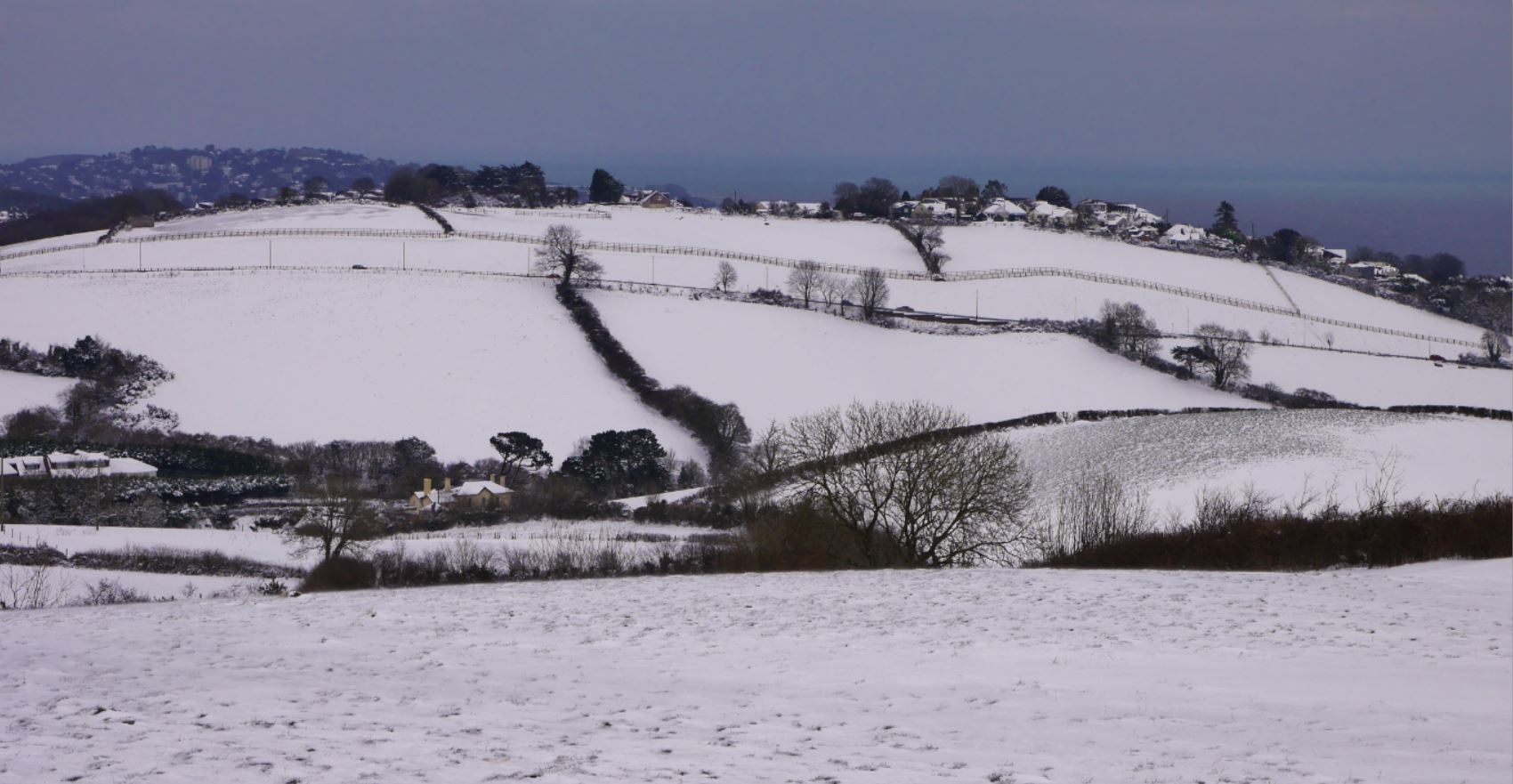
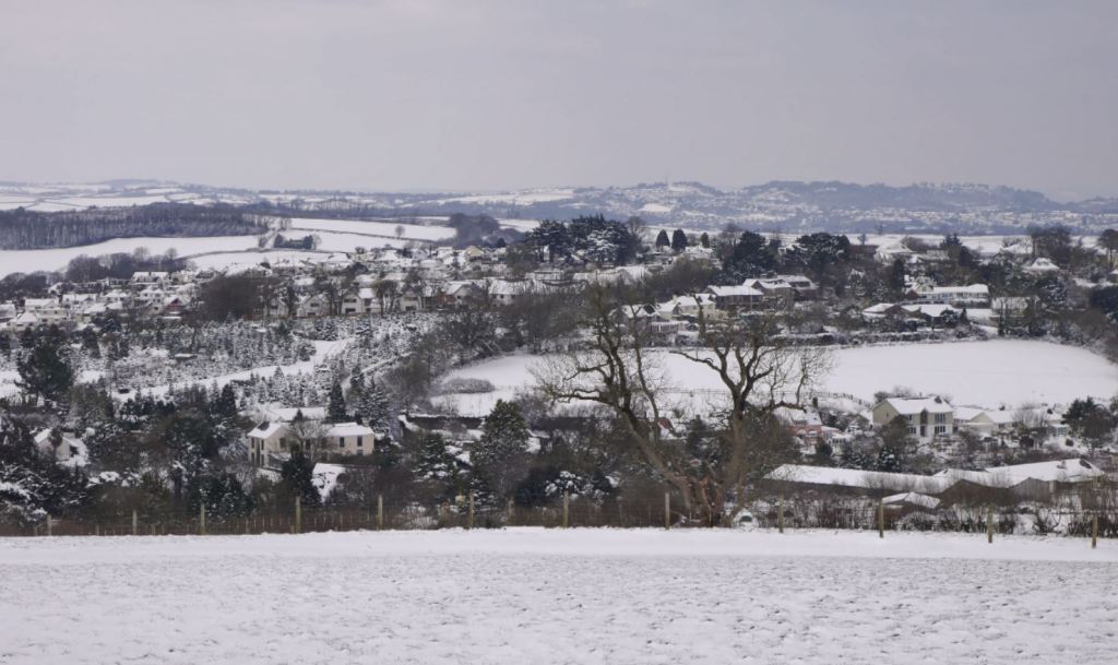
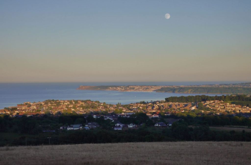
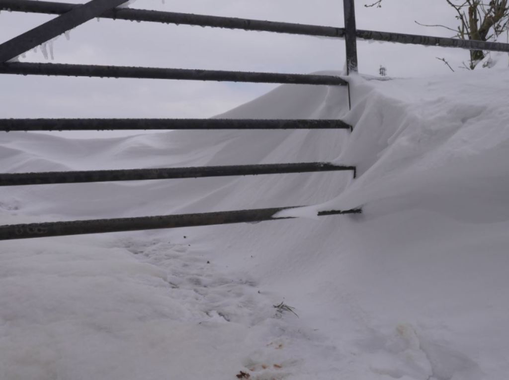
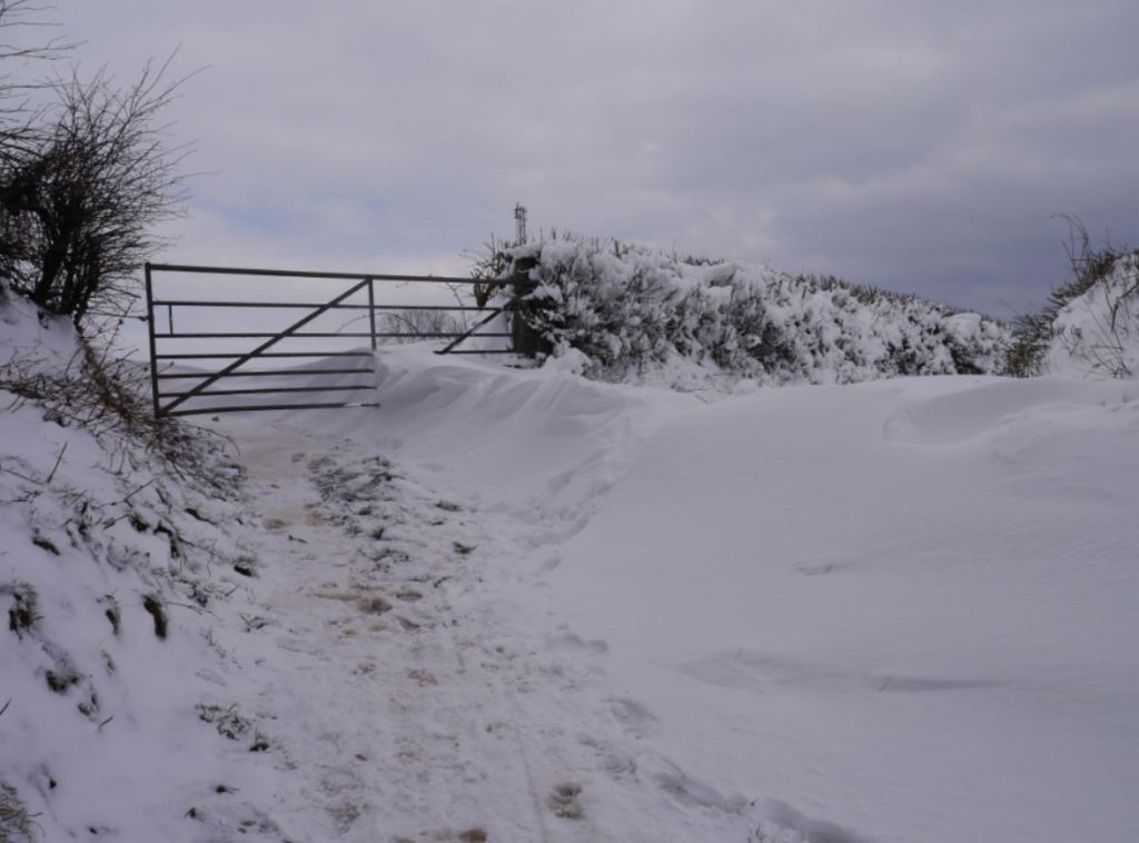
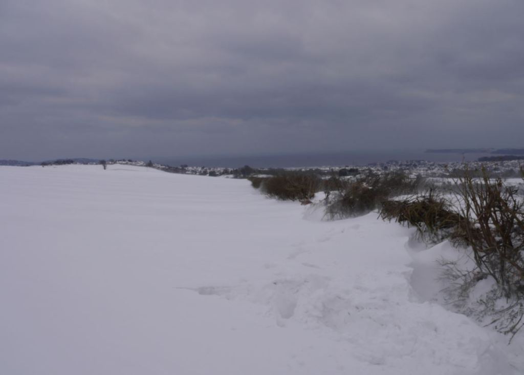
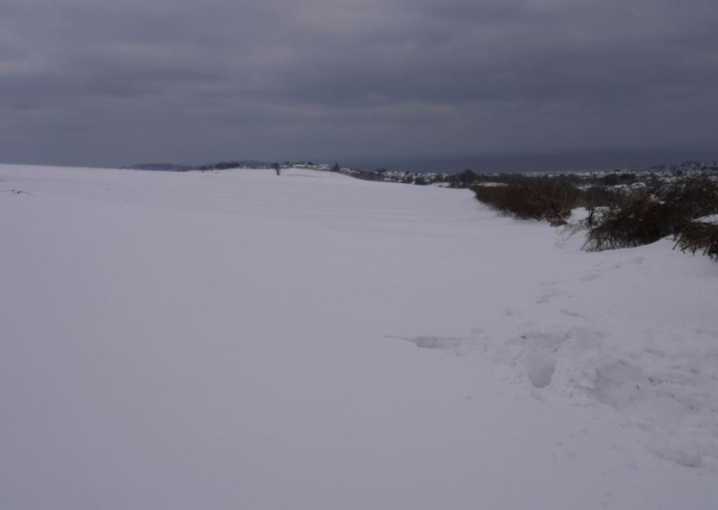
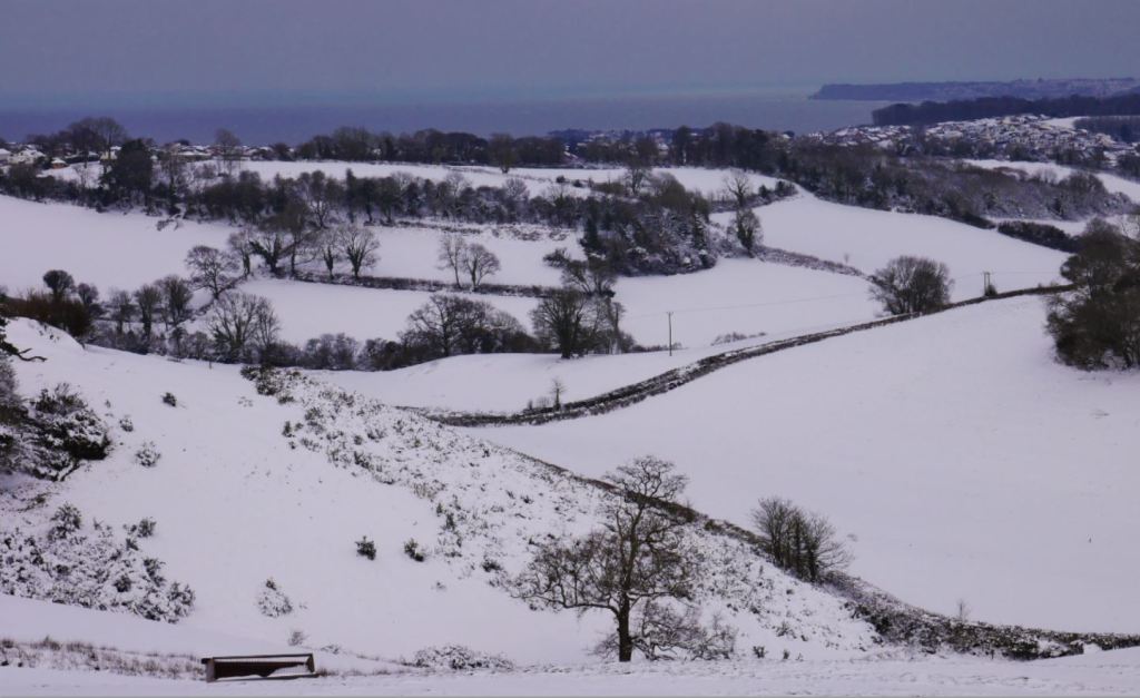
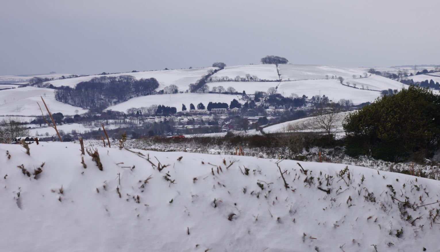
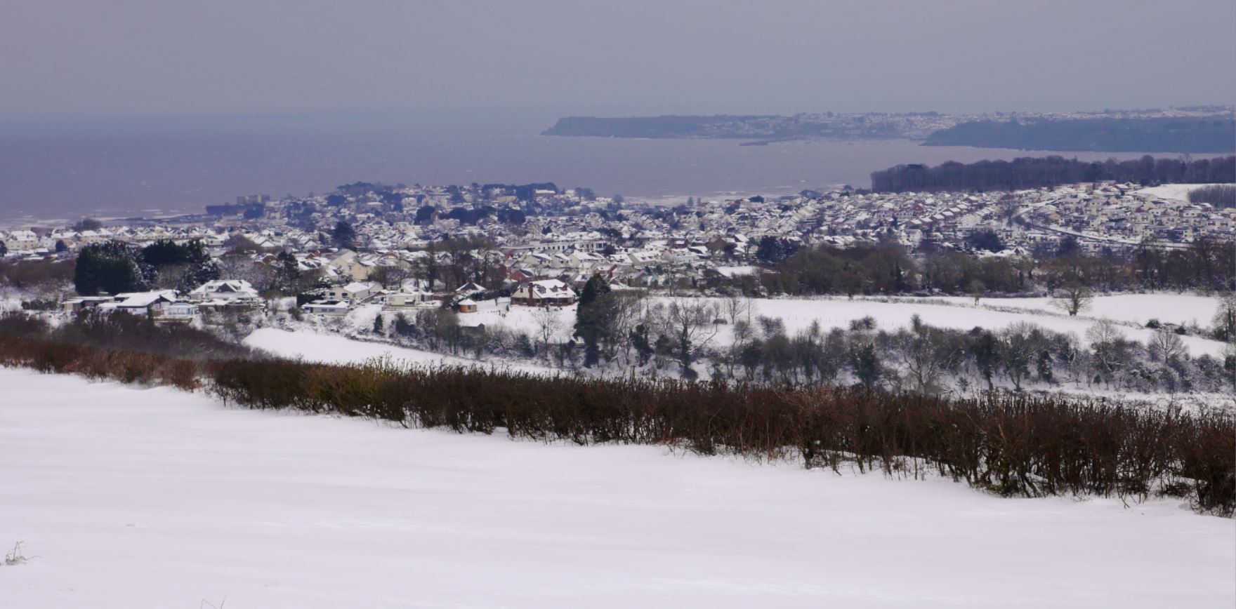
Those rare snowy winters add another dimension too; the snow can settle quite quickly, providing a fresh white blanket and some even better, brighter views if you brave the climb up and the inevitable wind that comes with it. My pictures come from a snowy walk up to the beacons in March 2018, although I cannot recall too many other times in recent years when such deep snow arrived.


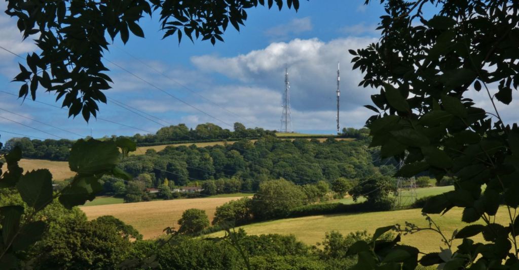
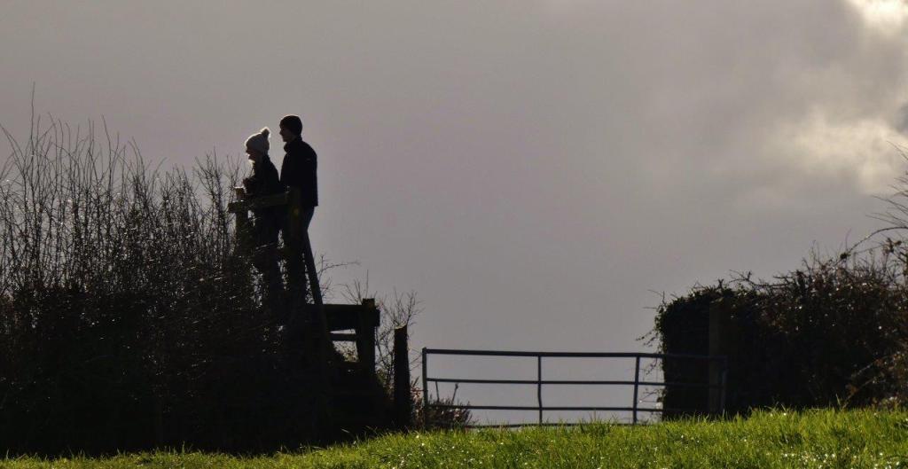
Bordered by fences, hedges, and a walled area that contains the third mast and reservoir, the way out at the upper end of the field is a rather steep set of steps that goes up and around the gate, which I have only ever seen shut. There is a wooden handrail to hold onto, but do be aware that these steps may prove troublesome for those who are less mobile.

The covered reservoir behind the wall contains little of interest, although I do occasionally daydream when passing about how the view must be from the top of the mast within the walls! I suppose Google Maps will have to suffice for now…


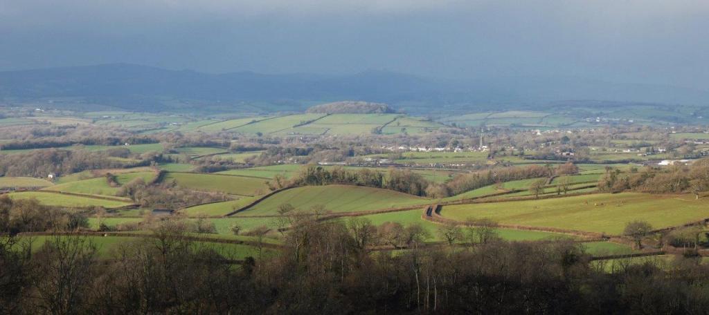
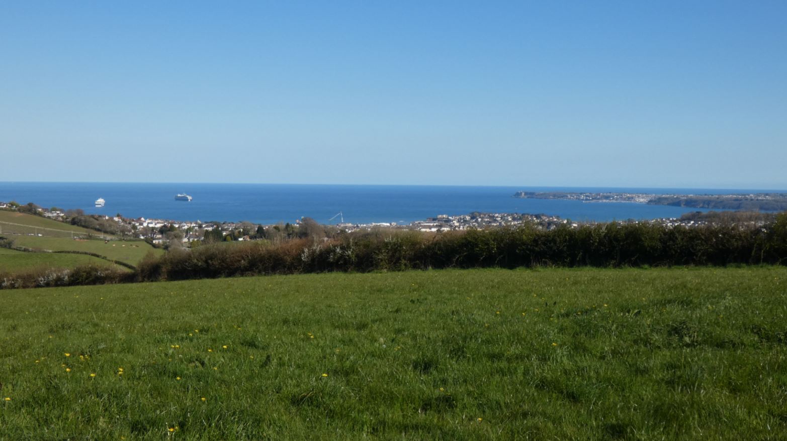
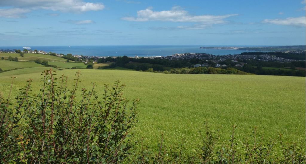
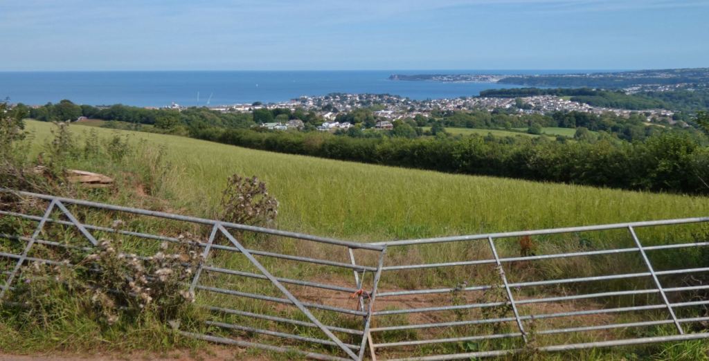
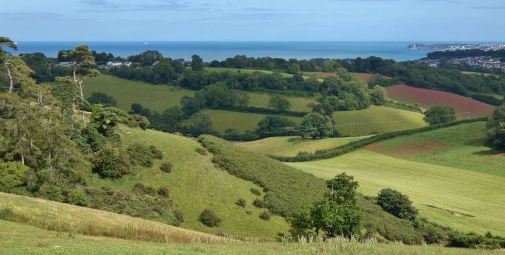
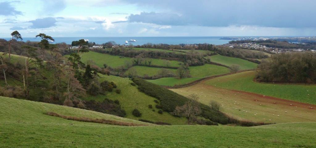
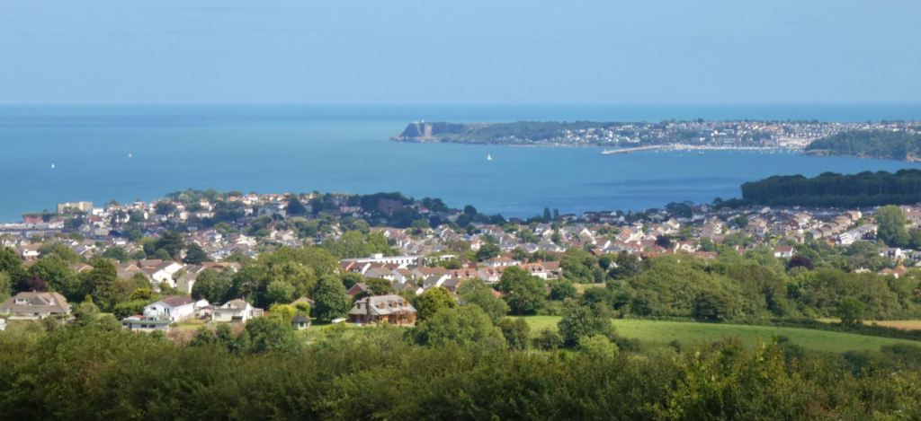
The best views, of course, come as you walk up to the higher parts of the field, but the very best view over everything from Torquay to Brixham comes when you stand up on the platform above the steps.
If the pictures do not do it justice, perhaps my video will help:
It is a narrow space, so you may need to vacate the platform if any other walkers need to use it, but I have spent many minutes both admiring the view on this platform and taking photographs, zooming in on anything I haven’t spotted before (and there is a lot to spot).

What can be seen from this field:
Abbotskerswell Priory

Brixham
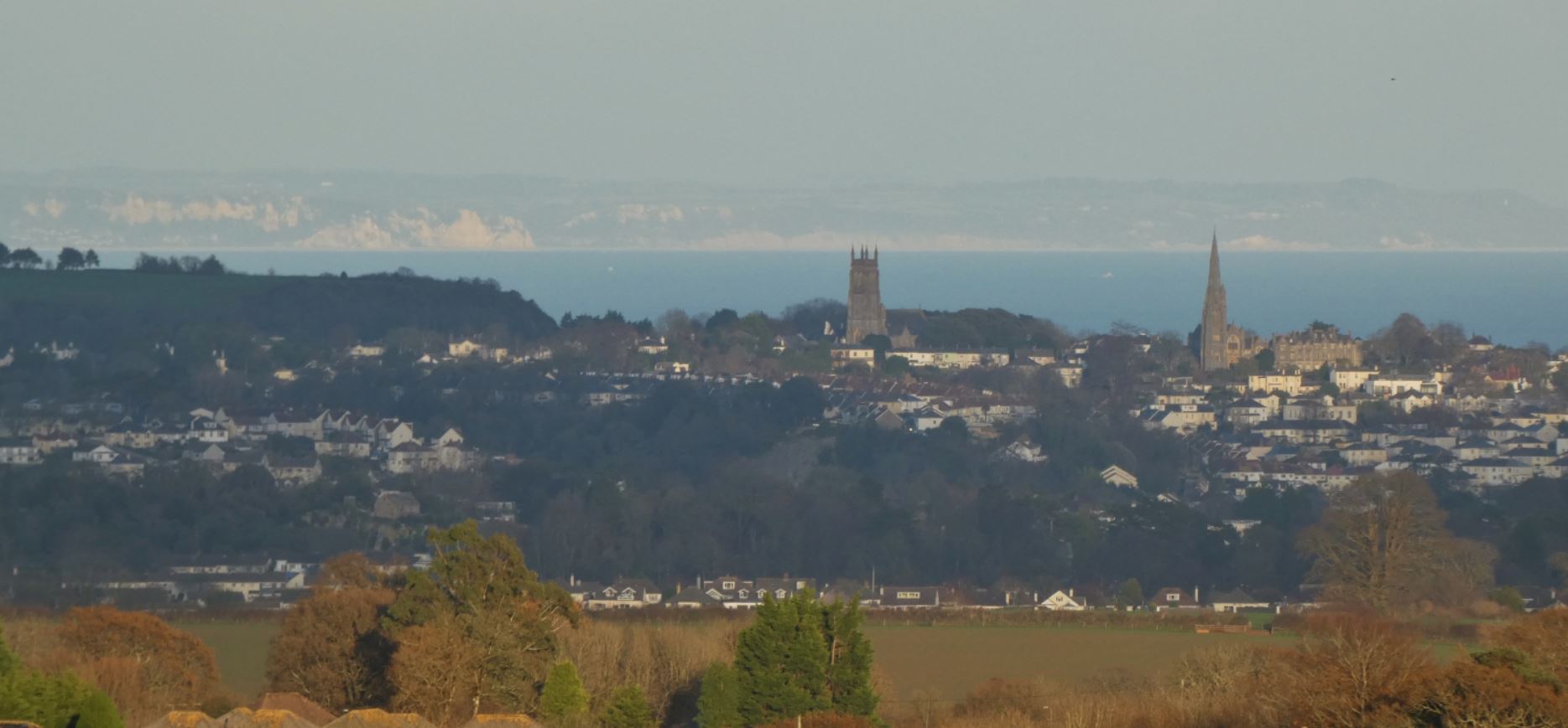
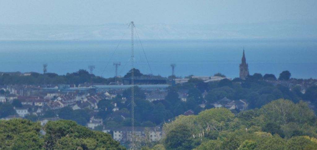
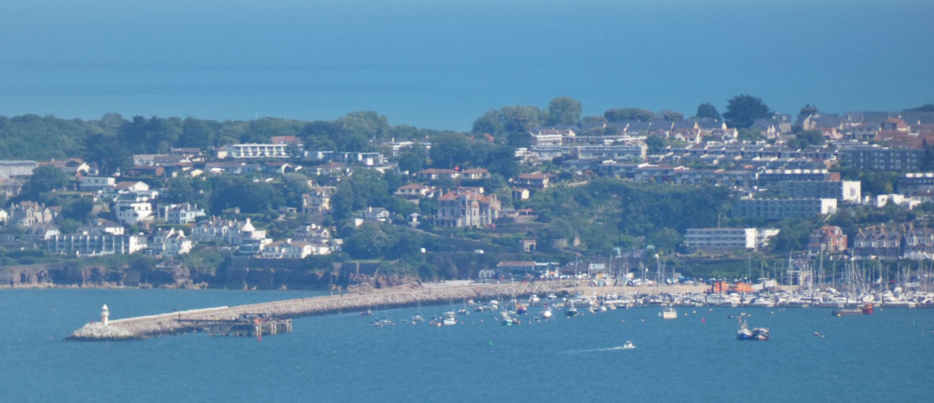
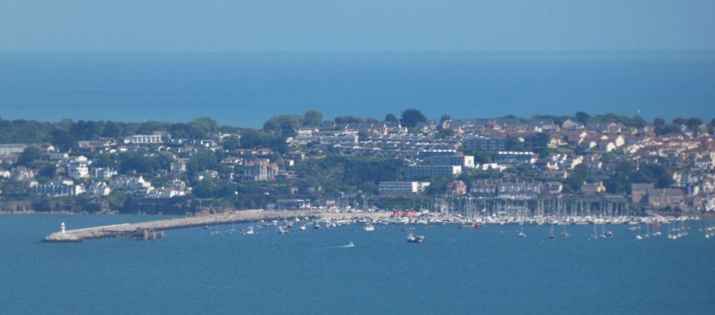
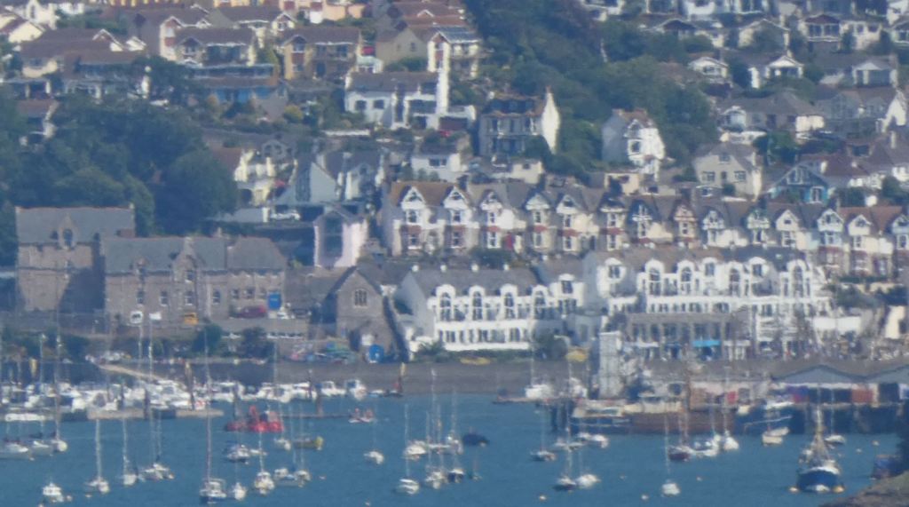
There are some wonderful views of Brixham from both this point of the walk and further down the lane. These views span from the woods near Elberry Cove and stretch right across to Berry Head. With binoculars or a zoom lens, picking out the landmarks around Brixham is good fun.


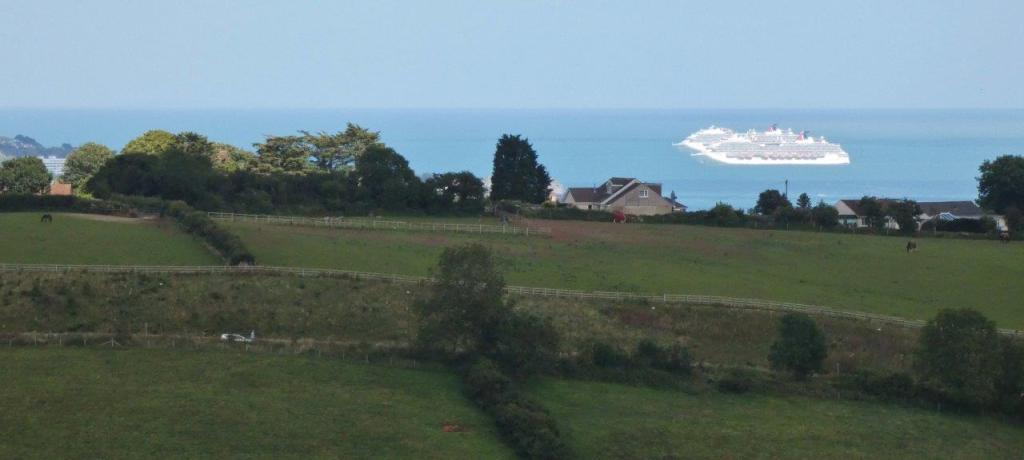
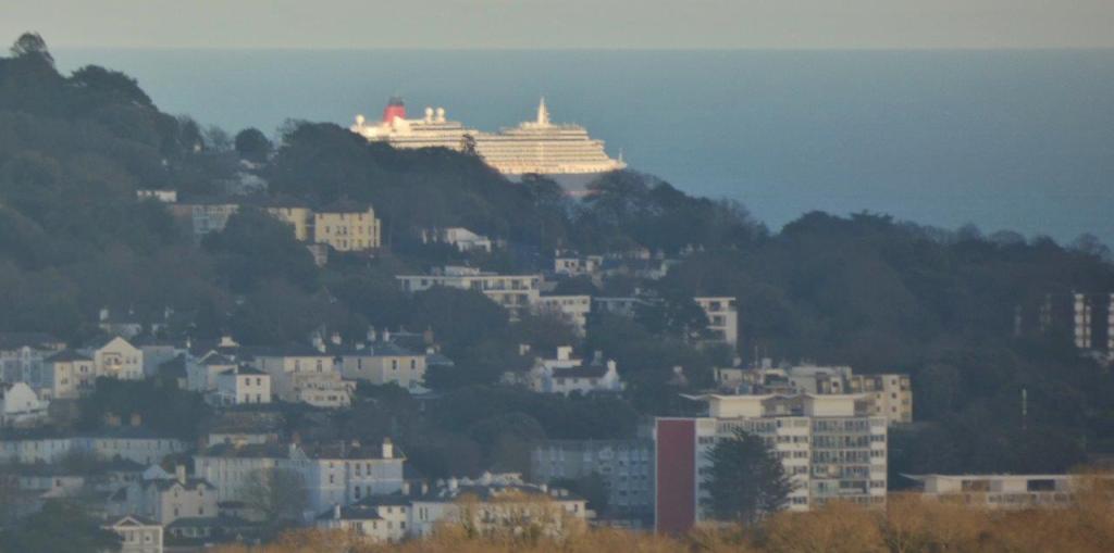
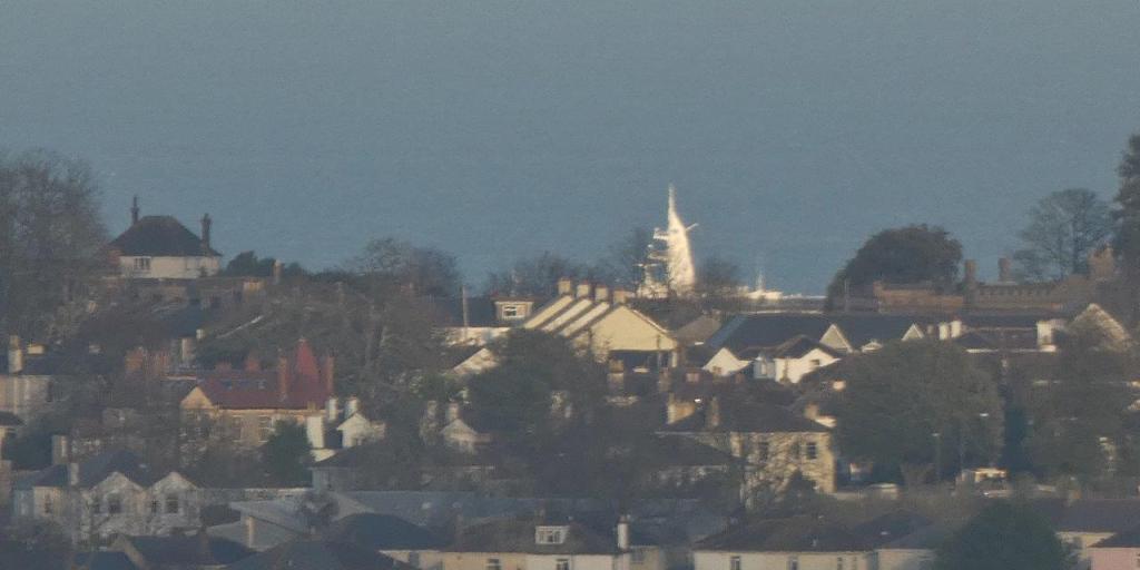
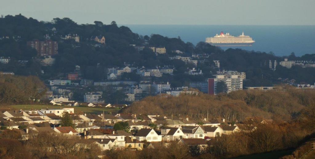
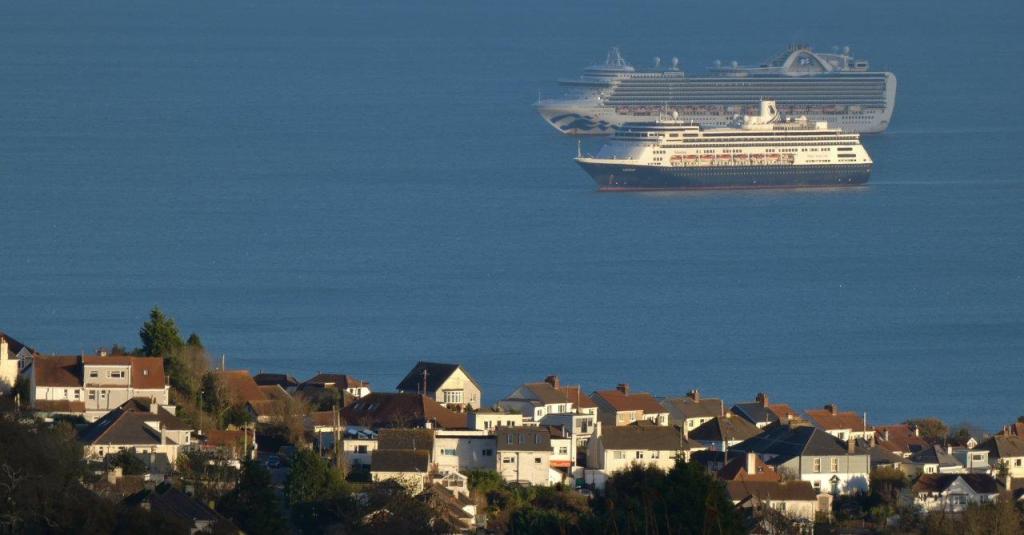
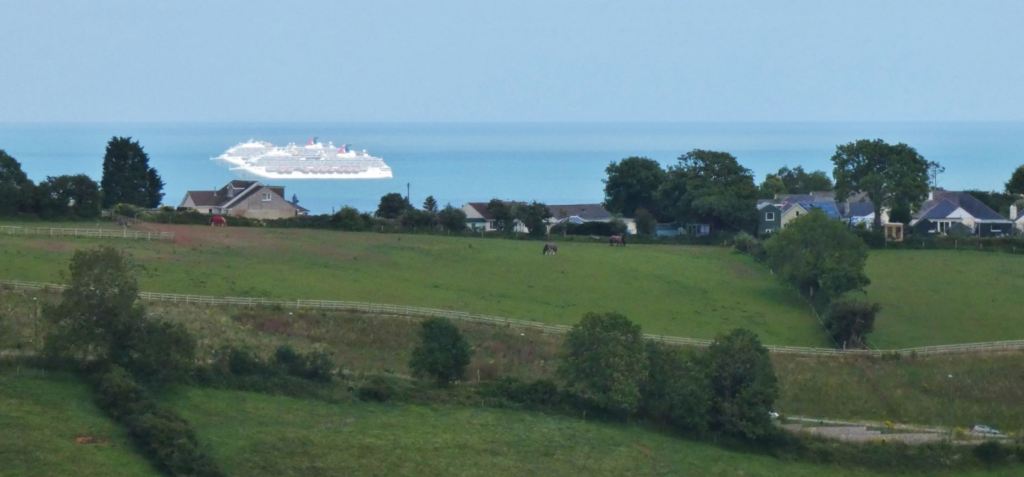
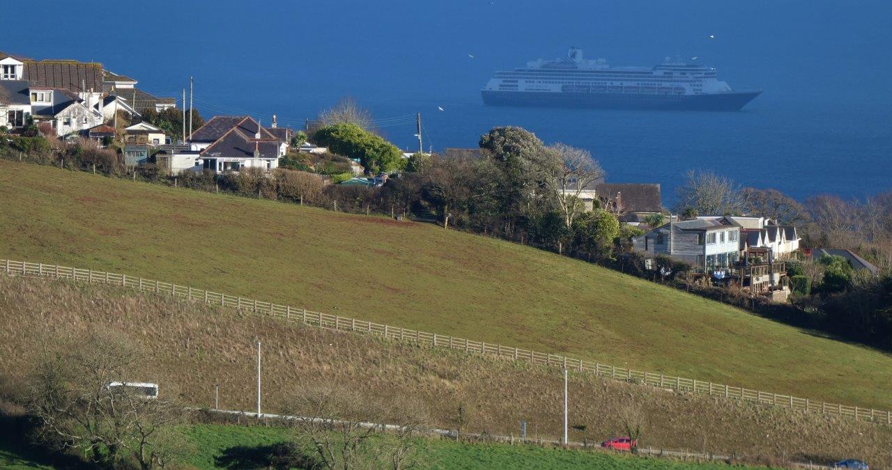
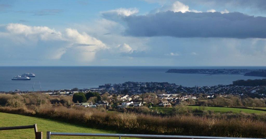
Cruise Ships
Okay, this may be out of date extremely soon after the time of writing (early-to-mid 2021) what with the unique circumstances surrounding the Covid pandemic that have led to various massive ships docking in our Bay, but few places can compare with here if you want to see the ships in all their glory!


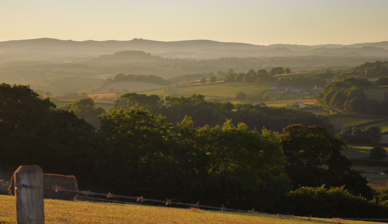
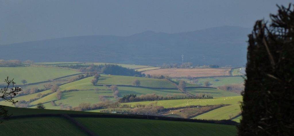
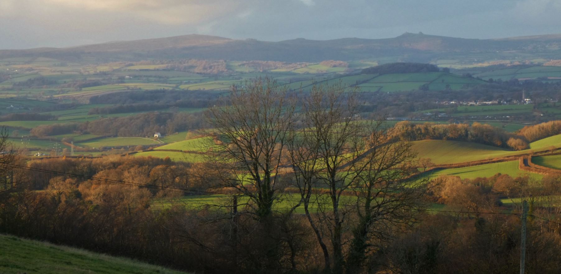
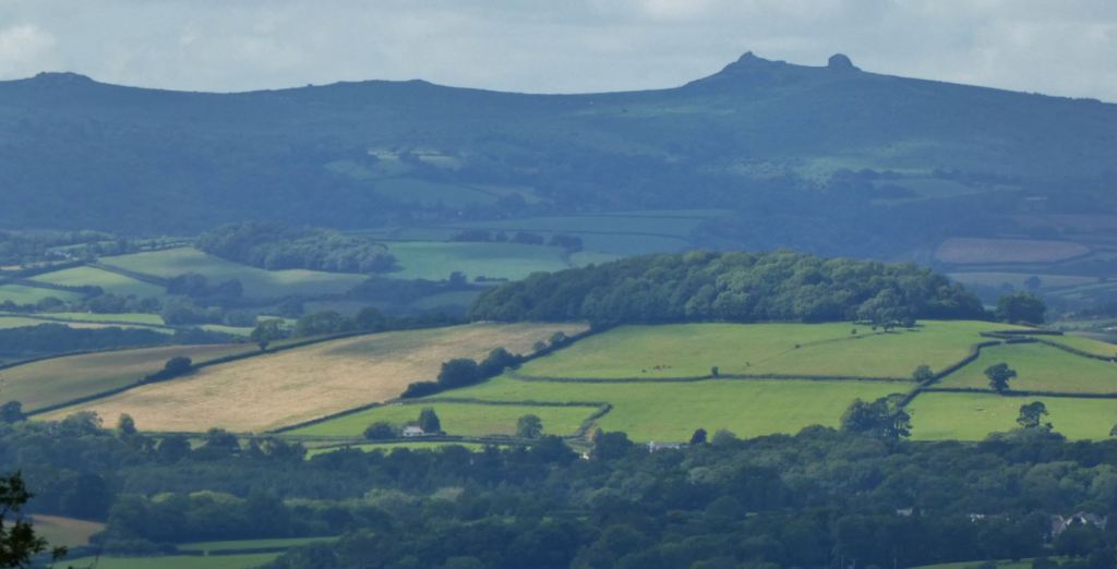
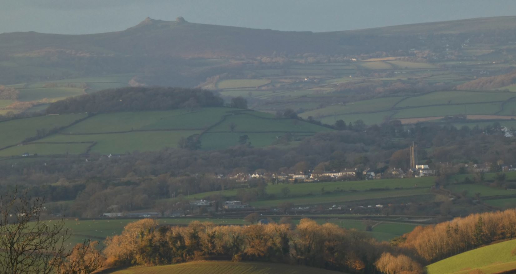
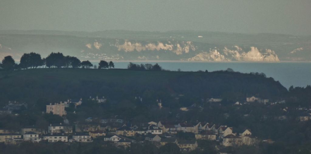
Dartmoor
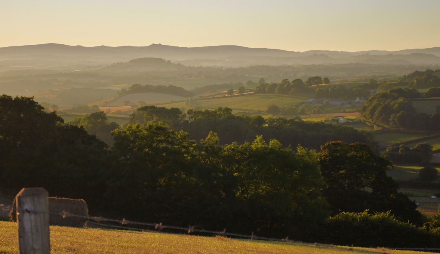
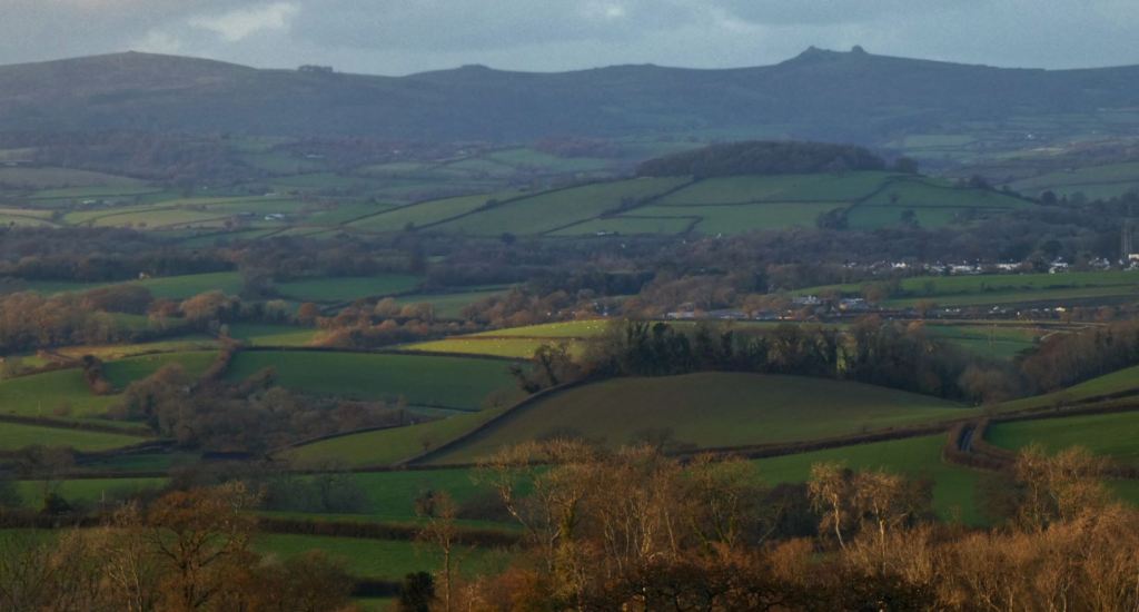
With it being such a large, open space, it is hardly a surprise that Dartmoor is visible from this point on the map, but pick the right day and you will be in your element identifying spaces on Dartmoor that you may have visited in the past. As with most places with a view of Dartmoor in the south-west Devon, Haytor is the easiest landmark to identify, but those with knowledge of the moors will delight in finding other tors and hills that provide plenty of opportunities for wonderful walks in themselves.


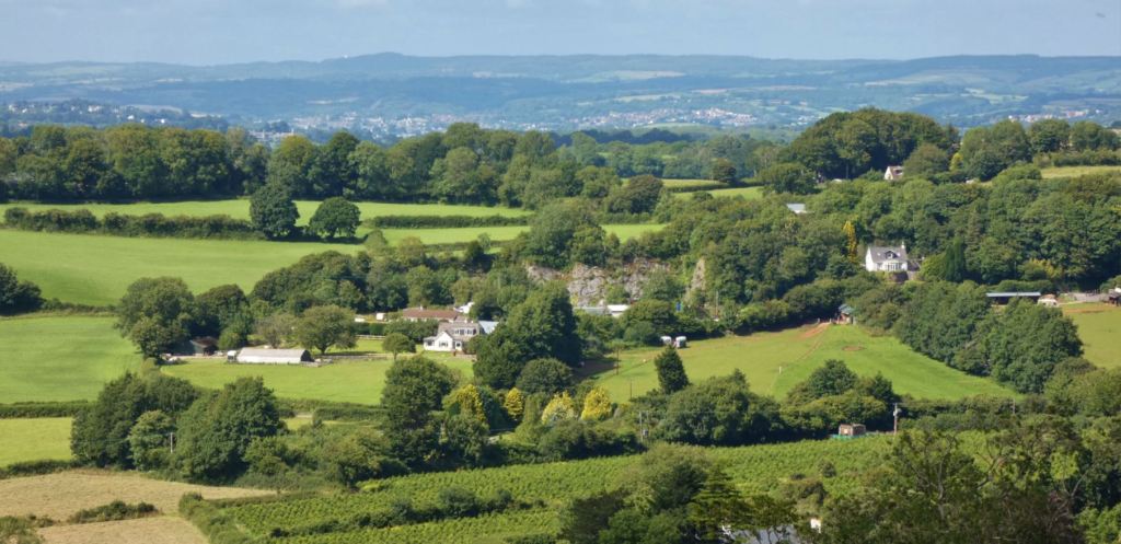
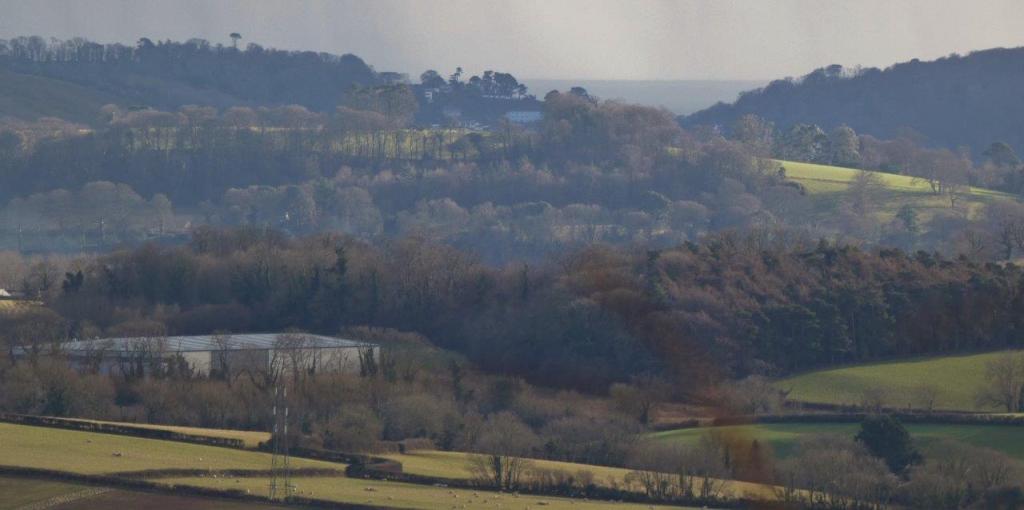
Denbury
It is not easy to see the village from here, but the surrounding countryside (including the countryside close to HMP Channings Wood) looks back on the beacons, so it is another place to search out. The most obvious landmark visible from here is the clump of trees at Denbury Down Plantation, the thick group of trees that stand out on a small hill just in front of Haytor.


Devon Windmill
A curious white ex-windmill that now acts as a guesthouse – it’s a cute place in itself, and you should easily be able to spot it from here.
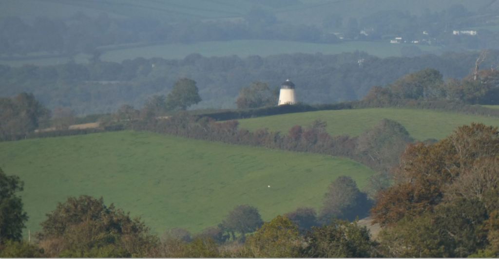


The garden centre nearby also acts as a visual landmark, with its covered nurseries glowing in the right light.

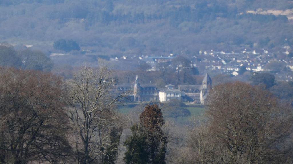
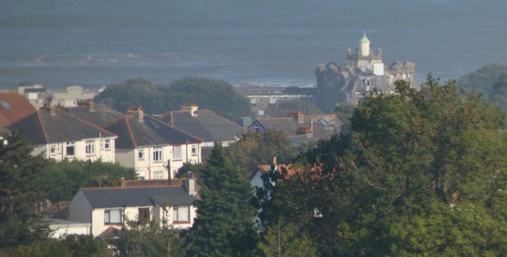
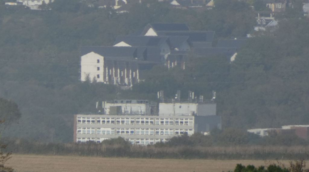
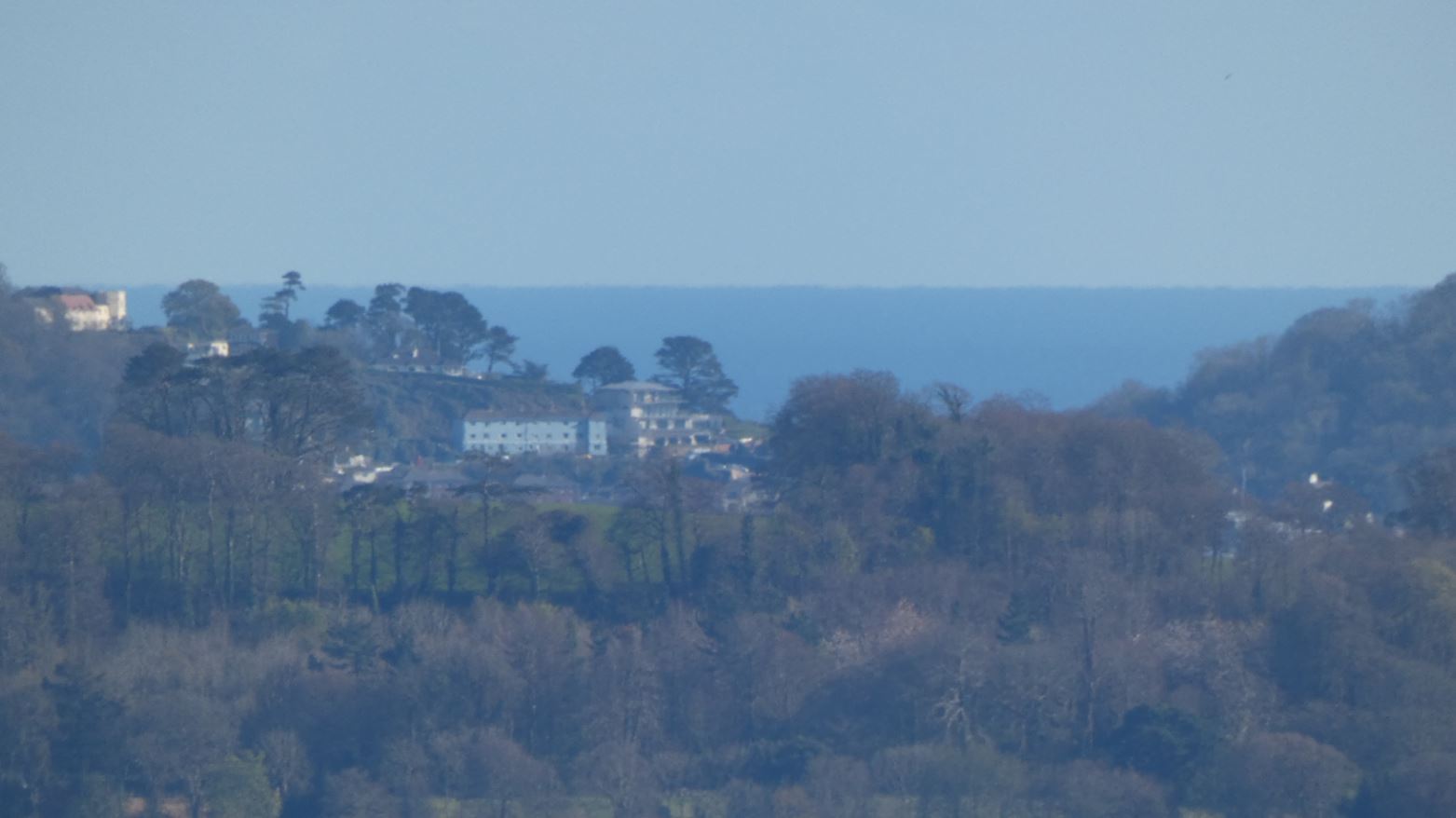
Haldon Belvedere
It is rather a long way away, but it can be seen with the naked eye, and this beautiful white castle, nestled in the forests towards Exeter, will be one of those subtle benefits to those who bring binoculars or a zoom lens!
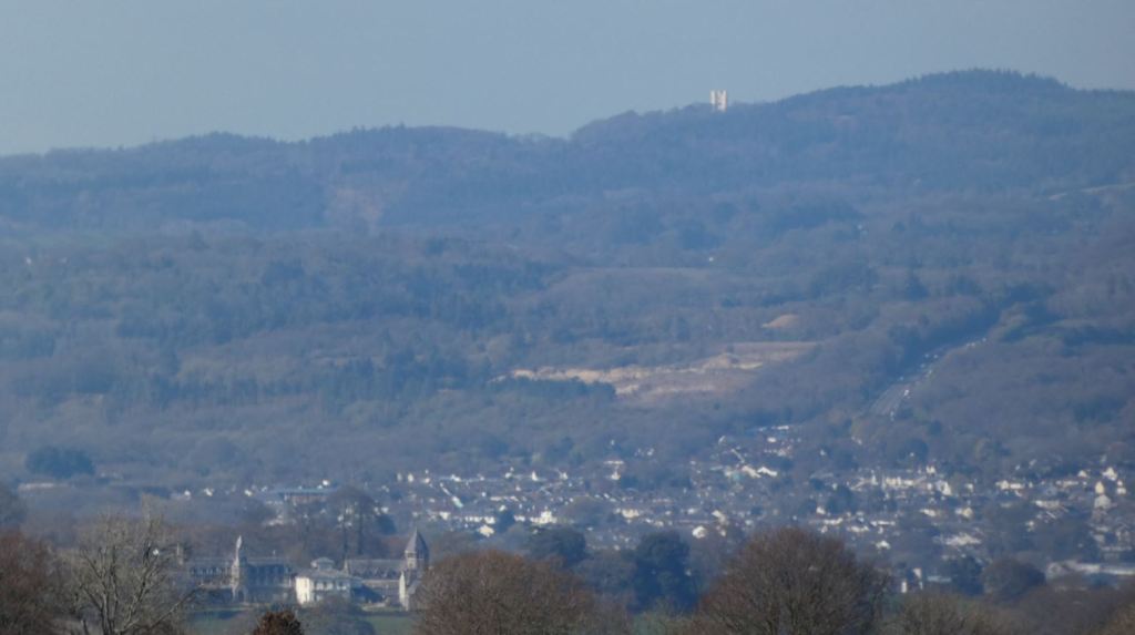

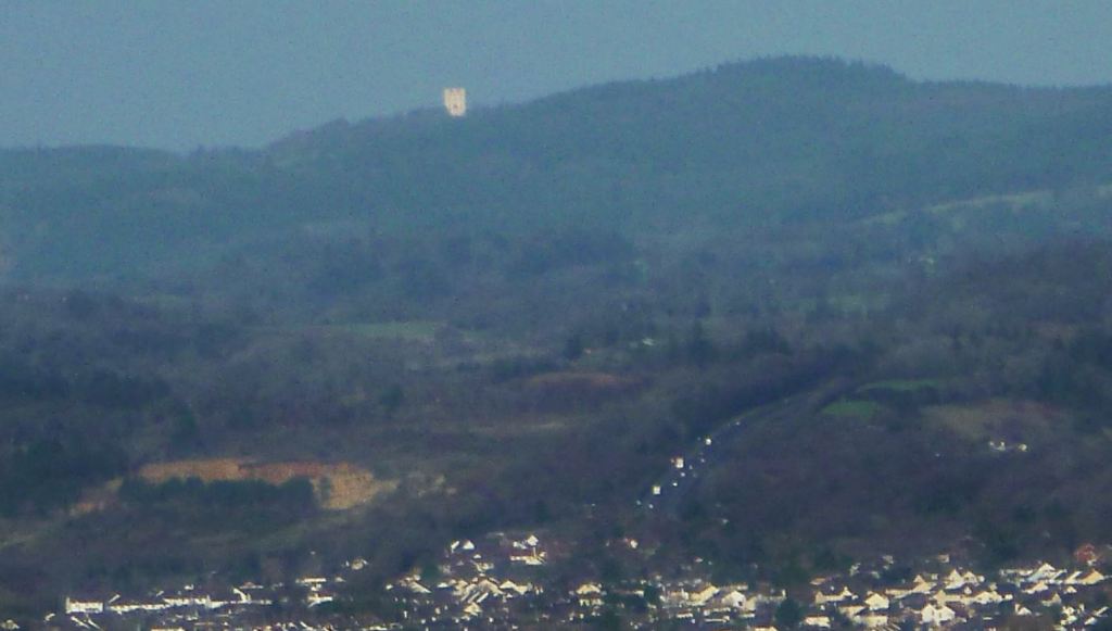
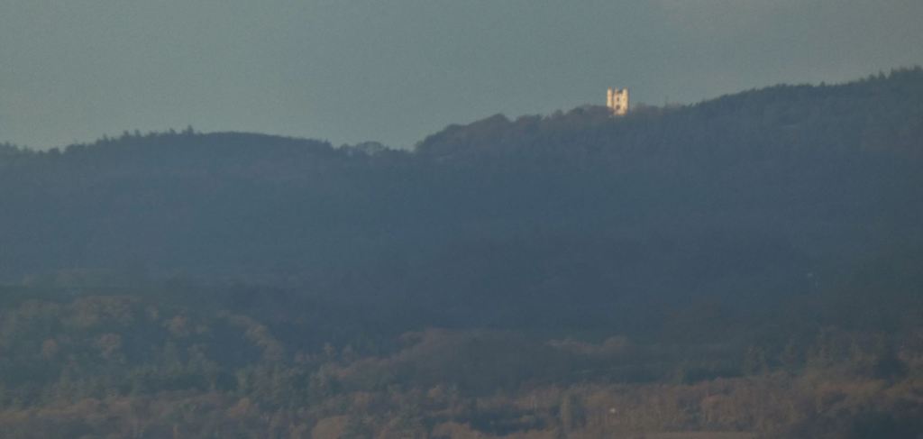
Haldon Belvedere. One photograph (slightly out of focus) shows Telegraph Hill, the steep road leading to Exeter.
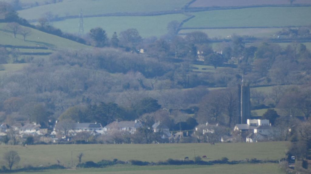
Ipplepen
The easiest landmark to look out for in Ipplepen is the church tower – the rest of the village that surrounds this (as well as the aforementioned Denbury Down Plantation clump of trees) are easy enough to follow from this point.


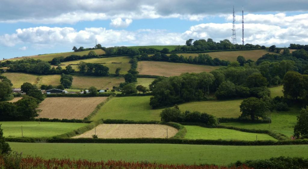
King’s Ash Hill
King’s Ash Road has undergone a lot of changes in the last decade. The beacons are obviously visible from the hill; likewise, the hill can be clearly seen from the fields.


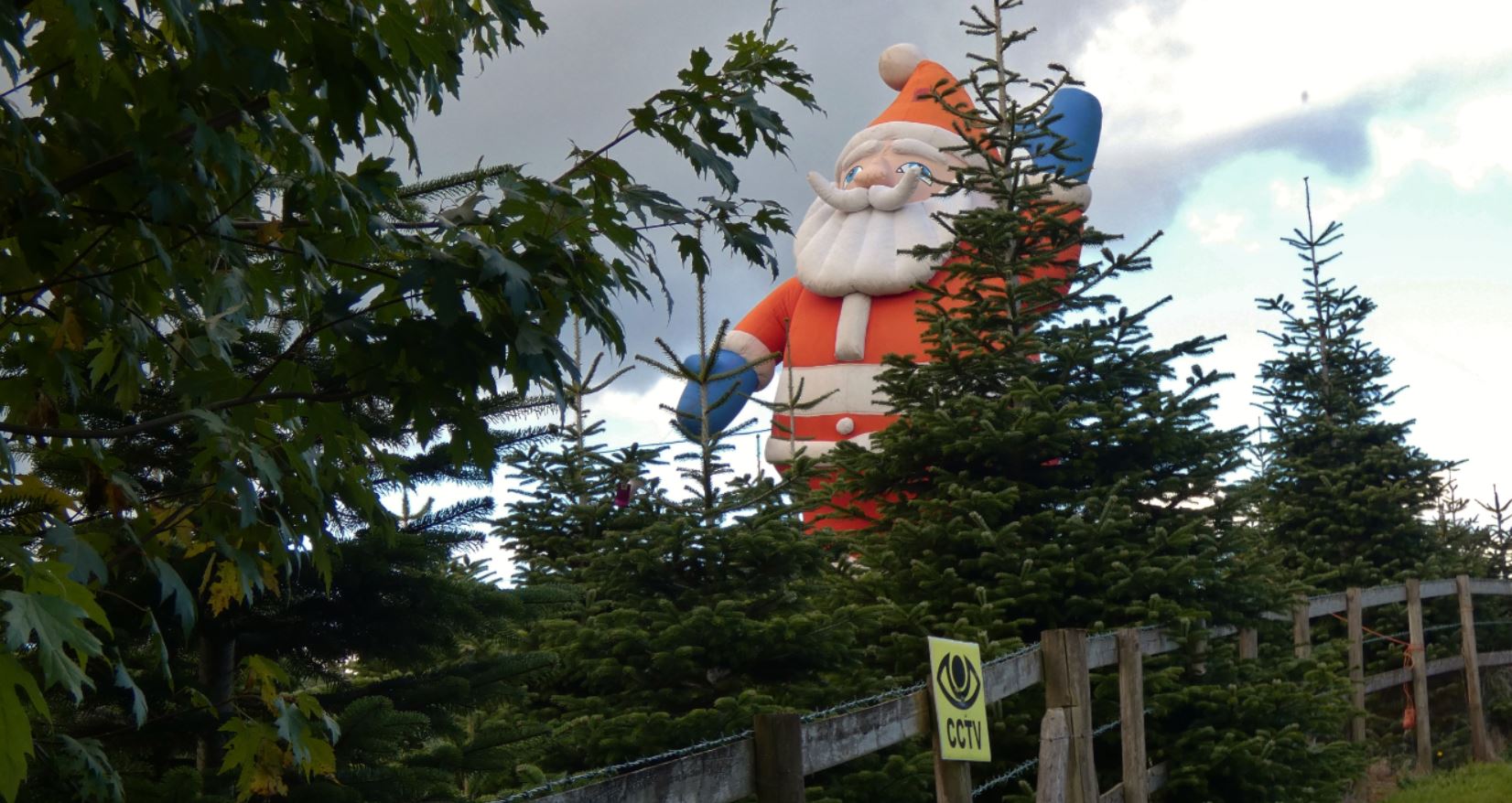
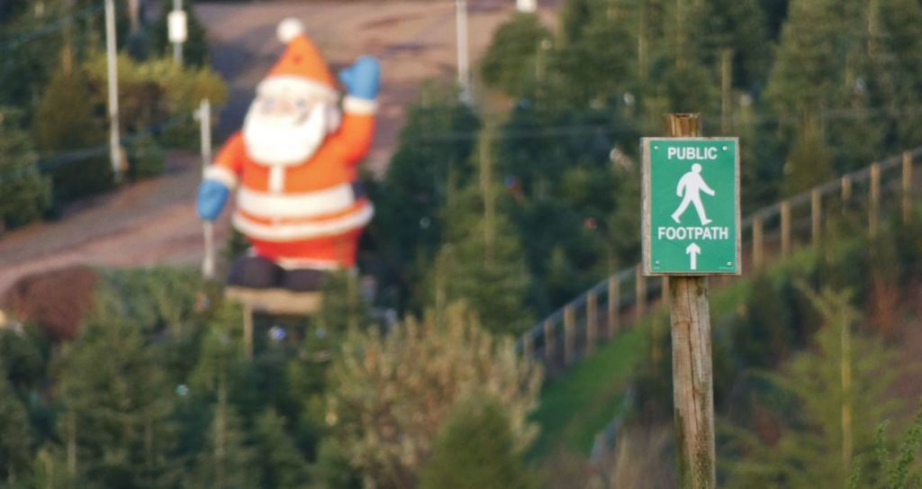
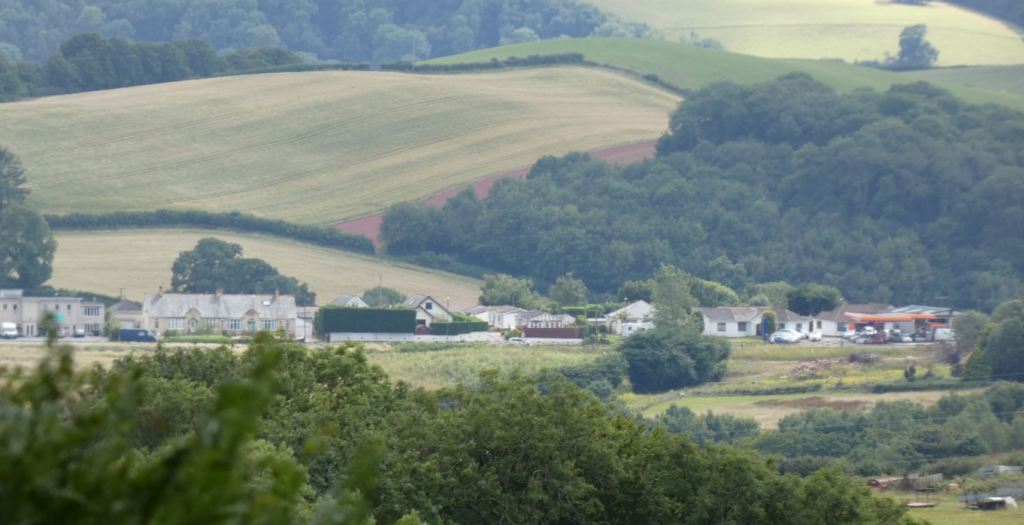
The Marldon Christmas Tree Farm (and Marldon itself!)
Somewhat unsurprising since it is located just down the road. Inflatable Santa may or may not be present on your visit!


The newbuilds in Marldon (opposite the Churscombe area mentioned earlier) are easy to see from here too.

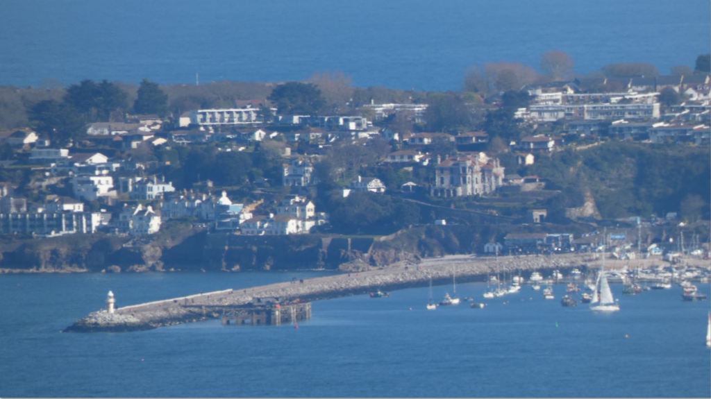
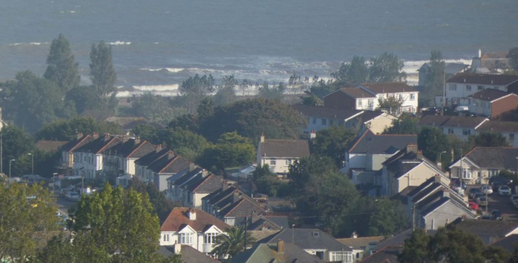
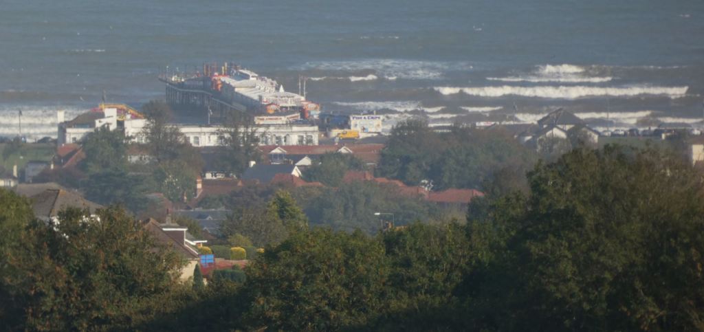
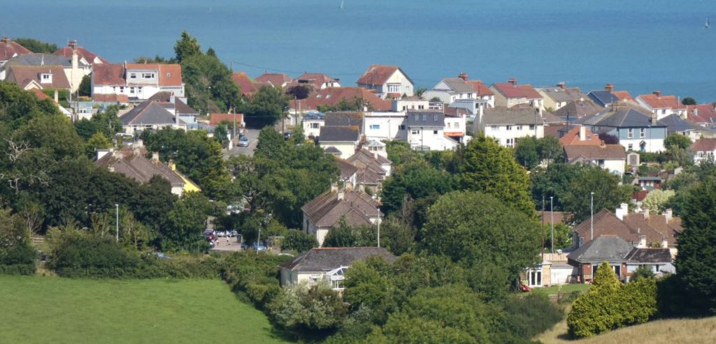
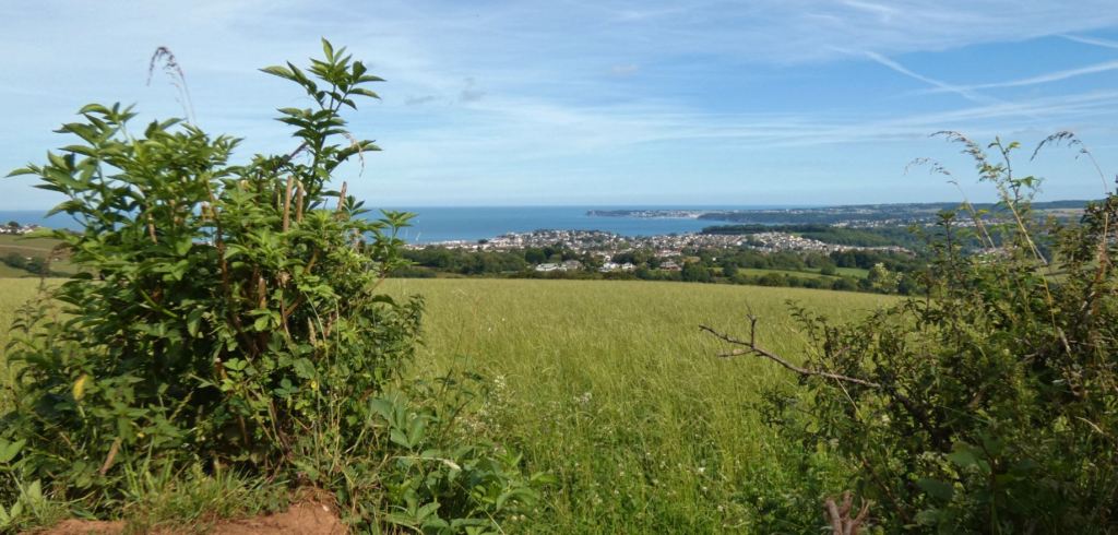
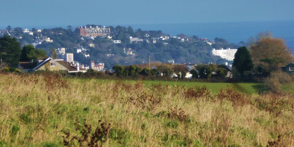
Paignton Seafront
I have already written about Paignton seafront, and although it has a special character in itself, when the beaches are particularly crowded or the green is particularly noisy, I have been known to peer back at the towers (which can be seen from the green and the beach) and wonder if I have chosen the right place to go for a walk!


Speaking of the seafront, I should probably mention here that if the weather forecast predicts strong easterly winds and chances of choppy seas, the beacons are an excellent place to observe the sea getting rough!

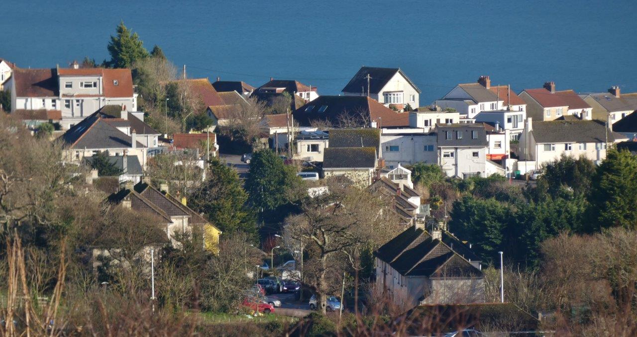
Paignton Town
Paignton town centre is too built up to be seen from this point, but plenty of other parts of Paignton can be seen from the fields at Beacon Hill. If you live in one of the residential areas of Paignton that lie on one of the higher hills of the town (and there are many), you may be able to see your home from this spot.

Foxhole, for instance, is right on the doorstep of this region (as I mentioned in Part One, I grew up in Foxhole, which is probably one of the reasons why this patch of countryside is so dear to my heart). Well, much of Foxhole is observable here: Hoyles Road, the first home that I can remember, can be peered straight down from these fields.

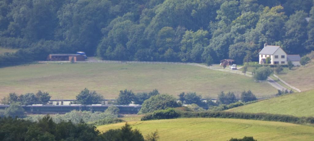
The South Devon Main Railway Line
It is hard to identify without a train to help you locate it, but time it right and you’ll spot the trains heading back and forth between Plymouth/Totnes and Newton Abbot!

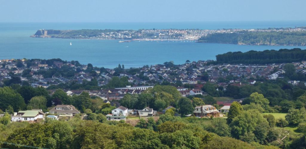
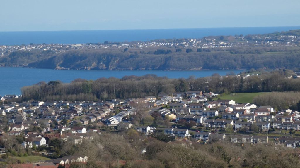
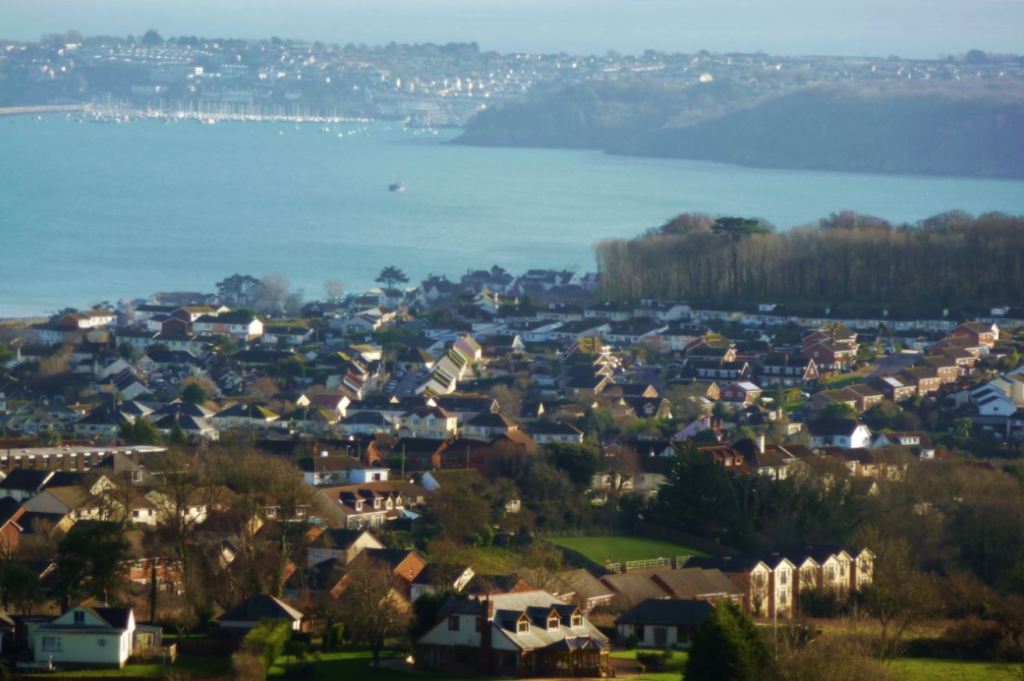
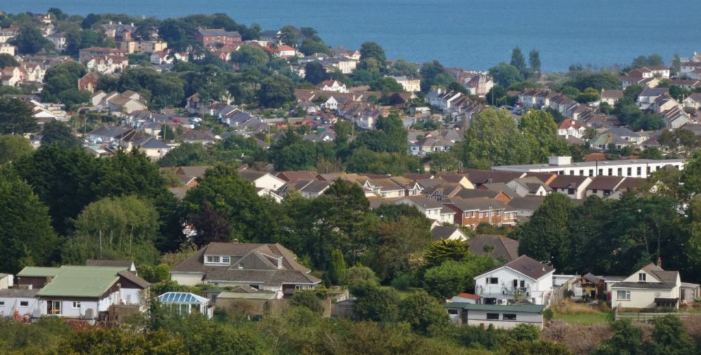
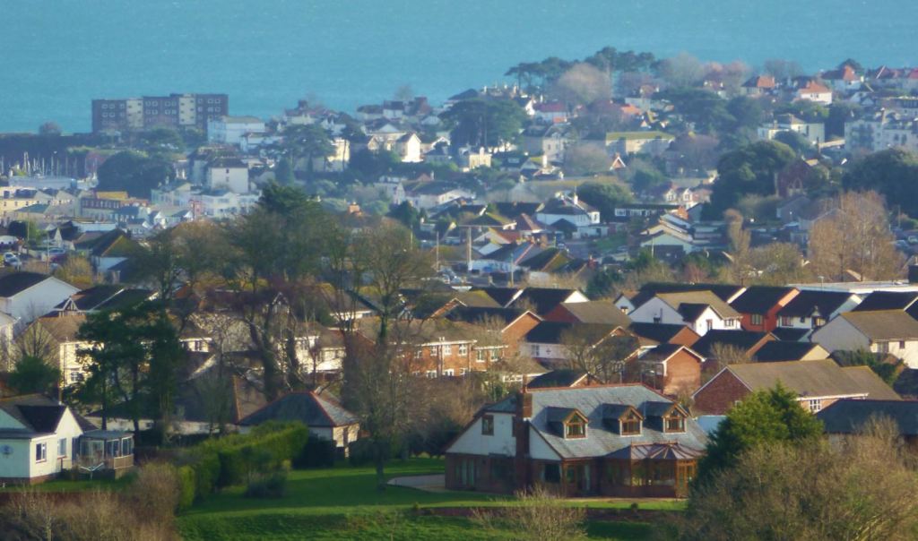
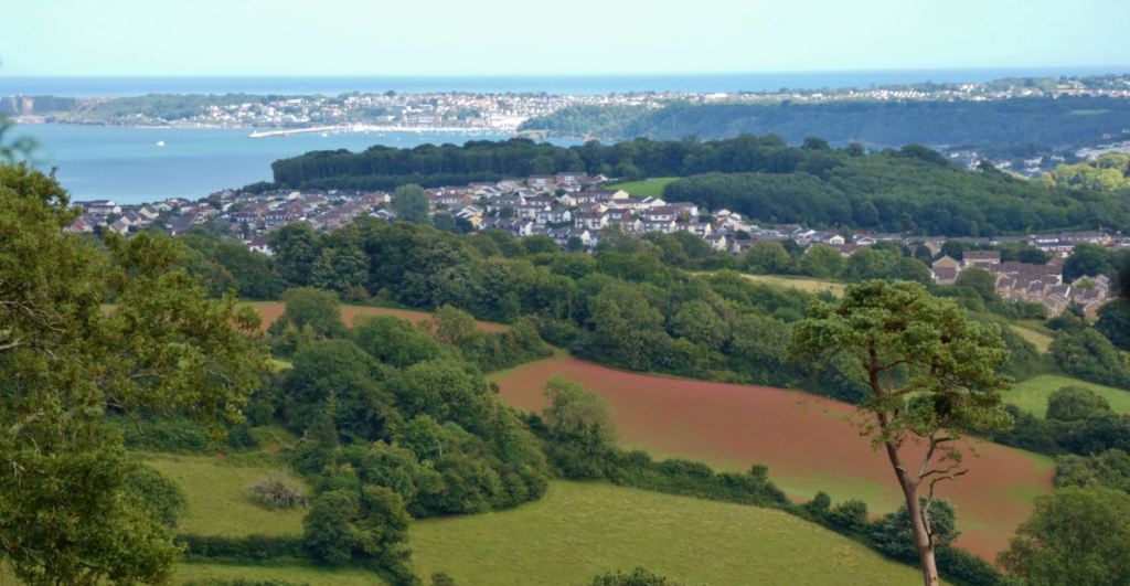
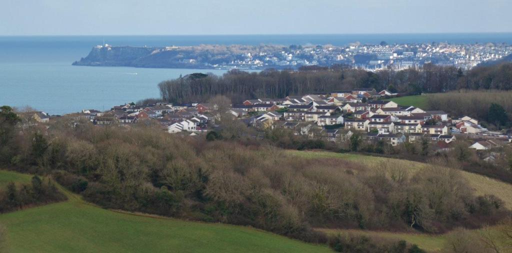
Torquay (and beyond!)
It can be easy to look beyond Torquay on a clear day since the cliffs and coastline of the start of the Jurassic Coast provide a quite dramatic backdrop to the town, but it is still worth taking a moment to scan the town for landmarks. For instance, Plainmoor stadium (home of the mighty Torquay United) is clearly visible, along with Torbay Hospital, St. Marychurch, and plenty of other easily identifiable points of interest if you are familiar with Torquay.


…and of course the beacons themselves
Although, to be honest, unless there are cute animals in the field, this is not likely to be the direction you will be facing for the majority of the time you are up here.
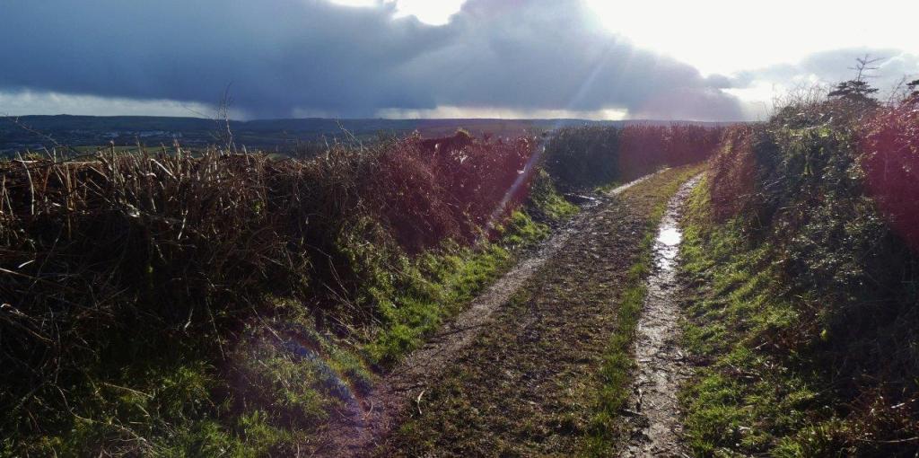
Lane to Buttshill
Let us now depart the wonderful viewing platform on those steps – worry not, however, as many more fantastic views are to come!


The final part of this segment of our walk in these glorious lanes is a simple descent, but it may take you a long time by virtue of the fact that there are so many points to stop and admire the surroundings to your left (east).

I challenge you to walk for more than four minutes and not feel the urge to stop to photograph or admire (or both) what you see. The gates to the fields provide the best apertures on what lies beyond, each offering a slightly different perspective on the bay. There are also other sights to look out for that were not present back up in the field at Beacon Hill.

As I have already mentioned, the ease of this descent depends on the recent weather – I have walked from the steps to Buttshill Cross with great ease following a dry spell, yet I have also found myself slipping and sliding around following a recent downpour. With the right footwear, no great challenge will present itself, but if you tend to leave the house on the spur of the moment for a walk without paying much heed to your immediate environment (like me), be prepared for the odd slippery surprise!


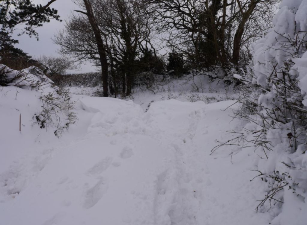
Speaking of slightly rough weather, I shall share my photographs of the great snowstorm of 2018 here as it was really quite deep at this point in Paignton and was rather a lot of fun to visit!


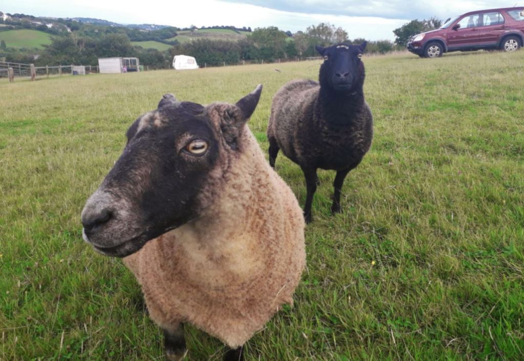
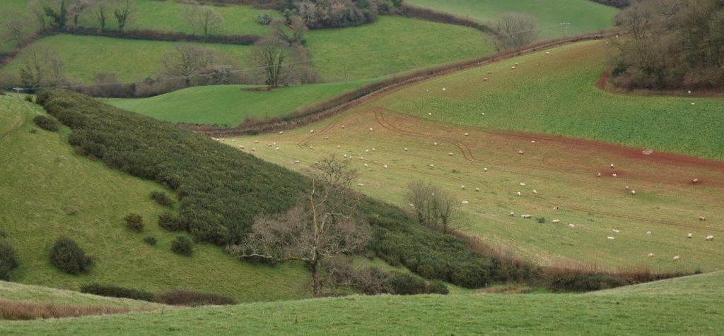
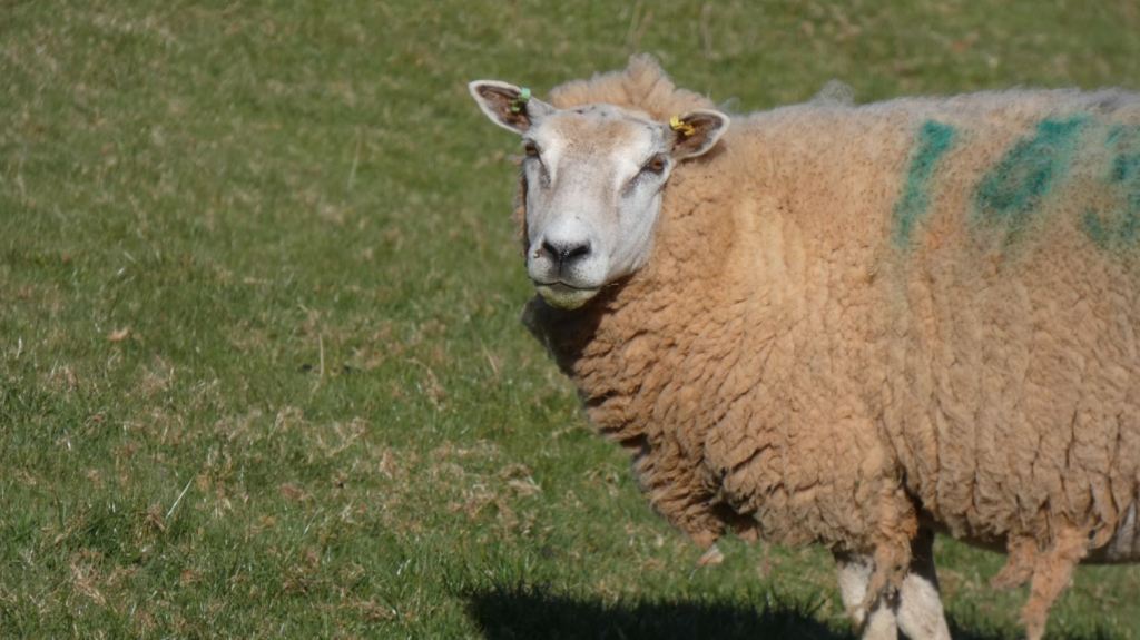
Leaving the steps behind us and proceeding through the lane, you may notice that the field to the right is inhabited by sheep. This may not always be the case, but I have seen crowds of them there in the past!


Follow the path and you will reach a gate to a field to your right and a continuation of the lane bending left. From this point on, all the fields to the right tend to run uphill, meaning that you are likely to see no more than crops, sheep/animals, and the beacons from different angles.


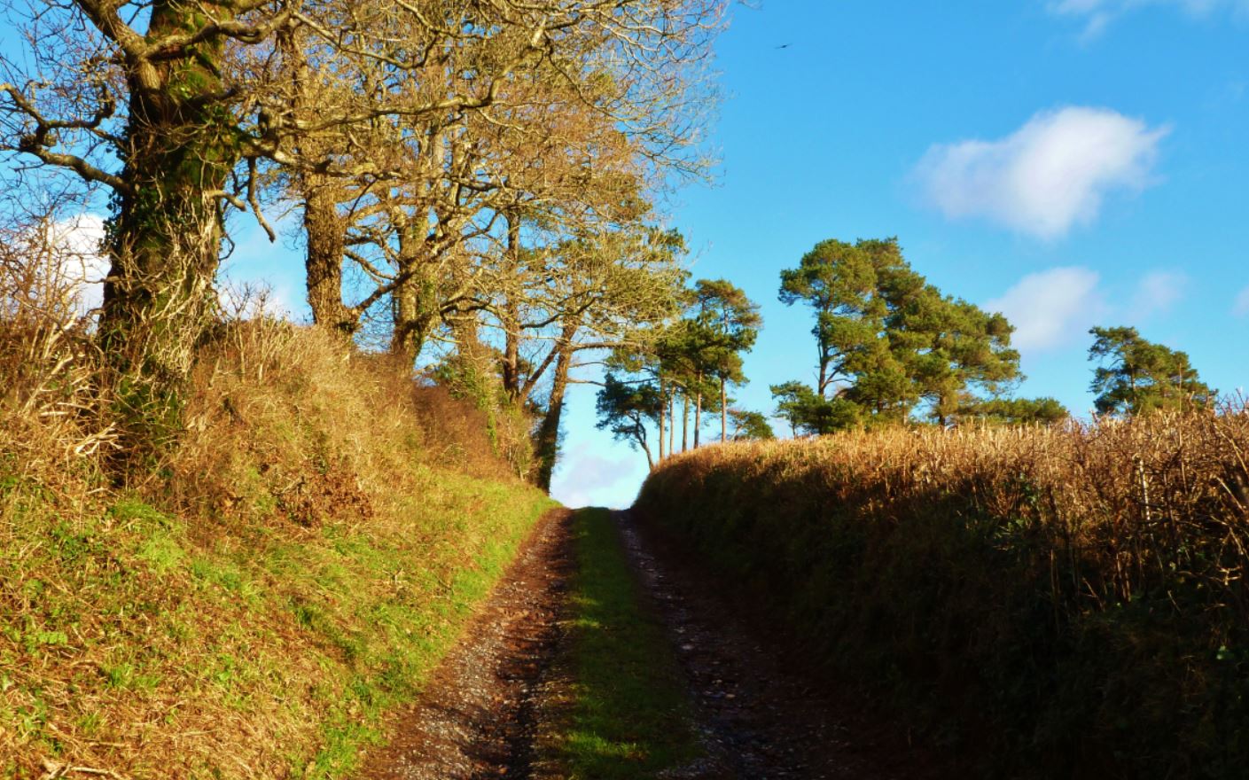
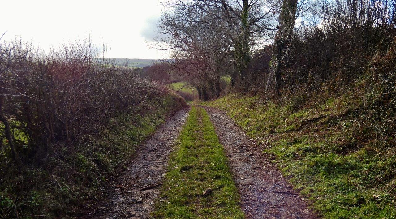
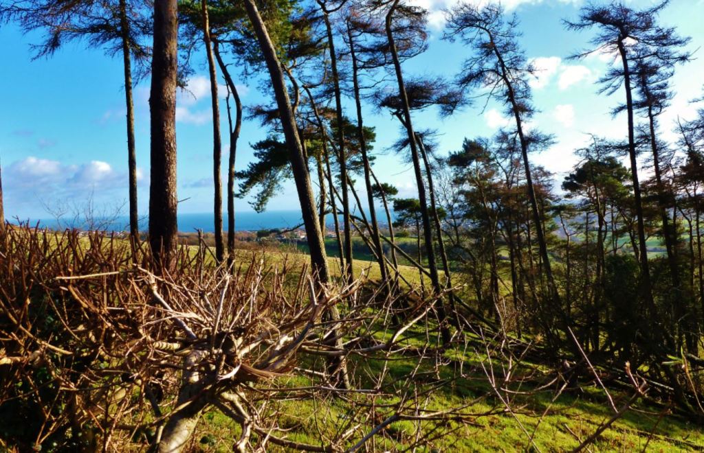
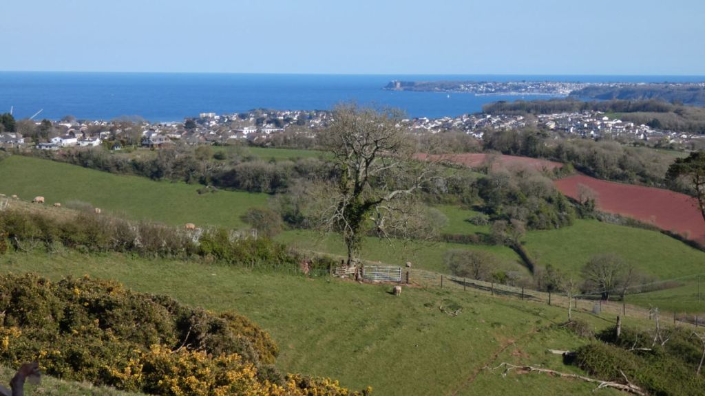
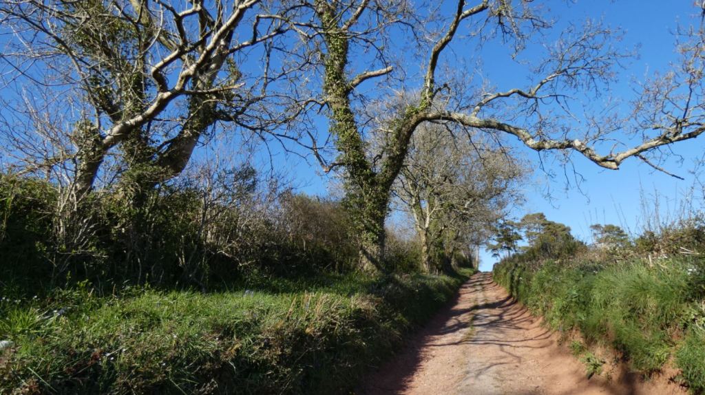
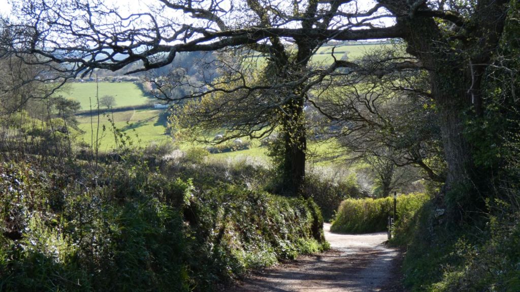
Looking left (mainly to the east) and through the fields that run down to the valley, there are (as always) gorgeous views. As before, I will cover the views by location, although some of my pictures are specific to particular fields. The lane itself is quite a picture – it varies in its appearance from season to season and from morning to evening, but the mid-point between Beacon Hill and Buttshill Cross, where the trees rise high and the leaves arch over the lane, is worth a moment of your time.


Let’s go from top to bottom:
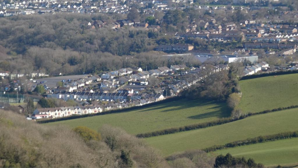
Higher up, the fields nearer to the steps over Beacon Hill field, the views are somewhat similar to before. A small part of the valley below is visible (in particular, the houses on the private lane on Luscombe Lane), most of Brixham is visible, and Paignton is still there.


A little further on, Torquay begins to disappear behind the hills. Meanwhile, the valley (covered in Part One) becomes more visible.


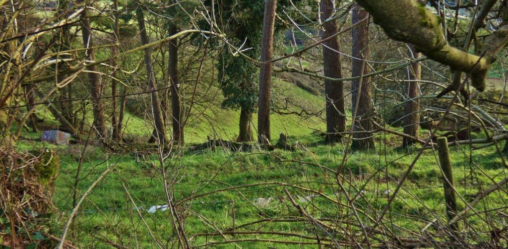
As we progress further downhill, a gate can be found that provides an interesting view. It possibly marks the half-way point of our descent, and this field is bordered by a small wood.


Following this middle point, I would say my favourite views from this lane are to come.


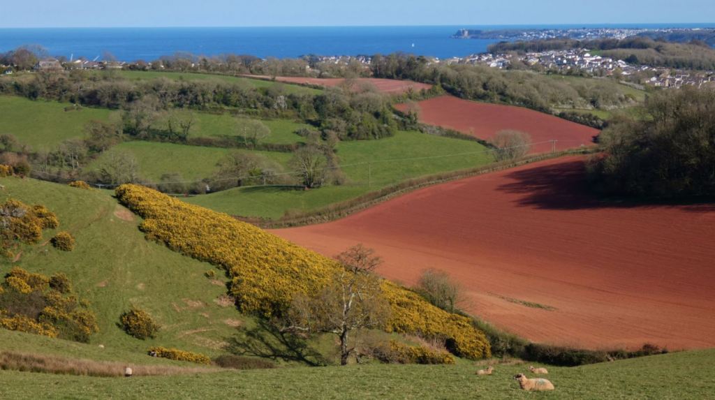
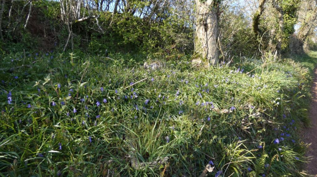
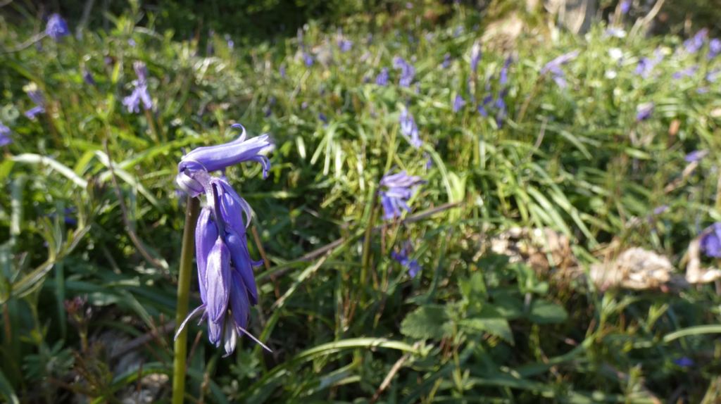
This is probably due to the fact that as well as the outward views across to Paignton, Brixham, et al., one can experience more inward views down to the valley (which is, after all, the subject of this whole guide!), more fields that surround the valley, and gorse. Lots of lovely blooming gorse. Behold the same gorse across the four seasons:


Something else.


Oh, and sheep too.


I mean, just watch the video below and tell me you don’t want to go there now…
When one is done with the views, one must head further down and approach the terminus to the part of the guide: Buttshill Cross. This point was also the end point to Part One, and will additionally be the final points to later parts of the guide, meaning it is a crucial intersection in these lanes.


What can be seen along this lane:
Beyond Totnes
By ‘beyond’, I mean far beyond the Dart – the mast between Harbertonford and Kingsbridge is visible, which is impressive.


Blagdon
I shall cover Blagdon more specifically in a future part of the guide, but for now it suffices to say that plenty of places there provides views of the beacons, and thus the reverse is true.

Brixham
As before, plenty of Brixham can be seen from here. Look out specifically for Battery Gardens and Berry Head, which are historically important.


Foxhole
Specifically, the Top Shops become more visible.


Paignton Seafront
The views down to the seafront only get better as we walk on: pay attention as a few mere footsteps forward present a different view down to Paignton’s harbourside and seafront.


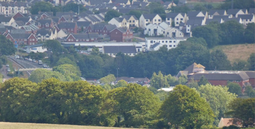
Paignton Town
Look out for the Monastery, the new-builds beyond Yalberton and Sainsbury’s, and a lot of the housing areas near the ring road.


It also looks quite nice come wintertime.
The River Dart
Extraordinarily, the mouth of the Dart and its banks are locatable from here. For a long time I believed the only sea visible comprised the bay and what lay beyond the edges of the bay at Torquay and Brixham, but an additional segment is there if you look for it. While the river itself is too low down to be seen, scan the horizon for the small blue patch of sea and you will be able to locate some locales nearby.


Totnes Road (the bigger one)
The bigger one that connects Tweenaways Cross to Totnes to the south.


The Westerland Valley (see part one)
The outstandingly beautiful area to be in looks outstandingly beautiful from above.


Waterleat
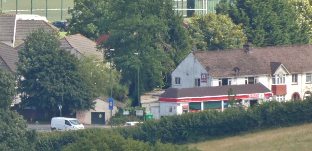
Plenty of the area around Waterleat in Paignton can be seen from here. Take, for example, the Spar shop on King’s Ash Road, near Paignton College. Step out of the doors of the shop and you will soon see the towers in front of you. Well, with the right equipment, you can look right back down at that shop yourself.

To Conclude
That about wraps up Part Two! It took a great number of hours to put together, and I really do hope it provides enjoyment or guidance to people. The feedback and reception I received to Part One of my guide was heart-warming, mainly because I read so many comments from people who were taken back to their childhoods, memories from people who no longer lived locally, and general positive comments on the beauty and character of the area, which I always love to hear. The final parts will come soon – thank you so much for reading!
Coming up…
3) Entering from Berry Pomeroy Castle direction / Totnes Road

Should one be heading towards Blagdon from the lanes nearer Berry Pomeroy Castle (a gorgeous area that I shall cover at a later date), one can enter this area on Blagdon Lane, which is far further down Totnes Road than the entrances mentioned above. The newly renovated ‘Beyond Escapes’ (Barton Pines) complex is something of a feature at this end of Blagdon Road, but to me the treasures still remain outside of the complex (and I shall describe them later on). Maps suggest that the Old Widdicombe Lane is a viable way to enter the area, and although it is indeed attractive, it is much harder to stay safe as a pedestrian in this area. I occasionally extend my walks up to the end of Old Widdicombe Lane, look left and right (up to the entrance to Widend Touring Park) but am reluctant to endanger myself as the road has little protection or shelter for the walker at this point.
4) Entering from Collaton St. Mary
Possibly the widest entrance to the lanes, the southern end of Blagdon Road that is bordered by Collaton Primary School and the Collaton St Mary church is a safe way to head into the countryside (providing you remain aware of any potential passing traffic – Blagdon Road is probably the ‘busiest’ road in these lanes).
5) Entering from Great Parks / Luscombe Road (QED)
What was once a quiet hill that sunk into the valley, the entrance at Queen Elizabeth Drive / Great Parks is now much more popular due to the development of the housing estate to its north, and is only likely to become more popular due to the new housing development that at the bottom of Luscombe Road/Lane. It does make me sad that this beautiful area is soon to be surrounded by even more houses, but I suppose the current batch of new houses are at least being built on land that exists between existing houses and are not extending further into the valley.

illustrious! 6 2025 Christmas Magic in Germany’s Black Forest – 10 Colourful, Wintery Days in the Schwarzwald and its Christmas Markets polished
LikeLike